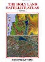
 Sunday Software has a special on the Holy Land Satellite Atlas, volume 1, with a fly-over CD, produced by Rohr Productions (Richard Cleave). The atlas itself is splendid and hard to find. This is the atlas to get if you want to see the land of Israel and Jordan. The maps are very detailed (1:275,000, 1:150,000, and 1:100,000) and includes both satellite images and layer-tint views (see the book cover for an example of each). Gorgeous and instructive!
The CD is even more difficult to find. I’ve seen various editions of this CD and am not sure exactly which one is for sale here, but I think the following adjectives apply to all of the versions I’ve seen: unique, beautiful, and buggy. For those who use Google Earth, it should be noted that this CD is not as easy to navigate and the resolution is not as high as GE (contrary to what Sunday Software says). But there are some close-up shots of biblical sites which you don’t get on GE.
The regular price for both is $70, and it’s $5 off until Thanksgiving (Nov. 23). Unfortunately Sunday Software does not carry volume 2 and I can’t tell you where to get it. Rohr Productions has been consistent for years in producing some of the best materials for studying the Holy Land and then making it nearly impossible to buy them. (Sunday Software says you can contact Rohr directly about buying volume two; good luck in getting a response.)
There are a lot more details about the atlas and software at Sunday Software’s site. They also carry a set of beautiful posters of the Holy Lands. If you’re in a rush to get them though, you’ll be disappointed. It took over a month for my set to arrive (to a US address).
7 thoughts on “Holy Land Satellite Atlas and CD”
I dunno, I was able to pinpoint the Moshav and even the hotel I stayed at in Aswan with GE, and they seem to be updating it with some regularity, and it is free…
The flyover pics would be great though.
From experience I can second your comment about Rohr’s lack of response for information and difficulty in obtaining products. I don’t know how they stay in business.
However, I do agree that the atlas is fine.
GE is also one of the real bonuses of having a computer and living in the 21st century.
Sunday Software has the latest version – 2.0. Older ver 1.0 was not as clear as Google. Google’s images start at 15m resolution. HolyLand 2.0 is 10m (higher). Google images don’t provide location details. HolyLand 3-D 2.0 integrates both the IVP and Eerdmann’s Dictionary of the Bible via clickable location markers as you fly. Holyland 2.0 integrates higher res images of particular locations, such as Jerusalem and Masada.
Neil:
Excuse me, but aren’t 10-place latitude and longitude coordinates, which Google Earth provides, “location details”? And, Google Earth is free.
re: 10-place, coordinates, free Google.
Google Earth is interesting software and maybe even terrific if you’ve never seen real 3d terrain software before like Holyland 3d. But by comparison to a true flyable terrain program such as the one found in Holyland 3d, Goggle Earth looks and feels clunky. G.E.’s flying tools are rudimentary at best. Rohr’s terrain is generated by a much higher end terrain program from Skyline technologies. The number and type of flight controls in Holyland 3d are far greater than in G.E.
The images used to create the HolyLand terrain are seamless, unlike Google’s which are a patchwork of images of varying quality.
Google’s placemarkers are nearly non-existent in it’s Israel map. HolyLand 3d is a true Bible atlas of locations, cross referencing to scripture which can be popped on screen. In addition, HolyLand 3D contains numerous photos of locations.
Holyland 3d gives OT, NT, Roman and Palestinian/Arab names and data. You can toggle on ancient and modern roads. Plus you can select a location from a dropdown menu and immediately be flown to it.
I understand some folks may choose to believe that I’m hyping the program. But it is very cool, and I frankly can’t believe we’re the only ones who have taken the time to carry it here in the US.
I spoke to Dr. Cleave of Rohr Productions just the other day. He IS hard to get hold of, mainly because he travels, but also because he is interested only in serious inquiries. I can probably get Volume II of his atlas for anyone who wants it, along with Vol I and the Holyland 3d CD. -Neil
Sorry for the delay in poster shipping Todd. We had some trouble in our initial order form process that’s been cleared up.
Note: The photos in the biblelandposters.com poster collection are from the ROHR’s (Richard Cleave’s) extensive collection. The posters are in limited supply as Dr. Cleave will not be making any more.
-Neil
Hi,
I'm selling the "HolyLand 3D Student Edition version 2" on e-bay if anyone is interested.
http://www.ebay.com/itm/222150932716?ssPageName=STRK:MESELX:IT&_trksid=p3984.m1555.l2649