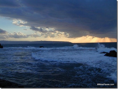
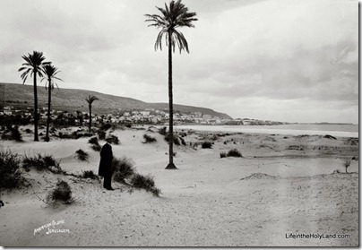
Question: Does your collection include a picture of where Mount Carmel runs into the sea? I recall seeing a picture once showing the impracticability of travel along the sea. –J.B.
Answer: There actually is a narrow strip of land along the water’s edge that is traversable, unlike the cliffs that plunge into the Mediterranean at Rosh HaNiqra. But in ancient times and modern, travelers have preferred the passes through Mount Carmel. One of the reasons for this in antiquity was the difficult, marshy conditions in the Haifa area.
This first photo comes from the “Acco” group on volume 1 of the Pictorial Library of Bible Lands.
This second one comes from the “Haifa” set on volume 1 of the American Colony and Eric Matson Collection.
Both give a sense for the proximity of the edge of Mount Carmel to the sea. You can also check out the view on Google Earth.


One thought on “Q&A: Mount Carmel and the Sea”
This is the route taken by Napolean following the disastrous failure of his siege of Acco in 1799. In this, his first military retreat, Napolean lost over 2,000 men, mostly to the plague. "Had St. Jean d'Acre fallen," Napolean wrote in his account of the expedition, "I would have changed the face of the world."