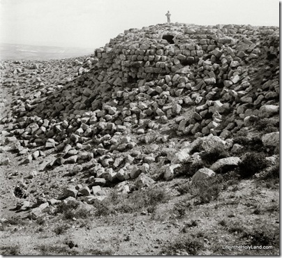
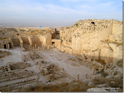
Early Western visitors were intrigued by a conical mountain about 4 miles (6 km) southeast of Bethlehem. Known by the Arabs as Jebel el Fureidis (Little Paradise Mountain), the site was believed to be the monument built by King Herod and named after himself.
Edward Robinson visited the site in 1838. He described his visit in his second volume of Biblical Researches in Palestine: “Leaving here our horses, a steep ascent of ten minutes brought us to the top of the mountain, which constitutes a circle of about seven hundred and fifty feet in circumference. The whole of this is enclosed by the ruined walls of a circular fortress, built of hewn stones of good size, with four massive round towers standing one at each of the cardinal points. . . . The tower upon the East is not so thoroughly destroyed as the rest” (170-71).
Today one can see how impressive that solid eastern tower is. Excavations began at Herodium in 1962 under the Franciscan Virgil Corbo. After Israel took the area in 1967, Ehud Netzer continued the archaeological work. Two years ago, Netzer discovered the long-sought-for tomb of Herod.


One thought on “Herodium, Then and Now”
This is a great then and now to show how much the site has changed. Thanks.