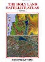
 Sunday Software has a special on the Holy Land Satellite Atlas, volume 1, with a fly-over CD, produced by Rohr Productions (Richard Cleave). The atlas itself is splendid and hard to find. This is the atlas to get if you want to see the land of Israel and Jordan. The maps are very detailed (1:275,000, 1:150,000, and 1:100,000) and includes both satellite images and layer-tint views (see the book cover for an example of each). Gorgeous and instructive!
The CD is even more difficult to find. I’ve seen various editions of this CD and am not sure exactly which one is for sale here, but I think the following adjectives apply to all of the versions I’ve seen: unique, beautiful, and buggy. For those who use Google Earth, it should be noted that this CD is not as easy to navigate and the resolution is not as high as GE (contrary to what Sunday Software says). But there are some close-up shots of biblical sites which you don’t get on GE.
The regular price for both is $70, and it’s $5 off until Thanksgiving (Nov. 23). Unfortunately Sunday Software does not carry volume 2 and I can’t tell you where to get it. Rohr Productions has been consistent for years in producing some of the best materials for studying the Holy Land and then making it nearly impossible to buy them. (Sunday Software says you can contact Rohr directly about buying volume two; good luck in getting a response.)
There are a lot more details about the atlas and software at Sunday Software’s site. They also carry a set of beautiful posters of the Holy Lands. If you’re in a rush to get them though, you’ll be disappointed. It took over a month for my set to arrive (to a US address).