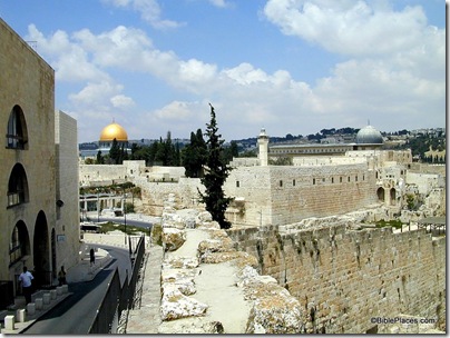
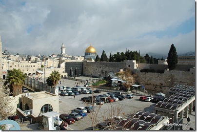
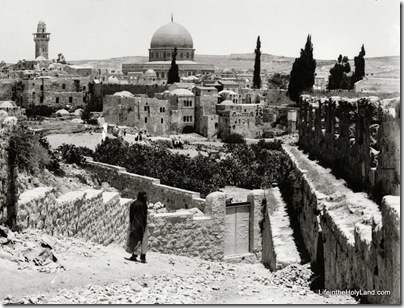
This photograph was taken by the American Colony photographers between 1900 and 1920 from the southern wall of the Old City (visible on the right edge). The Dome of the Rock is clearly visible, but you have to look harder to see a portion of the Western Wall below it. The buildings directly below the Dome are in the area of today’s “ramp” giving access to the Temple Mount to non-Muslims. The fields in the foreground are cactus.
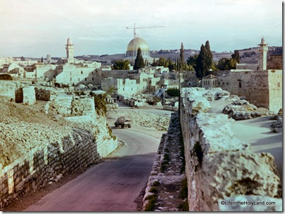
By 1964, the plants had been removed and a narrow road paved. The road today follows a circuitous route similar to that shown here, where buses pick up passengers from the Western Wall.

The problem today is that you can’t get the same perspective because of buildings in the way.

You get a better feel for the comparison if you move in front of the buildings.
If it’s easier for you to compare these if you have them in a larger size in a PowerPoint file, you can download that here (but see update below).
The first photo is one of 77 photographs in the “Views of Jerusalem” section of the Jerusalem volume of The American Colony and Eric Matson Collection. Photo: Library of Congress, LC-matpc-00886.
The second photo is from Views That Have Vanished: The Photographs of David Bivin.
UPDATE (9/23): Mark V. Hoffman has edited the PowerPoint file so that the images are aligned and transition smoothly one to the next. You can download that here. Thanks Mark!

