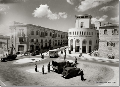
The photo below shows another very familiar place in Jerusalem, at the northwestern corner of the Old City walls. This site, I believe, may be distinguished as the location most often renovated in the modern city’s history. I’ve long suspected that the municipality, which has its offices on the north side of this square, uses the area as training grounds for its construction crews.
This American Colony photo shows how the area looked sometime between 1932 and 1946. The round building on the right served as Barclay’s Bank on the lower floor and basement, while the rest of the building held offices of the City Hall. Because it was located next to “No Man’s Land” from 1948 to 1967, the building’s facade today bears pockmarks from the hostilities. Mayor Teddy Kollek’s office was in the second floor of this building for many years.
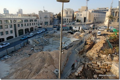
This picture could have been taken many times since, as the area has been torn up time and again to install various traffic features, water fountains, and pedestrian walkways. This photo was taken in December 2006 after the construction of a traffic tunnel. The round building is in the distant center.
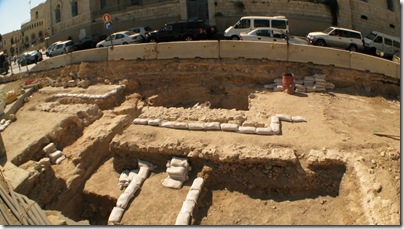
This photo was taken in July 2009 by Peter Wong and looks west (the municipal building is off to the right). It shows excavations of the area, including what appears to be a cistern in the top center.
Shortly after Peter took this photo, the area was cemented over.


2 thoughts on “Kikar Tzahal (IDF Square), Jerusalem”
re: an Azorean friend of mine (Portuguese) recently subscribed to your newsletter. However, she cannot read English. She has to unsubscribe unless the newsletter can be received in Portuguese. Is this possible?
Gnosis – the newsletter is in English only. She can unsubscribe at http://bibleplaces.engagepoint.com/subscribers/index.cgi/list_id=38