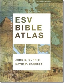
My first impression of this new atlas came from the weight of the box on my doorstep last night.
This atlas weighs even more than the ESV Study Bible, and it probably weighs more than any two atlases on my shelf. What makes it so heavy?
- 175 full-color maps
- 70 photographs
- 3-D re-creations of biblical objects and sites
- indexes
- timelines
- 65,000 words of narrative description
- a CD with searchable indexes and digital maps
- a removable, 16.5 x 22-inch map of Israel
Don’t miss the significance of 175 maps. That means you see many events and perspectives mapped out that you probably never have before (see Ritmeyer’s comment below). 
Another phenomenal resource of this atlas are the reconstruction drawings. Some of these were published in the ESV Study Bible, and they are even more appealing on glossy paper. They are also easier to find, as you do not have to page through large sections of the Bible to find what you’re looking for.
James Hoffmeier (see below) says the photographs are brilliant, and I am delighted to have contributed a large number of these. It is a real pleasure to see some of my favorite images presented in such an attractive book.
Many readers here will be thrilled that the atlas includes a CD with the maps. Many publishers never release the digital version, and those that do usually make you buy it separately (I have too many books that I’ve had to buy twice). I love Crossway’s commitment to being generous to its customers and I hope that it becomes the new standard.
Price: $35, with free shipping(!) from Amazon. With the CD, removable map, and full-color imagery, the book is worth much more.
Conclusion: Highly recommended
Still not convinced? What if you were offered a CD with 125 biblical maps for only $35? I get requests for such all the time. I don’t know where to find one for $135, let alone $35. Until now.
And they’ll throw in a massive book and an attractive wall map for free.
Many scholars are impressed, including James K. Hoffmeier and Leen Ritmeyer.
“This Atlas is a wonderfully illustrated tool to aid the layperson, student of the Scripture, or pastor who wants to dig deeper and gain new insights and appreciation of the setting, context, and message of the Bible. The text is easy to follow, pictures are brilliant, and maps are incredibly useful as the reader moves through the related narratives. I highly recommend this marvelous resource.”
—James K. Hoffmeier, Professor of Old Testament & Near Eastern Archaeology, Trinity Evangelical Divinity School
“I had the privilege of being involved in the production of drawings based on the latest research for the ESV Study Bible. It is a joy to see these drawings plus the original ESV Study Bible maps, woven together with numerous new maps, brilliantly evocative photographs and useful indexes to make up the new Crossway Bible Atlas. This volume will become an indispensable companion for Bible students, fulfilling every expectation you might have of such a tool. Particularly innovative is the use of terrain imagery to facilitate the reader’s understanding of such Biblical viewpoints as that of Abraham from Hebron over the cities of the plain or Moses from Mt. Nebo.”
—Leen Ritmeyer, Archaeological Consultant
Update (6/23): Leen Ritmeyer notes that you can view 45 pages of the atlas here.