A year ago yesterday this blog noted the excavation of an arched bridge in the Hinnom Valley. The current issue of Hadashot Arkheologiyot includes a final excavation report by Yehiel Zelinger.
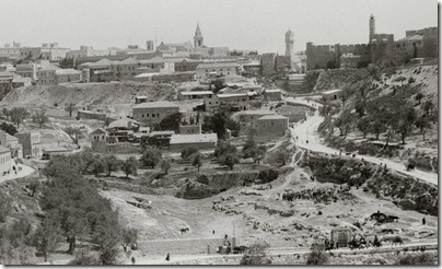
The Sultan’s Pool, which was built in the upper part of the Ben-Hinnom Valley, is located in the lowest spot of the region and was therefore used as a reservoir for floodwater. To maintain the elevation of the aqueduct that passed through the pool, a bridge was constructed to support the aqueduct over the valley. The bridge is visible in photographs taken at the end of the nineteenth century (Fig. 2); however, it was covered over with alluvium during the twentieth century.
[…]
Conrad Schick was the first to describe the aqueduct and the bridge that carried it when he documented the Sultan’s Pool and its surroundings in 1898. The detailed plan and sections that accompany his article enabled the reconstruction of the aqueduct and the bridge; however, they are useless for dating the remains. The Lower Aqueduct provided water to Jerusalem as of the Hasmonean period and continued to function until the Ottoman period. Due to its prolonged use and the numerous repairs made to it, it is difficult to date the different phases. The method of construction in the southwestern section of the aqueduct is similar to sections of the aqueduct that were exposed in the past and were dated to the Early Roman period. The arch bridge, however, is dated to the Mamluk period, based on the dedicatory inscription from 1320 CE that was incorporated in it (it is visible in photographs but has not yet been exposed).
The report concludes:
The aqueduct was probably built originally in the Hasmonean period and crossed the channel in the Ben-Hinnom Valley on a bridge that was destroyed due to neglect or floods and a new bridge had replaced it in the Mamluk period.
The article includes five illustrations, including a plan and section of the excavation.
