fbpx
(Post by A.D. Riddle)

The answer to yesterday’s challenge is Nabi Yoûnis (or Nebi, Neby, Yunus, Younes, Yunas—there are a variety of English spellings. I will use the spelling “approved” by the U.S. Board on Geographic Names). It was answered correctly and quickly in the comments, so maybe next time, we should leave out the Google Earth view. The name Nabi Yoûnis is Arabic for Prophet Jonah, and the site commemorates the location where the great fish spit Jonah out onto dry land. It is located in Google Earth at 33.660894°, 35.418515°.

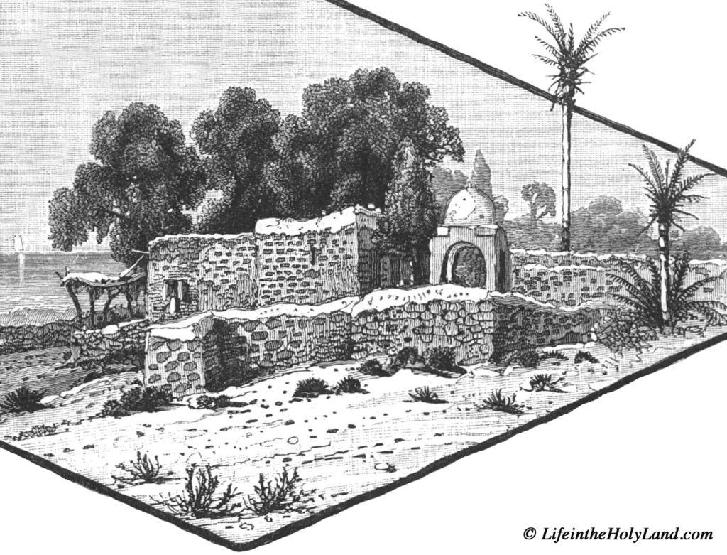
At 8:10 am on Tuesday, June 26, 1838, Edward Robinson passed by Khan Nabi Yoûnis on his way from Sidon to Beirut. He mentions that nearby was “Wely Neby Yunas, with a white dome, marking the place where, according to the Muhammedan legend, the prophet Jonas was thrown up by the fish” (Biblical Researches 3: 430-431). A nearly identically-worded description is found in Picturesque Palestine 3: 40. 

Drawing of Nabi Yoûnis from Picturesque Palestine, vol. 3.

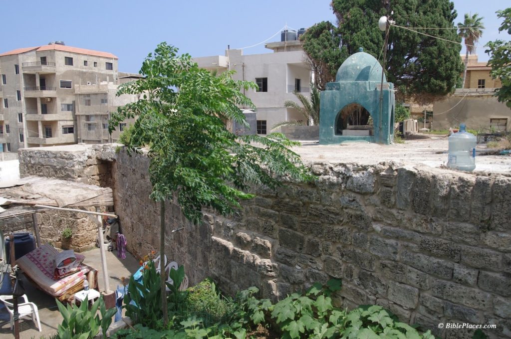
Today, the Muslim shrine described by Robinson is surrounded by the Shiite village named Nabi Yoûnis and bears little resemblance to the drawing above. Also, the dome is now green.

Modern Nabi Yoûnis. 

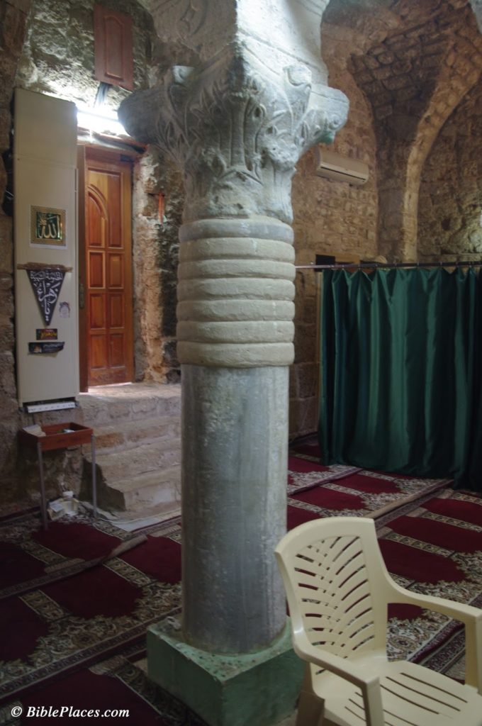
The Muslim shrine occupies the site of an earlier Byzantine church which was apparently destroyed by earthquake. Some remains from this church can be seen in reuse inside the shrine. During the Mamluk period, the structure was rebuilt and converted into a Muslim shrine.

Nabi Yoûnis, Corinthian capital from Byzantine church reused in modern Muslim shrine.

I have no way for evaluating whether or not this tradition is historically accurate, that Nabi Yoûnis is the place where Jonah was spit out. It is interesting to note that according to 2 Kings 14:25, a prophet named Jonah son of Amittai lived during Jeroboam II’s reign. This verse explains that Jonah announced large territorial gains for the kingdom of Israel in the time of Jeroboam II. For a brief moment in history, the boundary of the kingdom extended north to Lebo-Hamath, identified with modern Labwe in Lebanon. The Aramean kingdoms of Damascus and Hamath were also subjected to Israel. Nothing is said concerning the Phoenician coastal cities, so I do not know if Nabi Yoûnis would have been under some kind of Israelite control or not at this time as well.

Further note: a small side room in the Nabi Yoûnis shrine supposedly houses the tomb of Jonah. As with Noah, there are apparently multiple sites that are believed to be Jonah’s burial place. Another such tomb of Jonah is located in el-Meshhad, Israel, the site identified with Jonah’s hometown, Gath-hepher (see Picturesque Palestine 2: 61, illustration on 56).

References
Harb, Antoine Khoury.
2008     The Roots of Christianity in Lebanon. Beirut: Lebanese Heritage Foundation.

Share:

For last year’s Water in Antiquity Conference, Chris McKinny provided some brief notes. Now the papers and PowerPoints are available for many of the presentations.

Archaeologists in Turkey are claiming to have found a long-lost city where Abraham lived.

Carl Rasmussen considers why Paul skipped the ship and walked to Assos. The photo of the Roman road is available for download. Mark Wilson interacts with the discussion in the comments.

Leen Ritmeyer has the scoop on where and when the Jerusalem IMAX movie will be showing.

The Ancient Near East Today, produced by Friends of ASOR, is a good resource for staying up-to-date. You can sign up for free here.

HT: Jack Sasson

Share:
About the BiblePlaces Blog

The BiblePlaces Blog provides updates and analysis of the latest in biblical archaeology, history, and geography. Unless otherwise noted, the posts are written by Todd Bolen, PhD, Professor of Biblical Studies at The Master’s University.

Notice

As an Amazon Associate we earn from qualifying purchases. In any case, we will provide honest advice.