Our friends at Preserving Bible Times have just announced a new website. In addition to the many articles and resources available, I would highlight two areas to check out:
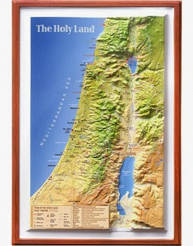
1. 3-D Israel Topographical Relief Maps: Their collection has expanded (and the prices reduced) for an OT version, a Gospel Version, and a contemporary Holy Land version. The maps are roughly 9 x 14 inches (22 x 35 cm) and sell for $29.95 plus shipping. Check out the website for photos of the maps.
2. The Gallery section includes a series of glass slides from 1905.
You can stay up-to-date with the latest resources by visiting the “What’s New” section regularly.
3-D Topographical Relief Map of the Holy Land
