Yesterday, Huffington Post released a story that re-hashed the equation that Tall el-Hammam may be identified with biblical Sodom proposed by S. Collins. While there is nothing new to report from the story and Todd and Bill Schlegel have clearly illustrated many of the difficulties with this identification, I would like to take it a step further and point out an additional geographical/toponymic problem with the Tall el-Hammam = Sodom viewpoint.
 |
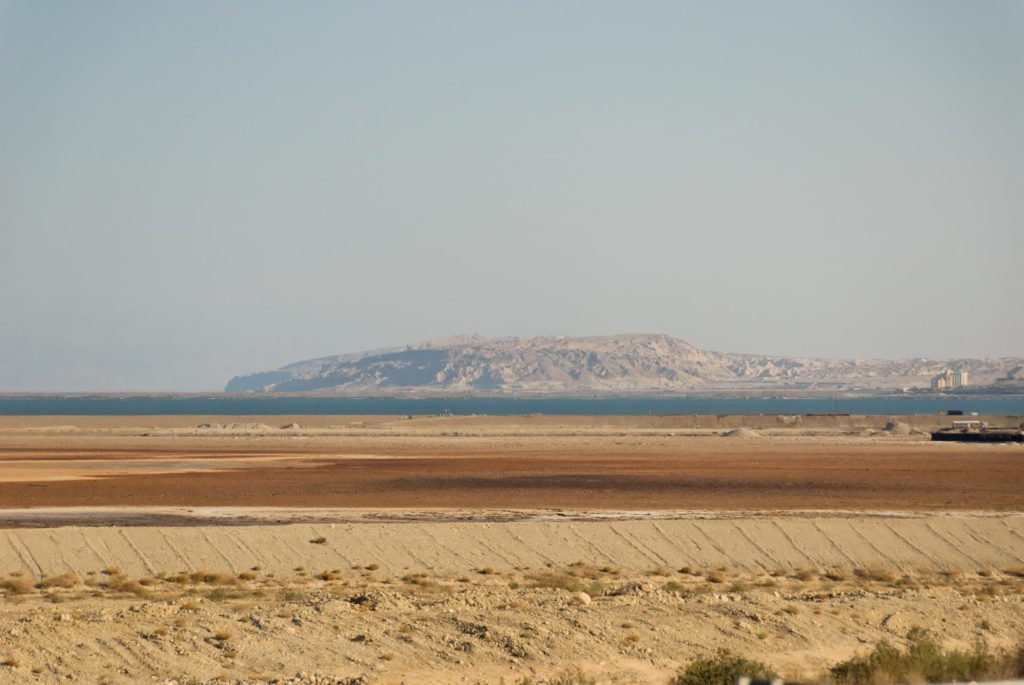
| Mount Sodom (Jebel Usdum) from north – copyright BiblePlaces.com |
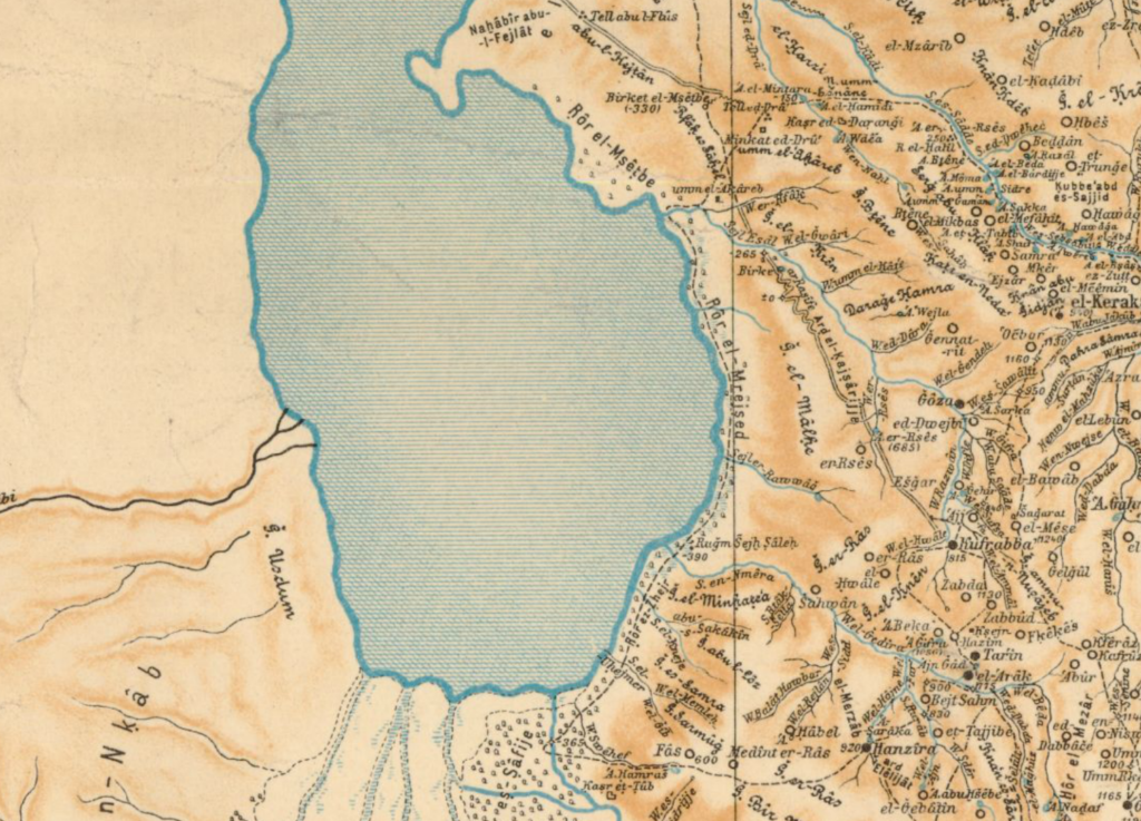
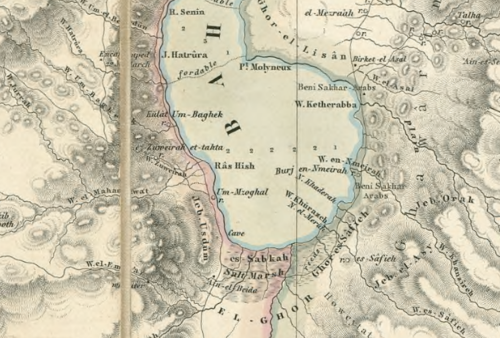
Simply put, there appears to be good toponymic evidence for the traditional references to “Mt. Sodom” that is located on the southwestern side of the Dead Sea. Researchers may be unfamiliar with this evidence, because it is absent from both the well-known Survey of Western Palestine Maps (which did not survey this part of Palestine) and the later British Mandate Map of the Negev prepared by S.F. Newcombe. In fact and somewhat ironically, this area is a bit of a black hole in the early cartographic sources of 19th and early 20th century Palestine. However, at least two sources clearly show the name “J. Usdum” in the area that is commonly referred to as Mt. Sodom. One of these sources is the lesser known map of Arabia and Petrea prepared by Alois Musil in 1900, which can be found online in three parts here. The other is a very important map prepared by Charles Van de Velde that includes the mid-19th century explorations of Edward Robinson and Charles Van de Velde and also shows the name “Jeb. Usdum” on the rocky scarp above the western shore of the Dead Sea.
 |
| Section of Musil 1900 – Karte von Arabia Petraea – see “J. Usdum” on left side near Dead Sea |
 |
| Section of Van de Velde 1865 – Map of the Holy Land – see “Jeb. Usdum” on left side near Dead Sea |
To those unfamiliar with Arabic toponymy and its relation to biblical place names – Jebel Usdum would seem to clearly preserve the name “Sodom.” The toponym’s proximity to the southern candidates (e.g., Bab edh-drah, Numeirah, etc.) would at least plausibly connect them to the cities of the plain or perhaps to destroyed and then submerged cities within the Dead Sea (as originally suggested by Albright 1924:2-12). This connection finds further support in Eusebius’ description of the “Lasan” (Hebrew = Lisan [tongue]) that he describes as being “near Sodom” (Onom. 120.3). The Lisan is the boundary of the promised land below the Dead Sea (Josh. 15:2). In light of this evidence and regardless of one’s opinion regarding the historicity or chronology of the patriarchal narratives that mention Sodom, the occurrence of Jebel Usdum on the southwestern shore of the Dead Sea together with the early Christian witness to Sodom near the “Lisan” would seem to be (more) compelling evidence that Sodom and the cities of the plain should be located on the southern end of the Dead Sea.
Bibliography