fbpx
Every discipline has its champion, its most famous pioneer, the person whom most everybody identifies as being the embodiment of a particular area of study – for the discipline of Historical Geography that person is Edward Robinson.  Robinson, the great explorer and geographer is credited with identifying over 1,000 ancient places names through his knowledge of ancient Near Eastern history and linguistics and his revolutionary usage of toponomy.  However, Edward Robinson was not the only great explorer living in the mid-1800s – there were a few men of great standing, who along with Robinson helped build the foundation of ancient Near Eastern studies for today’s scholarship.  One of those men of great standing was Titus Tobler.

Personal Biography

From Konrad Furrer’s biography on Tobler


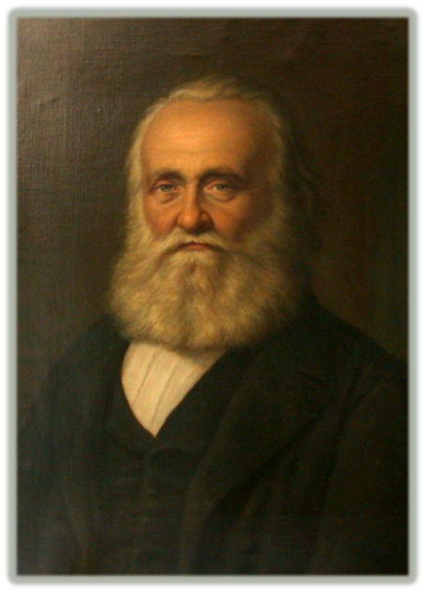
Known affectionately as the “Father of German Exploration in Palestine,[1] Titus Tobler (1806-1877), Swiss doctor and 19th century Palestine explorer, was an important figure during the mid-19th century explorations of the Holy Land. 


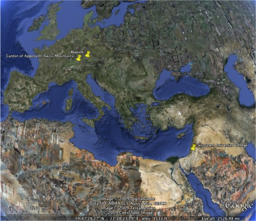
Over the course of his career Tobler made four expeditions to the Holy Land (1835, 1845, 1857, and 1865) – these expeditions were mostly directed at Jerusalem and its environs.  Tobler came to Palestine the first time as a 29 year-old physician who had just begun to practice medicine in the mountains of Canton of Appenzell [2]  Ten years later, Dr. Tobler returned to the Holy Land and accomplished one of the most in-depth, analytical studies of the region of Judea up until that time.  This expedition had such a positive impact in mid-19th century scholarship that Tobler is considered by historians to be the most important explorer of Jerusalem in the 1840s.[3]  Tobler’s personage and career are thought to be on par with the renowned Edward Robinson by researchers of the 19th century explorers of Palestine.[4]  Tobler was a highly respected explorer and diligently worked on publishing his explorations and translating ancient pilgrim documents up until his death in 1877.[5]


Methodological Developments

Titus Tobler’s Holy Land expeditions and subsequent publications were contemporaneous with other better-known 19th century explorers such as the aforementioned Edward Robinson and the Survey of Western Palestine’s C.R. Conder and H.H. Kitchener.  At first Tobler was dejected at the seemingly overcrowded group of scholars surveying, analyzing, and excavating the Levant in the 19th century.  Despite this, Tobler was able to find his own niche within the broader framework of ancient Levantine studies by combining his own considerable knowledge and research with the concepts and publications of his contemporaries.[6]  Tobler was one of the first to realize that there was no lack of problems to solve in Levantine research.  Tobler concerned himself with more than the general scope of biblical studies and site identification – he began to study “the customs and manners of the people, the nature of the soil and climate, and many other things.”[7] In examining and categorizing these subjects Tobler introduced two scholarly tools into the Holy Land studies: the monograph and the bibliography.[8] 
Notable Discoveries

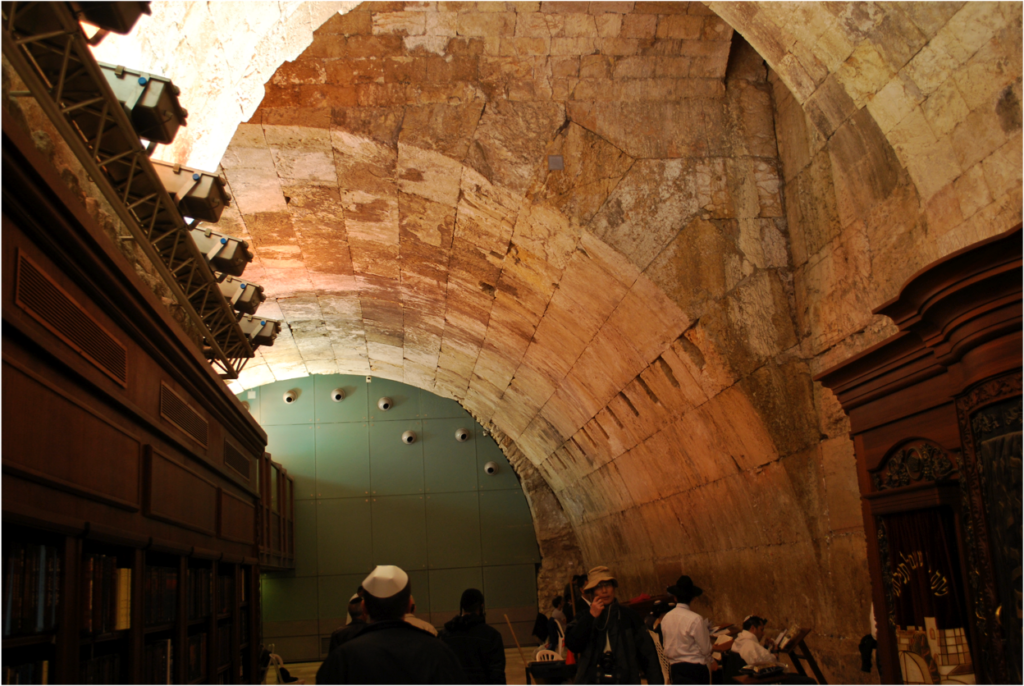
Wilson’s Arch – The 19th century explorer is most well known for discovering and suggesting the function of an arch from the Herodian Temple Mount to the Western Hill of Jerusalem.  Today this arch is known as “Wilson’s Arch” after Charles Wilson who published it, but Wilson would not have known about the arch unless Tobler had showed it to him.[9]   

“Wilson’s Arch” 2010


The “First Wall” inside of Bishop Gobat’s School (modern day Jerusalem University College) – Tobler correctly identified the remains of Josephus’ “First Wall”[10] that runs along the rocky cliffs of the southwestern part of the Western Hill above the Hinnom Valley.
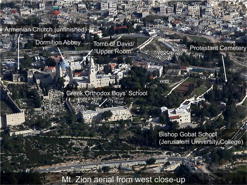
The First Wall runs beneath the Bishop Gobat School (today’s Jerusalem University College) structure and continues through the Protestant Cemetery (to the right of the school – east)

Quotes pertaining to Titus Tobler

Ben-Arieh shows Tobler’s perspective of other scholars as he quotes Tobler as saying, “Rivalry between explorers increases knowledge.”[11] 
 

Hilprecht compares Edward Robinson and Titus Tobler’s historical impact by writing the following, “As an historical topographer Titus Tobler perhaps accomplished still more than Robinson.”[12]


Tobler’s methodology and work ethic was summed up by Johannes Nepomuk Sepp (1816-1909)[13] as follows:
“A welcome incident brought me to meet Dr. Titus Tobler.  I still remember vividly the first meeting, after which we, without knowing each other, went to sleep for some hours after the celebration of the Nativity in the vault of the monastery in Bethlehem, beside a murderer running away from Egypt.  I knelt before the altar of Christ’s birth full of emotions I had never felt before, as a man to my left started measuring the steps with a measuring cord and a folding measure: one could think that he wanted to make sure that until his next visit the Holy Grotto would not be replaced: this was Tobler.  We both thought that we were opposite characters and suited to complement each other conscientiously; anyhow we considered ourselves to be an opening a new chapter in the history of Palestine pilgrims, I applauded with the fullest appreciation his extreme thoroughness; only a German can work as diligently as he…Never were greater scientific results achieved for smaller financial expense as by Tobler, who is suited to the task by his tough perseverance and effort.” [14]
Regarding the importance of Tobler’s life work Benzinger writes the following, “To this very day he who desires to concern himself with the history of these places must begin with Tobler’s investigations.”[15]
With reference to Tobler’s bibliography Gage writes, “Tobler is the first living authority, so far as the literature of Palestine is concerned; and no man has gone through more painstaking efforts than he, to extend the area of our knowledge respecting the Holy Land.”[16]
Hilprecht discusses the nature of Tobler’s bibliography as he records,
“Besides what he observed and found in the land itself, we must not forget what he accomplished at home in investigating the old descriptions of travels. One of his favorite wishes was to publish all descriptions of travels from the third to the fifteenth century in the most carefully edited form possible. This project he could, however, carry out only in a fragmentary way, and mostly at his own expense.  His excellent annotations made a number of the old writings for the first time really serviceable.”[17]

Additional Info:


For a complete list of Tobler’s 62 publications concerning Palestine refer to: Stern, S. and Haim, Goren. “A Bibliography.” Cathedra 48 (1988): 46-48.

See here for an English translation of Tobler’s bibliography of ancient Holy Land travelers (Appendix III – pages 391-411)


Check out one of Tobler’s maps of Jerusalem from Hebrew University’s database.
[1] Yehoshua Ben-Arieh, The Rediscovery of the Holy Land in the Nineteenth Century, (Jerusalem: Magnes Press, Hebrew University, Israel Exploration Society, 1979). 133.  H.V. Hilprecht, Exploration in Bible Lands During the 19th Century, (A.J. Holman & Co.: Philadelphia, 1903.) 585.
[2] Ibid, 588.
[3] Ibid, 133, 139, 177.  Haim Goren, “British Surveyors in Palestine and Syria: 1840-1841,” Tel Hai Academic College (2005): 7.
[4] Ibid, 590-591.
[5] Ibid, 177.
[6] Ibid, 74. And Ibid, 585.
[7] Ibid, 590.
[8] Ibid, 57.
[9] Dan Bahat, “Jerusalem Down Under: Tunneling Along Herod’s Temple Mount Walll” BAR 26 1 (1995): 32.
[10] For more information on the “First Wall” and its course see David Tarler and Jane Cahill, “The City of David,” The Anchor Bible Dictionary. 6 vols. Edited by David Noel Freedman, (New York: Doubleday, 1992.) 2:60.
[11] Ibid, 74.
[12] Ibid, 588.
[13] A Catholic Historian from Munich, who visited Palestine for the first time in 1845, and became famous as a leading, though controversial figure in German Holy Land research until the end of the century.  Ibid, 60.
[14] Quoted in Ibid, 60 from Johannes Sepp,  Jerusalem und das heilige Land, Pilgerbuch nach Palastina, Syrien und Aegypten, (Schauffhausen, 1863.) 8-9.
[15] J. Benzinger, “Researches in Palestine,” Explorations in Bible Lands during the 19th Century, Philadelphia (1903): 589.
[16] Ibid 391.
[17] Ibid, 590.

 
@font-face {
font-family: “Courier New”;
}@font-face {
font-family: “Wingdings”;
}@font-face {
font-family: “Cambria”;
}p.MsoNormal, li.MsoNormal, div.MsoNormal { margin: 0in 0in 10pt; font-size: 12pt; font-family: “Times New Roman”; }p.MsoFootnoteText, li.MsoFootnoteText, div.MsoFootnoteText { margin: 0in 0in 0.0001pt; font-size: 12pt; font-family: “Times New Roman”; }span.MsoFootnoteReference { vertical-align: super; }p.MsoListParagraph, li.MsoListParagraph, div.MsoListParagraph { margin: 0in 0in 10pt 0.5in; font-size: 12pt; font-family: “Times New Roman”; }p.MsoListParagraphCxSpFirst, li.MsoListParagraphCxSpFirst, div.MsoListParagraphCxSpFirst { margin: 0in 0in 0.0001pt 0.5in; font-size: 12pt; font-family: “Times New Roman”; }p.MsoListParagraphCxSpMiddle, li.MsoListParagraphCxSpMiddle, div.MsoListParagraphCxSpMiddle { margin: 0in 0in 0.0001pt 0.5in; font-size: 12pt; font-family: “Times New Roman”; }p.MsoListParagraphCxSpLast, li.MsoListParagraphCxSpLast, div.MsoListParagraphCxSpLast { margin: 0in 0in 10pt 0.5in; font-size: 12pt; font-family: “Times New Roman”; }span.FootnoteTextChar { font-family: “Times New Roman”; }div.Section1 { page: Section1; }ol { margin-bottom: 0in; }ul { margin-bottom: 0in; }
Share:
Over the next week or so I will be discussing a topic of considerable interest to this author – the identification of Beth Haccherem.  My conclusions are not revolutionary (or new), however, the methodology with which I reached my conclusion has not been used elsewhere (at least according to my knowledge.)  With that being said allow the following information to inform and introduce you to the ancient site of Beth Haccherem. 

Site Name 
Beth Haccherem literally means “the house of the vineyard.”  The name testifies to the city’s location and function.  The Judean hill country’s vine-producing capabilities are some of the best in the Levant.  Beth-Haccherem is within a larger group of sites with names derived from agricultural man-made devices. 

p.MsoNormal, li.MsoNormal, div.MsoNormal { margin: 0in 0in 0.0001pt; font-size: 12pt; font-family: “Times New Roman”; }div.Section1 { page: Section1; }
Textual Concordance (source document, available on request)
@font-face {
font-family: “Courier New”;
}@font-face {
font-family: “Wingdings”;
}p.MsoNormal, li.MsoNormal, div.MsoNormal { margin: 0in 0in 0.0001pt; font-size: 12pt; font-family: “Times New Roman”; }p.MsoListParagraph, li.MsoListParagraph, div.MsoListParagraph { margin: 0in 0in 0.0001pt 0.5in; font-size: 12pt; font-family: “Times New Roman”; }p.MsoListParagraphCxSpFirst, li.MsoListParagraphCxSpFirst, div.MsoListParagraphCxSpFirst { margin: 0in 0in 0.0001pt 0.5in; font-size: 12pt; font-family: “Times New Roman”; }p.MsoListParagraphCxSpMiddle, li.MsoListParagraphCxSpMiddle, div.MsoListParagraphCxSpMiddle { margin: 0in 0in 0.0001pt 0.5in; font-size: 12pt; font-family: “Times New Roman”; }p.MsoListParagraphCxSpLast, li.MsoListParagraphCxSpLast, div.MsoListParagraphCxSpLast { margin: 0in 0in 0.0001pt 0.5in; font-size: 12pt; font-family: “Times New Roman”; }div.Section1 { page: Section1; }ol { margin-bottom: 0in; }ul { margin-bottom: 0in; }
1.     Joshua 15:59a (LXX) (you can download a free translation of the LXX here)
2.     Jeremiah 6:1 (key verse)
3.     Nehemiah 3:14 (updated – not 3:1)
4.     Genesis Apocryphon 22:13-14 (Dead Sea Scrolls)
5.     The Copper Scroll X:47-51 (Dead Sea Scrolls)
6.     Midoth 3:4 (Mishna)
7.     Niddah 2:7 (Mishna)
8.     Jerome – Jeremiah Commentary (v. 6:1)
Proposed Identifications
@font-face {
font-family: “Courier New”;
}@font-face {
font-family: “Wingdings”;
}p.MsoNormal, li.MsoNormal, div.MsoNormal { margin: 0in 0in 0.0001pt; font-size: 12pt; font-family: “Times New Roman”; }p.MsoListParagraph, li.MsoListParagraph, div.MsoListParagraph { margin: 0in 0in 0.0001pt 0.5in; font-size: 12pt; font-family: “Times New Roman”; }p.MsoListParagraphCxSpFirst, li.MsoListParagraphCxSpFirst, div.MsoListParagraphCxSpFirst { margin: 0in 0in 0.0001pt 0.5in; font-size: 12pt; font-family: “Times New Roman”; }p.MsoListParagraphCxSpMiddle, li.MsoListParagraphCxSpMiddle, div.MsoListParagraphCxSpMiddle { margin: 0in 0in 0.0001pt 0.5in; font-size: 12pt; font-family: “Times New Roman”; }p.MsoListParagraphCxSpLast, li.MsoListParagraphCxSpLast, div.MsoListParagraphCxSpLast { margin: 0in 0in 0.0001pt 0.5in; font-size: 12pt; font-family: “Times New Roman”; }div.Section1 { page: Section1; }ol { margin-bottom: 0in; }ul { margin-bottom: 0in; }
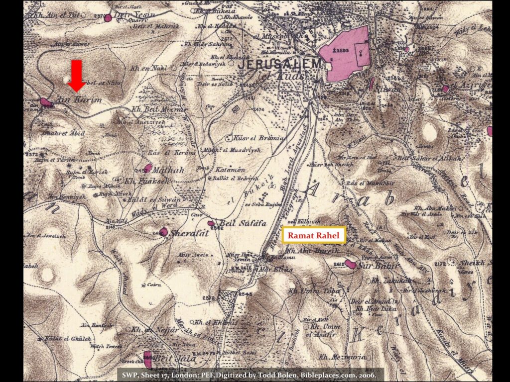
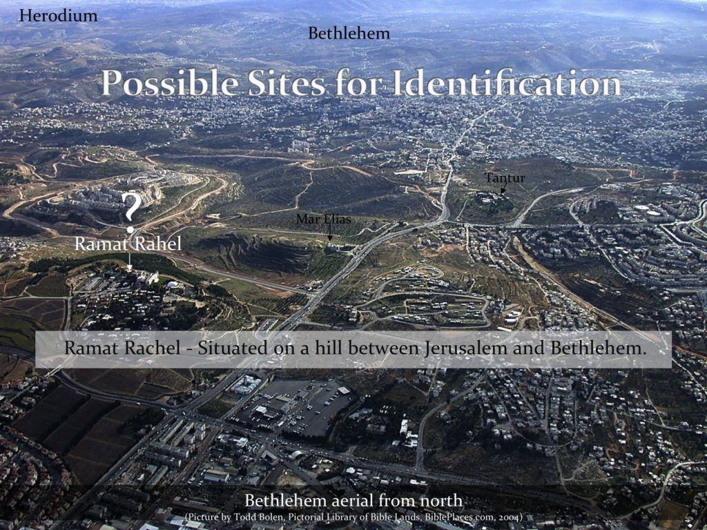
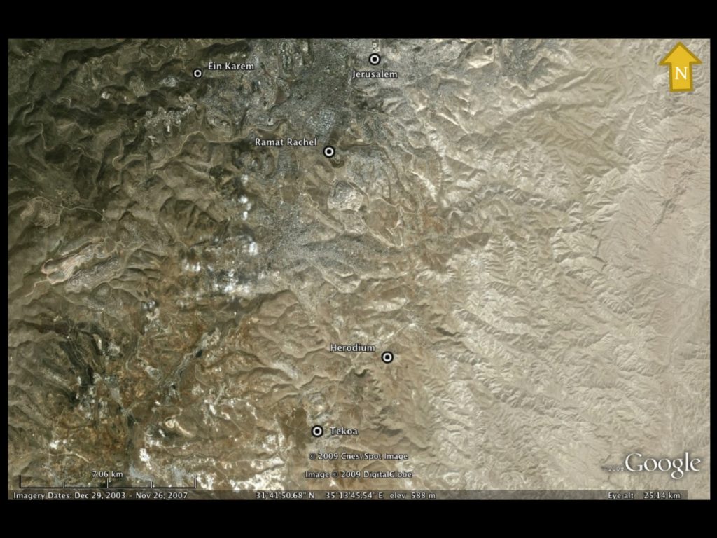
  • Herodium (Edward Robinson 1838)
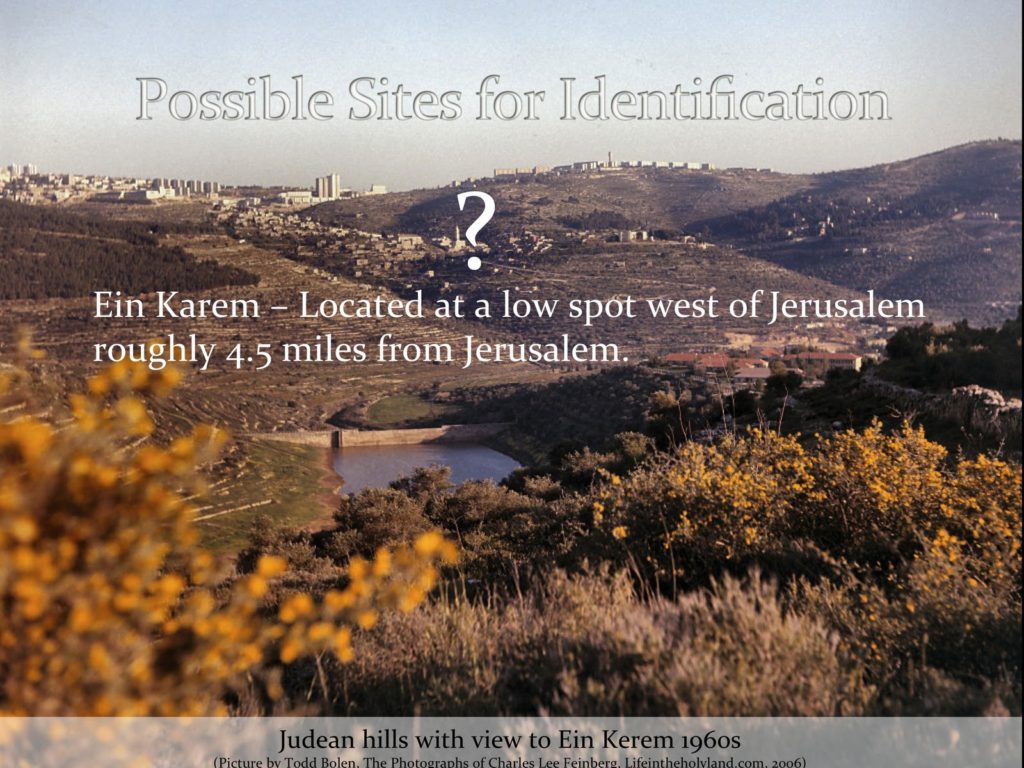
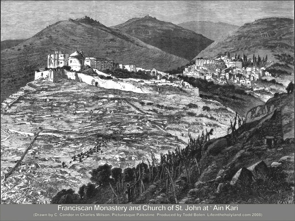
  • Ein Karem (Edward Robinson 1856 – traditional identification)
  • Ramat Rachel (Yochanan Aharoni 1950s)
Map of proposed sites (click on images to zoom)
Possible Toponymic Connections
@font-face {
font-family: “Courier New”;
}@font-face {
font-family: “Wingdings”;
}p.MsoNormal, li.MsoNormal, div.MsoNormal { margin: 0in 0in 0.0001pt; font-size: 12pt; font-family: “Times New Roman”; }p.MsoListParagraph, li.MsoListParagraph, div.MsoListParagraph { margin: 0in 0in 0.0001pt 0.5in; font-size: 12pt; font-family: “Times New Roman”; }p.MsoListParagraphCxSpFirst, li.MsoListParagraphCxSpFirst, div.MsoListParagraphCxSpFirst { margin: 0in 0in 0.0001pt 0.5in; font-size: 12pt; font-family: “Times New Roman”; }p.MsoListParagraphCxSpMiddle, li.MsoListParagraphCxSpMiddle, div.MsoListParagraphCxSpMiddle { margin: 0in 0in 0.0001pt 0.5in; font-size: 12pt; font-family: “Times New Roman”; }p.MsoListParagraphCxSpLast, li.MsoListParagraphCxSpLast, div.MsoListParagraphCxSpLast { margin: 0in 0in 0.0001pt 0.5in; font-size: 12pt; font-family: “Times New Roman”; }div.Section1 { page: Section1; }ol { margin-bottom: 0in; }ul { margin-bottom: 0in; }
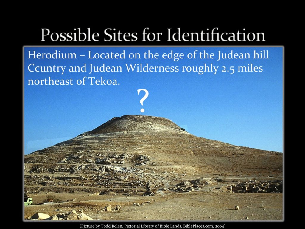
  •  Jebel Fureidis (modern – Herodium) – Arabic meaning “mountain of Herod.”
  • Ain Karem  (modern – Ein Karem) – Arabic meaning “spring of the vineyard.”
  • Khirbet Salih (modern – Ramat Rahel) – Arabic meaning “ruin of Salih” unlike many place names it is not a variant of some ancient place name.
   
More to come…
Share:
Over the last 60 years there has been some debate concerning the function of the “oldest building in the world” at Jericho (i.e. the Neolithic tower at Jericho/Tell es Sultan).  The Neolithic tower is well-known to visitor’s of Jericho, but its function as a structure has befuddled archaeologists. Amihai Mazar best sums up the various views like this,

“The walls and tower of PPNA (Pre-Pottery Neolithic A) Jericho are a most surprising discovery from a period when almost no public architecture is known elsewhere.  They were explained by Kenyon as a fortification system, and they led her to define Jericho as the earliest urban community known.  An alternative suggestion, offered by O. Bar-Yosef, is that the massive walls were intended to protect the settlement from the thrust of silt and eroded debris from the wadi to the west.  The round tower remains unexplained by this theory, but it could not have had a defensive purpose due to its location on the inner side of the wall.  Perhaps it had some ritual function.”*

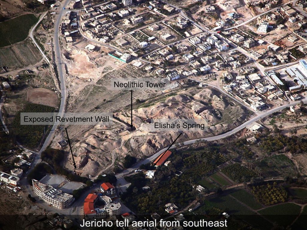
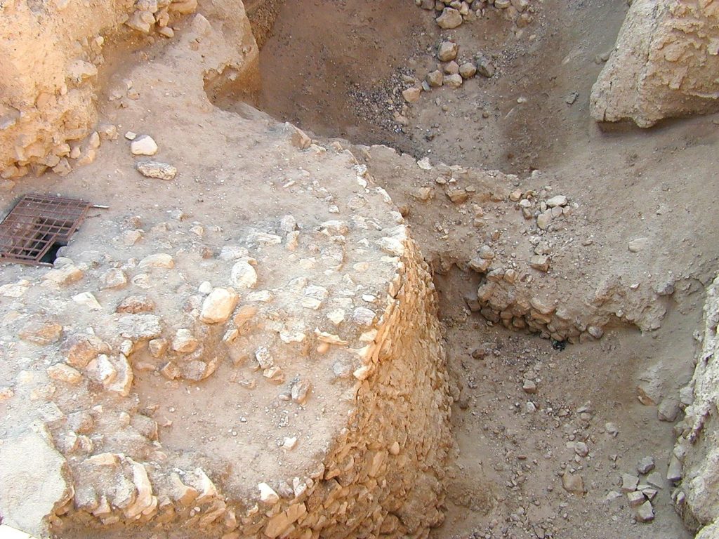
Neolithic tower with adjoining wall

Enter “worker intimidation” to the list of potential explanations.   Arieh O’Sullivan disseminates the theory of Ran Barkai and Roy Liran at The Media Line

The world’s first skyscraper was built by early farmers, who were frightened into erecting a solar marker by mankind’s early bosses, archaeologists say.

Long before its Biblical walls came tumbling down, Jericho’s residents were being enticed to give up hunting and gathering and start farming for a living. They settled in this oasis next to the Jordan River and built a mysterious 8.5-meter (28-foot) stone tower on the edge of town.

When discovered by archaeologists in 1952, it was dated at over 11,000 years old, making it the first and oldest public building even found. But its purpose and the motivation for erecting it has been debated ever since.

Now, using computer technology, Israeli archaeologists are saying it was built to mark the summer solstice and as a symbol that would entice people to abandon their nomadic ways and settle down.

“The tower was constructed by a major building effort. People were working for a very long time and very hard. It was not like the other domestic buildings in Jericho,” said Ran Barkai of the Department of Archaeology at Tel Aviv University, who was part of a team that did the computer analysis.

Barkai and fellow archaeologist Roy Liran used computers to reconstruct sunsets and found that when the tower was built the nearby mountains cast a shadow on it as the sun set on the longest day of the year. The shadow fell exactly on the structure and then spread out to cover the entire village. 

HT: Joe Lauer

*Quote taken from Mazar, Amihai. Archaeology of the Land of the Bible. New York: Doubleday, 1992.

Share: