There is a fabulous new resource available that I’m delighted to be the first to tell you about. For the last four years when teaching seminary and church groups in Israel, I’ve had as the class guide an outstanding resource that nobody else could buy. I joked with my last group that this book cost $3,640 because they could only get it by coming with me on the trip. The other option was to enroll as a student in one of the short- or long-term study programs at The Master’s College’s campus in Israel for even more money. Today, for the first time ever, you can purchase your own copy of the Satellite Bible Atlas. This new work by Bill Schlegel replaces the venerable Student Map Manual but is superior to it in many ways. One obvious advantage is that you don’t have to spend 60+ hours marking it before it is usable! All the historical markings are printed in bright colors on top of satellite map imagery. Another advantage is that the commentary is on facing pages with the maps, so you have easy access to everything that is going on. If you want more, you can download the free, 200-page expanded commentary, The Land and the Bible: A Historical Geographical Companion to the Satellite Bible Atlas. This resource is ready for personal use, classroom use, and field trip use. The author, Bill Schlegel, has been teaching college and seminary students in Israel for 25 years. Everything in the Satellite Bible Atlas is field-tested by a professor who knows God’s land and loves God’s Word. Here are 7 more reasons I love the Satellite Bible Atlas: 1. The maps are full-size, full color, and full of rich detail of the hills, wadis, plains, and passes.
 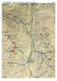 2. There are 85 maps which means that every major historical event is covered, from Abraham to Paul. Too often the New Testament gets short-changed in atlases, but not here: the Satellite Bible Atlas has 9 maps for the life of Christ and 6 for the apostolic period. 3. The Satellite Bible Atlas includes 17 detailed topographical maps without historical markings. These are ideal for getting the best view of the terrain as well as both ancient and modern sites. 4. I fully trust the markings and the commentary. There are not many works in this field for which I can say that. 5. The north-orientation of the maps means there is no immediate learning curve as there was with the previous atlas we used which put east at the top. I put this atlas in the hands of my church group last year and they were immediately off and running. Several have commented to me in the last few weeks that they regularly use the Satellite Bible Atlas as they read the Bible. 6. The atlas comes with a free copy of all the maps in digital (jpg) format. You will receive a link to download the maps with your order confirmation. 7. For $30, plus $3 shipping and tax where applicable, you get an excellent atlas at an outstanding price. (For an additional discount on purchases of 10 or more copies, contact us.) Check out the sample maps, the table of contents, endorsements, teaching videos, and the free downloads. You can order here.
This is a series I should have done on this blog. But BibleX has done it first and quite well: Picture Taking Tips for the Holy Land, Part 1, Part 2, and Part 3. Thank you, Dr. Savelle.
The Shephelah is a great place to live. The ancients knew it and now modern people are catching on.
That’s bad for those who care about the preservations of ancient sites, as Luke Chandler explains in his well-illustrated post, Khirbet Qeiyafa to be Enveloped by City Expansion.
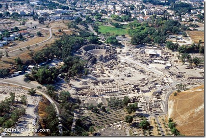
Beth Shean—A Place for Happy Explorers: Check out the photos, the video, and the city’s lingering lesson.
“Huge flocks of synchronized starlings that appear like a black cloud returned to Israel last year for the first time in 20 years.” This free Haaretz article includes impressive photos.
Jerusalem Online has a 4-minute video on The Search for Herod’s Grave. You can read the transcript at the same link.
The ancient Corinthians liked to feast, a fact confirmed by the recent excavation of more than 100,000 bones excavated in the abandoned theater.
The Guardian reports on Turkey’s on-going efforts to blackmail museums around the world.
For more, check out the Archaeology Weekly Roundup at the ASOR Blog.
HT: Joseph Lauer, Jack Sasson
Photo from Samaria and the Center.
- Tagged Greece, Jezreel Valley, Museums, Shephelah, Tourism, Turkey, Weekend Roundup
Old City: A small excavation inside a dwelling south of Damascus Gate and west of the Austrian Hospice revealed pavement and pottery from the Mamluk period.
Rasm al-‘Amud: This site on the lower southeastern slopes of the Mount of Olives is located nearly 1 mile east of the City of David. Excavation of fifty squares revealed six strata dating from the Intermediate Bronze (VI-V), Middle Bronze IIA (IV), Middle Bronze IIC-Late Bronze (III), Iron II (II), and Late Roman-Early Byzantine (I). The best preserved remains are the earliest and come from a semi-nomadic group that settled down near the water source. In the 9th-7th centuries, the site was a cultivated garden and a jar handle was found with an inscription that reads “ …ל (?)מ/נחם ” (“Le[?]m/nhm”). The report includes a photo of the inscription.
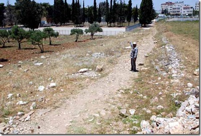
Beit Hanina: Remains were excavated of seven phases of the Roman road that branched off from the Jerusalem-Shechem road heading towards the Beth Horon ridge. The report doesn’t mention it, but this is the route Paul would have taken on his way to Antipatris and Caesarea (Acts 23:31). Other road segments were excavated, but no map has been published.
Nahal Rephaim: A survey of this valley southwest of the Old City (see 2 Sam 5:18-25) identified 42 sites including watchman’s huts, a limekiln, a burial cave, a cistern, five roads, and farming terraces.
“Based on the rural nature of the surveyed area, it seems that it constituted part of Jerusalem’s agricultural hinterland, at least during some of the ancient periods.” Compare Isaiah 17:5: “It will be…as when a man gleans heads of grain in the Valley of Rephaim.”
Photo by IAA.
- Tagged Excavations, Jerusalem
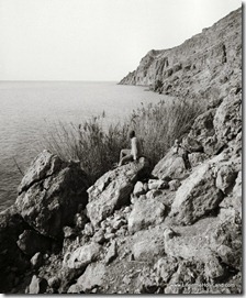
The level of the Dead Sea has risen for the first time in the last ten years.
Egyptian police seized a carload of 863 ancient artifacts, including 10 scarabs, 180 amulets, 120 Ptolemaic coins, 407 Roman coins of bronze, 3 Osirion wooden statues, and a limestone statue.
Victor Avigdor Hurowitz, Professor in the Department of Bible, Archaeology and Ancient Near East at Ben-Gurion University, has died after a long illness.
Shmuel Browns’ Photo of the Week is an impressive shot of the Keshet Cave in western Galilee.
The Samaritans on Mount Gerizim can vote twice this week.
Accordance Bible Software has an outstanding sale going on right now for both sets (9 volumes) of the Zondervan Illustrated Bible Background Commentary, Old and New Testaments. It’s marked down now 63% to $150. These volumes have lots of images you can easily search and use. Sale ends on Monday.
HT: Charles Savelle
Photo from Southern Palestine photo collection
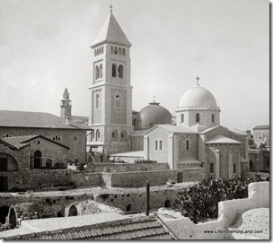
This may be the most interesting archaeological excavation in the Old City of Jerusalem in the last few years. The Lutheran Church of the Redeemer is located next door to the Church of the Holy Sepulcher. From DW:
Two-thousand years of biblical history lay buried 14 meters beneath the Lutheran Church of the Redeemer in Jerusalem. German archeologist Dieter Vieweger led the excavation of the site.
A Herodian quarry, the remains of Golgotha, buildings from the period of the Roman Emperor Hadrian, mosaics from the Church of Saint Maria Latina: At the end of 2012, the Archaeological Park was opened under the Lutheran Church of the Redeemer in Jerusalem, giving visitors the chance to take a tour of these locations and understand the city’s colorful past. German archeologist Dieter Vieweger spent three years building the park together with a team of students and experts.
[…]
The archaeological park makes 2,000 years of history in Jerusalem visible – from Herod to the Crusaders to today. As a biblical archeologist, which chapter in history do you find most interesting?
For me, of course, the oldest layers are the most interesting – those buried 14 meters (46 feet) under the Church of the Redeemer. That’s where we found a stone quarry built by Herod the Great. You can actually walk around it and see how thick the stones were carved out, sawn and broken. The quarry was used to expand the city to the east of the site at Herod’s instruction. But not all of the stone was taken from the ground where the Church of the Redeemer now stands. This area was later called Golgotha, the location where Jesus was crucified. In this section of the archeological park, visitors come very close to Christian and Jewish history.
The full article is here. The site is now open to the public, but it closes early in the afternoon. In a post last year, Tom Powers wrote about his tour of the site before it opened.
Photo from The American Colony and Eric Matson Collection
- Tagged Excavations, Jerusalem
The Israel Museum’s largest and most expensive archaeological project will open on February 12 and run for nine months. From Phys.org:
Israel’s national museum said Tuesday it will open what it calls the world’s first exhibition devoted to the architectural legacy of biblical King Herod, the Jewish proxy monarch who ruled Jerusalem and the Holy Land under Roman occupation two millennia ago. The display includes the reconstructed tomb and sarcophagus of one of antiquity’s most notable and despised figures, curators say. […] Herod’s final grandiose project was to prepare for death. Curators believe Herod constructed an extravagant, 25-meter-high (80-foot-high) tomb. Israeli archaeologist Ehud Netzer spent 35 years of his career searching for it. In 2007, Netzer drew international attention when he announced he had found what he believed was the tomb at the Herodion, the ruler’s winter palace, located on a cone-like hill that still today juts out prominently in the barren landscape of the Judean Desert, near the West Bank city of Bethlehem. In 2008, the archaeologist approached the Israel Museum about creating an exhibit that would display artifacts from one of the greatest finds of his career. While surveying the Herodion site with museum staff, Netzer fell to his death. Museum staff pushed forward with planning the exhibit. In 2011, the museum used a crane to remove dozens of half-ton columns and the roof of what Netzer identified as the top floor of Herod’s tomb, which he thought held his sarcophagus. Each stone was affixed with an electronic chip so it could be more easily be put back together at the Israel Museum. Three sarcophagi were found at the site, and curators believe one was Herod’s. Though it bears no inscription, it is made of a special reddish stone, found smashed into hundreds of pieces. The Jewish zealots who took over the Herodion after Herod’s death likely smashed the sarcophagus to pieces, destroying the symbol of a man who worked with the empire they were rebelling against, curators said.
The full story is here. Barry Britnell also notes a 60-second promo video made by the Israel Museum. In related news, The Times of Israel reports:
As part of a new plan, a replica of his tomb at Herodium, situated outside the West Bank city of Bethlehem, will tower to 83 feet and will be visible from Jerusalem.
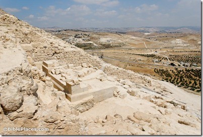 Remains of Herod’s tomb at the Herodium.
Photo from Judah and the Dead Sea.
- Tagged Judah, Museums, New Exhibits
The BiblePlaces Blog provides updates and analysis of the latest in biblical archaeology, history, and geography. Unless otherwise noted, the posts are written by Todd Bolen, PhD, Professor of Biblical Studies at The Master’s University.
As an Amazon Associate we earn from qualifying purchases. In any case, we will provide honest advice.
