fbpx

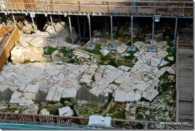
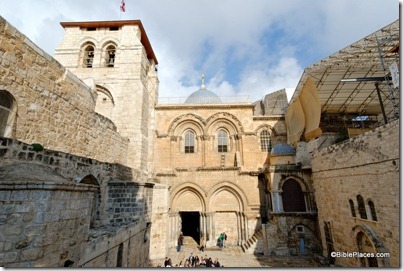
In Old City Odds ‘n Ends, Tom Powers reports on the clean-up of Hezekiah’s Pool, repairs at the Church of the Holy Sepulcher, and construction in Solomon’s Quarries. He also lists some posts he hopes to write in the months ahead.

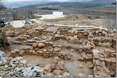
Luke Chandler has some new photos of Khirbet Qeiyafa.

Over on the Accordance Forum, David Lang asks whether commercial graphics collections are useful in light of Google Images.

Larry Hurtado highly recommends the Atlas of the Early Christian World (1958).

The reformatted Soncino Babylonian Talmud is now available online.

In recent weeks, Wayne Stiles has taken readers of his column at the Jerusalem Post to Masada and the Citadel of David.

A 64th tomb has been discovered in Egypt’s Valley of the Kings. (The tomb of King Tut was number 62.)

Some thieves were caught looting a site in the Judean wilderness near Tekoa.

The Harvard Semitic Museum is baking thousands of ancient clay tablets.

HT: Jack Sasson, Joseph Lauer

Share:

One of the most significant cities in the Shephelah of Judah, Azekah has never been scientifically excavated. Victim to the spades of Robert Alexander Stewart Macalister and Frederick J. Bliss in 1898-99, Azekah’s secrets have remained hidden while major expeditions have studied the nearby cities of Gezer, Beth Shemesh, Gath, and Lachish. Now the Wissenschaftlich-Theologisches Seminar of Heidelberg University has joined with Tel Aviv University to lead an international consortium in a survey and excavation of the site and vicinity.

The excavation will be directed by Oded Lipschits and Yuval Gadot of Tel Aviv University along with Manfred Oeming of Heidelberg University. The first season runs from July 15 to August 24, 2012 and volunteers are encouraged to apply. Three courses are offered for credit for university students.

The importance of Azekah is clear from its mention in Assyrian and biblical texts.

  • The Canaanites escaping from Joshua’s attack fled as far as Azekah (Josh 10:10-11).
  • The Philistines and their giant Goliath were camped between Azekah and Socoh (1 Sam 17:1).
  • Rehoboam fortified Azekah (2 Chr 11:9).
  • An Assyrian king, possibly Sargon II, said of the city, “Azekah is a stronghold which is situated in the midst of the mountains, located on a mountain range like a pointed dagger, it was like an eagle’s nest and rivaled the highest mountains and was inaccessible even for the siege ramps and for approaching with battering rams it was too strong.”
  • Azekah was one of the two last cities holding out against the Assyrian king Sennacherib (Jer 34:7; cf. Lachish Letter #4).
  • Azekah was resettled after the Babylonian exile (Neh 11:30).

HT: G. M. Grena

Azekah and Elah Valley aerial from east, tb011606799

Azekah and Elah Valley from the east
Share:

Neot Kedumim is a treasure in the heart of Israel that too few visitors know about. This biblical landscape reserve is located between Jerusalem and Tel Aviv and includes 620 acres of trees, plants, flowers, and fauna that were common in Israel in the biblical period.

A new three-minute video does a great job of showing the park in its glory (HT: Biblical Flora).

I brought a group of seminary students to Neot Kedumim last week and it was a valuable time for all.

This is one of the few places where one learns with all of the senses. One could spend as little as two hours on a tour or as much as a week without seeing it all. If you have not yet been, you should put this site on your list for your next visit.

The books of founder Nogah Hareuveni are excellent, and I see that Amazon has a few used copies for very good prices (and some copies at very high prices):

Nature in Our Biblical Heritage (from $3.96)

Tree and Shrub in Our Biblical Heritage (from $2.86 and $9.99)

Desert and Shepherd in Our Biblical Heritage (from $84.97)

Neot Kedumim sells these books in their shop for about $30. Shipping is extra.

Tamarisk tree at Neot Kedumim, tb011012331

Tamarisk tree at Neot Kedumim, January 2012

Genesis 21:33 (NIV) “Abraham planted a tamarisk tree in Beersheba, and there he called upon the name of the Lord, the Eternal God.”

1 Samuel 22:6 (NIV) “Now Saul heard that David and his men had been discovered. And Saul, spear in hand, was seated under the tamarisk tree on the hill at Gibeah, with all his officials standing around him.”

1 Samuel 31:13 (NIV) “Then they took their bones and buried them under a tamarisk tree at Jabesh, and they fasted seven days.”

Share:

Question: I teach Sunday School to teens and plan on teaching adult Bible studies as well. Do you know of any comprehensive multimedia teaching materials that would cover all the books of the Bible, allowing me to read line by line from Genesis to Revelation and explain the spiritual meaning while also being able to simultaneously project photos, maps, charts, etc. relating to these scriptures to add depth to the teaching/preaching? –P.K.


Answer: A really good resource that does just this is Glo. I selected nearly 1,300 photos from my collections that were most relevant to each book of the Bible. Digital Immersion added hundreds of videos, charts, and graphics, all organized by biblical book and chapter. The software is very impressive, and remarkably inexpensive (~$60).

Readers who have other suggestions are welcome to post a comment.

image

Share:

Question: I was wondering if you know of any websites that sell maps of Israel (4 x 3 feet or so) for decorative wall mounting? I found some information about Palestinian Exploration Fund linen maps selling for $200-400, dating back to 1800s but that’s about it. I prefer a vintage look over a modern National Geographic look. If you have any leads, could you pass them on? Thanks! –J.K.


Answer: I don’t know of anywhere to purchase printed maps like these, but perhaps you could find some high-res ones online that you could enlarge and print. Because any created before 1923 are no longer under copyright restriction (in the U.S.), many are available online. I would recommend that you begin with the following sources:

http://www.jnul.huji.ac.il/dl/maps/pal/html/

http://jewishhistory.huji.ac.il/links/maps.htm

http://www.lib.utexas.edu/maps/historical/index.html

Another possibility is the collection of Survey of Western Palestine maps that we produced. These are very high resolution on the CD (~7500×6500 pixels) and in my archive I have even higher-resolution images available by request.

Readers who have other suggestions are welcome to comment below.

Jerusalem center, SHEET_17

Survey of Western Palestine (1880), a section of Sheet 17
Share: