fbpx

More than 20,000 people have offered suggestions as to the purpose of the mysterious marks recently uncovered by archaeologists in Jerusalem. From the Jerusalem Post:

Last week, Ir David Foundation head archeologist Eli Shukron told reporters he was so puzzled by the shapes – three V’s about 50 cm. long and 5 cm. deep – that he couldn’t begin to guess their function. The figures were found in a room near a spring, an important ritual area for the ancient city.
But Shukron’s bewilderment hasn’t stopped people around the world from offering their conjectures. Among the most interesting ideas: a torture device, drainage for ancient urinals, the original McDonald’s sign, an abbreviation for “veni vidi vici” (Latin for “I came, I saw, I conquered”), a footprint from King Solomon’s pet dinosaur, molds for smelting iron to make tools, the Trinity, a representation of mountains or the symbol for water, signs to the exit, an alien cryptogram, or support for a wooden structure.
Or perhaps, as one reader commented, “3,000 years ago, a worker said to his buddy, ‘I know how to drive archeologists crazy…’”

marks
The marks remind me of preparation to cut a board. If these engravings are directly above Hezekiah’s Tunnel (and I don’t know that they are), I’d surmise that the outer arrows mark the edges of the cutting and the middle one marks the center point.

The full story is here. You can read the 20,000 comments and make your own here.

HT: Joseph Lauer

Share:

Jerusalem’s city engineer has ordered that the only access route for non-Muslims to the Temple Mount be closed immediately. The Western Wall Heritage Foundation has one week to submit objections. Haaretz reports:

Jerusalem municipality officials stressed that the wooden bridge poses a severe security threat since it is highly flammable and in danger of collapsing. They warned that if a fire breaks out it could spread to the Temple Mount.

I can’t help but thinking that this is a political move, not primarily an issue of safety. The bridge has been made of wood since it was constructed and did not become “highly flammable” yesterday. As for a fire spreading to the Temple Mount, the doors at the gate might burn, but everything else in the area is made of stone. In other words, there seem to be other reasons for this urgent order. Of course, is there anything in Jerusalem that is not political? Yet the news reports make no such suggestion, so it seems worth pointing out to those less familiar with the situation.

A brief review of recent history of access to the Temple Mount may be helpful:

Sept. 2000 – Muslims close access to Temple Mount and its shrines to all non-Muslims.

Aug. 20, 2003 – Israel re-opens the Temple Mount to tourists over Muslim objections (photos here). Shrines remained closed.

Feb. 14, 2004 – The earthen ramp to the Mughrabi Gate collapses after a snowstorm (photos here).

Mar. 2005 – A wooden bridge is constructed to permit access to the Temple Mount.

Jan. 2007 – Excavations begin on the earthen ramp (photos here). Muslims protest after being told by
their leaders that the Temple Mount is being undermined. Israelis halt the excavation in June.

Mar. 2011 – Construction of a new bridge is authorized by an Israeli judge.

June 2011 – Israel delays construction of a new bridge until September.

Oct. 2011 – Jerusalem’s city engineer orders that the Mughrabi bridge be repaired or closed.

Nov. 2011 – Prime Minister Netanyahu orders that closure of the ramp be postponed.

This review excludes other relevant events, including the opening of the Western Wall tunnel, the illegal excavations on the Temple Mount, the resultant bulges on the southern and eastern walls, and the continuing political impact of these events.

Today’s story is reported by the Jerusalem Post and Haaretz. An aerial photo with the relevant sites labeled is posted here.

Share:

Archaeologists working near the Gihon Spring are confounded by a series of “V” shapes cut into the floor of a room. Archaeologists Eli Shukron and Ronny Reich date the marks to 800 BC or earlier, and they note a similar mark from the excavations of Parker, but they cannot explain the purpose of these 1.5-feet-long (0.5-m) carvings in the limestone. From the Associated Press:

Israeli diggers who uncovered a complex of rooms carved into the bedrock in the oldest section of the city recently found the markings: Three “V” shapes cut next to each other into the limestone floor of one of the rooms, about 2 inches (5 centimeters) deep and 50 centimeters long. There were no finds to offer any clues pointing to the identity of who made them or what purpose they served.
The archaeologists in charge of the dig know so little that they have been unable even to posit a theory about their nature, said Eli Shukron, one of the two directors of the dig.
“The markings are very strange, and very intriguing. I’ve never seen anything like them,” Shukron said.

The continuation of the story gives more information about the “V” found by Parker, the unique nature of the room, the standing stone found nearby, and a couple of nice photos.

The City of David Facebook page is asking readers who have seen anything similar elsewhere in the world to share their knowledge.

Share:

We noted last week the inauguration of the “Gospel Trail,” a 40-mile route that runs from Nazareth to Capernaum. Tom Powers has noted an article in Haaretz that discusses the need for a $700,000 expenditure to create a trail with essentially the same purpose and route as one established several years ago.

All well and good, but a brief perusal of the map of Israel reveals that another route was dedicated three years ago and goes by a few names, among them the “Jesus Trail.” It follows a slightly different route, 65 kilometers in length, with orange trail markings, from Nazareth to Lake Kinneret, and caters – until recently, with the enthusiastic encouragement of the Tourism Ministry – to exactly the same clientele.
The creation of the older route began as an initiative of Maoz Yinon, a 35-year-old entrepreneur who owns the Fauzi Azar hostel in Nazareth, plus another hostel in Jerusalem. At the time Yinon won the support of many groups for his plan, among them the Tourism Ministry, the Israel Trails Committee (part of the Society for the Protection of Nature in Israel ) and several local authorities. Together with an American Christian named David Landis, he developed a route based on three principles: It would have a connection to Christian tradition, it would feature hiking in beautiful landscapes and it would encourage the involvement of local communities.

Tom references a blogpost (that I cannot locate) on the Jesus Trail site which distinguishes between the two trails. In Tom’s words (slightly reformatted):

The new Gospel Trail does not

  • take into account hikers’ need for regular water sources,
  • it bypasses too many important Christian sites,
  • it was not planned in cooperation with local communities,
  • and the places visited are not truly representative of Galilee’s diverse social fabric – more specifically, it steers the trail users away from Arab towns and villages in favor of Jewish areas.

I’m sure that the Israeli Ministry of Tourism will have a different perspective to justify their expenditure of 3 million shekels.

Share:

Ferrell Jenkins has produced an interesting series of posts this week on an important stop on Paul’s first and second missionary journeys:

Shmuel Browns has been off Hiking Nahal Og. This is a loop hike not far from Jerusalem that takes two hours. The photos confirm his introduction:

This is a real gem of a hike. Nahal Og is less than a half hour from Jerusalem in the Judean desert. It’s picturesque in a rugged, desert kind of way so it’s a good opportunity for taking photographs of the scenery and of course your family/group.

A recent conference at the Notre Dame Center in Jerusalem “discussed the geography and history of the country and how to better organize pilgrimages and prepare pilgrims so when they arrive at their destination, they may have a greater awareness of their experience.”

A new visitor’s center has apparently opened in Jaffa (biblical Joppa). “We built new galleries, we opened a new visitors’ center. We tell the stories of the history of the city from the time of the Bible, the Ottoman and Roman Empires, and the Egyptians in Jaffa.” The report includes a two-minute video.

Penn Museum has announced its Online Collections Database. “Currently, the online database contains more than 314,000 objects records representing 660,000 objects with 46,000 images illustrating 21,000 object records. Based on current workflows, we expect the number of objects records to increase by roughly 7,000 records every six months, with an additional 5,000 object photographs added as well.”

A large statue of Amenhotep III has been discovered at the pharaoh’s mortuary temple in Luxor.

HT: Jack Sasson

Share:

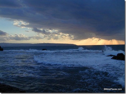
An old tradition identifies the area of Kursi as the place where demon-possessed pigs drowned themselves in the water. Developers planning to construct a vacation village have now been granted permission as long as they provide public access to the beach and construct a promenade to connect with a path around the Sea of Galilee. From the Jerusalem Post:

A compromise was approved by a district court last Thursday between Adam Teva V’Din – Israel Union for Environmental Defense and vacation village developers, that will allow for guaranteed public access to the beaches and infrastructure developed at a Kinneret beach on the Golan Heights, both sides confirmed on Tuesday.
Along with local residents, Adam Teva V’Din had filed a petition arguing that the Kursi resort project should not be allowed to go forward without public access to the beach and open areas.
The parties eventually reached a compromise, allowing for the continued construction of the village, but with an officially mandated agreement that will allow for public access to the beach and surrounding nature spots. In addition, the developers will be responsible for building a public parking lot and a promenade that connects with the existing path that surrounds Lake Kinneret, according to Adam Teva V’Din.

The full story is here. According to the best NT manuscript evidence, no pigs died at Kursi. The site of the swine dive should be located in the territory of the Gadara on the lake’s southeastern shore.

Kursi cliff view to north, tb102602013

View north from the slope of Kursi
Share: