fbpx

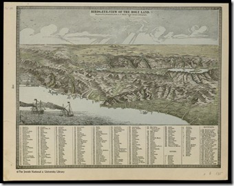
The Ancient World Online (AWOL) has several posts of map resources this week. The Digital Atlas of Roman and Medieval Civilizations is a work-in-progress by students and faculty at Harvard. The Jewish National and University Library in Jerusalem has now made available online the Eran Laor Cartographic Collection. For more historic maps, start with the Links page at this site.

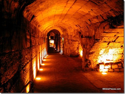
Tom Powers reports that you can now walk underground (on the street and through the drainage channel) from the Pool of Siloam to the Givati Parking Lot opposite the entrance to the City of David. He also has photos of the new exit for the passage just below Robinson’s Arch. (The unsightly railing smack in the middle of the first-century street will cause distress for those who haven’t already taken photographs of this historic site.)

The Jerusalem municipality is promoting a “Take two days in Jerusalem” campaign this summer, and the list of cultural events is extensive:

The International Festival of Light, Knights Festival, International Film Festival, Puppets Theater Festival, Opera Festival, Balabasta Festival in Mahane Yehuda Market, Jerusalem Beer Festival, Arts & Crafts Festival, End of Summer Celebration Festival, Wine Tasting Festival, Shalem Dance Festival, Ziggy Marley, Infected Mushrooms, Matisyahu, Eyal Golan, Renee Fleming and more!

Arutz-7 is reporting illegal construction activity at Gibeah of Saul.

Recent events in the Middle East may have a downside: “The ‘Arab Spring’ may have facilitated trade of a treasure trove of stolen assets in the world’s art and antiquities markets.”

The Ashmolean Museum at Oxford will be opening new wings for ancient Egypt and Nubia in November.

Amihai Mazar will be giving a public lecture in Sydney, Australia in September.

HT: Joseph Lauer, Jack Sasson, BibleX
pal0700_b

Bird’s Eye View of the Holy Land, engraved from A. J. Marks lithograph, 1880s. Source: Eran Laor Cartographic Collection.
Share:

Many of the blogs related to Israel and biblical sites are focused on matters of academic or current interest. The purpose of David Lang’s new blog is to help the reader to connect facts to faith. Lang is the author of the Bible Lands PhotoGuide for Accordance Bible Software and he is currently writing a book, Feet to Follow, Eyes to See. He writes:

Ultimately, that’s my goal in writing this book. There are plenty of excellent books which offer facts about biblical backgrounds, but I want to bridge the gap between fact and faith. I don’t just want you to understand the Bible more clearly; I want you to hear God speaking to you through His Word.

His series “Dotwatch” helps readers to “connect the dots” for readers who live in a different time and place than biblical writers. In his most recent post in this series, he reflects on the difference between what his intense study of the land of Israel prepared him for and the reality he experienced on his first trip.

Even though my in depth study of all those photos gave me a good sense of what to expect, there was one thing those photos could not adequately give me: a proper sense of scale. There’s a difference between seeing a photo of the colonnaded street of Beth-Shan and actually standing at the foot of one of those massive columns. Even if the photo actually shows people standing next to those columns, so that your mind is able to conceive the difference in height, it is somehow not the same thing as actually being there. Getting a sense of scale from a photograph is a clinical kind of knowledge. It cannot convey the experiential knowledge of actually being dwarfed by something and feeling awe at its grandeur. Somehow, this second kind of knowledge is deeper and far more real. I suppose you could say it’s the difference between seeing in three dimensions rather than two.

I appreciate Lang’s insights and personal style. I look forward to following along with him on his journey.

Share:

The latest issue of Hadashot Arkheologiyot: Excavations and Surveys in Israel has now been published online. Most of these excavations are salvage digs, conducted quickly in advance of a building project. The list of sites is impressive and includes:

  • Ashkelon
  • Bethlehem of Galilee
  • Caesarea
  • En Gedi
  • Omrit
  • Jerusalem: Sultan’s Pool, City of David, Via Dolorosa
  • Kafr Kanna (Cana?)
  • Kinneret: Path around the Sea of Galilee
  • Nein (Nain of Luke 7)
  • Ono
  • Tel Dor
  • Tel Qasile
  • Tel Rekhesh
  • Zippori (Sepphoris)

One report, however, is missing. Last week reader Roi Brit alerted me to the report on “Jerusalem, the Old City, Wilson’s Arch, and the Great Causeway.” This is now missing from the list and the link is defunct. One can still see, however, evidence of its existence in the list of “Recently Published” on the home page (just above the notice of “Copyright Legalicy” [!]). I can only speculate why the report was removed, but given the sensitivity of the area of Wilson’s Arch and the Great Causeway, it’s tempting to suppose that political considerations are involved. The Wayback Machine is not helpful this time.

Arches supporting Street of Chain, tb031600201

Great Causeway near Western Wall of Temple Mount
Share:

Hezekiah’s Pool is now clean, for the first time in decades if not centuries. Tom Powers gives the report and includes many photos. He suggests that the workers found a paved or plastered floor.

(Background here.)

Biblical Archaeology Society has a brand spanking new blog that includes an RSS feed and welcomes readers with a new 140-page ebook entitled the “Ten Top Biblical Archaeology Discoveries.” The new site also allows readers (upon sign-in) to control which email subscriptions they receive. The blog is part of a complete re-design of the BAS website.

Olof Pedersén has posted his list of ANE Placemarks for Google Earth.

Foreign Policy has posted a photo essay entitled, “Once Upon a Time in Damascus.” More than a dozen photos from the American Colony/Eric Matson collection are featured.

The work of Gustaf Dalman is being celebrated in a program to be held at the Austrian Hospice in Jerusalem on August 18-19. I’ve been working on publishing a Dalman project myself but I will not be finished in time for the 70th anniversary of his death.

Restoration work is scheduled to be restarted at the Stepped Pyramid of Djoser (Zoser) at Saqqara (with photo). The article notes that already a second successor to Zahi Hawass is in office.

The Pantheon in Rome may have been built as a massive sundial.

In recent weeks, Wayne Stiles has visited En Gedi and the Church of the Holy Sepulcher.

CBN News has a 30-second video of the tunnel where they discovered the Roman sword and etching of a menorah. Ynet News posts a two-minute video of the tunnel with English subtitles (to start you may need to click the smaller button on the right side of the screen).

HT: Charles Savelle, Joseph Lauer, Jack Sasson

Share:

What some people view as cute critters are becoming a troublesome pest to others. Hyraxes, also known as rock badgers or coneys, are mentioned in Leviticus 11:5, Deuteronomy 14:7, Psalm 104:18, and Proverbs 30:26. A BBC report describes how these relatives of the elephant and aardvark are leaving the crags and entering villages.

“A lot of people in the west haven’t heard of the hyrax, but it’s very common in the Middle East,” lead researcher Arik Kershenbaum told BBC Nature.
“It’s even mentioned in the Bible as one of the main inhabitants of the land.”
But, as Mr Kershenbaum explained, around Galilee the animals are no longer behaving in a “biblical way” – making their homes in the rocky hills and cliffs of the countryside.
“They’re coming into the villages and eating everything they can find,” said Mr Kershenbaum.
[…]
“It turns out that it’s the piles of boulders [created by clearing sites for building] that attract the hyraxes,” said Mr Kershenbaum.
They make their homes in the underground caverns and crevices created by these man-made rubble piles.
[…]
But early research indicates that simply filling in the boulder piles would drive hyraxes out of the villages and back to the cliffs, just as it says in the Bible.

For more information about the hyrax, see the Anchor Bible Dictionary 6:1143.

HT: The Land and the Book

Rock badger, coney, at Haibar, tb052004807

The high mountains belong to the wild goats; the crags are a refuge for the coneys (Ps 104:18).
Share:

Tel Zayit is a small site in the Shephelah of Judah best known for the 10th-century abecedary discovered in 2005. Tel Zayit is 5 miles (8 km) south of Gath (Tell es-Safi), 6 miles (9 km) southwest of Azekah, and 4.5 miles (7 km) north of Lachish. The excavator, Ron Tappy, has suggested that Tel Zayit is biblical Libnah, though for that identification Zayit is competing with Tel Burna (pdf), only 2.5 miles (4 km) to the east.

Gordon Franz joined the Tel Zayit team this summer and he has posted some of his personal reflections and experiences on his blog.

There were no spectacular small finds at Tel Zayit this summer. The most important discovery, however, was a clearer understanding of the stratigraphy of the site. In K-20 it was the newly discovered Persian period level as well as another phase of the Roman period. In O-19 all indications point to the abecedary being clearly dated to the 10th century BC. If this date is correct, it would demonstrate that Israelites living in this out-of-the-way city were literate and, therefore, not a bunch of hillbillies living in some little cow town!

I’ve heard that the team will not be in the field next summer, but you may want to consider joining as a volunteer in 2013.

Shephelah-Google-Earth

Important sites in Shephelah. Source: Google Earth. For other images with marked routes, see Chris McKinny’s blog.
Share: