fbpx

I may get in trouble for this one, but with limited time, it’s either this or nothing today.  And it is ostensibly related to biblical places.  Published at Arutz-7, this feature is entitled “Do You Know Your Geography of Israel?”  You can take the test by identifying the locations of thirteen photos.

UPDATE 9/6: I regret posting this “quiz.” I was first intrigued by a “geography quiz” of Israel and then surprised at the “answer.” I posted it more for amusement value than as a declaration in support of certain “truths.” I have no knowledge that the claim of this quiz is accurate and no interest in promoting it as accurate (even if it is). But this was certainly not clear in my original posting. 

Deleting this post would halt my continued perpetuation of this “story,” but it would not provide the opportunity for the clarification that I am making now. For some specifics of the problems with this “story,” see Tom’s second comment below.

Share:

The Kishon River drains the Jezreel Valley into the Mediterranean Sea, and it was the location of the slaughter of the prophets of Baal during the time of Elijah (1 Kgs 18:40).   From Arutz-7:

The Kishon River, considered the most polluted river in Israel, will soon be the object of a major cleaning and purification project. The initiative is a joint project of the Ministry of the Environment, the Kishon River Authority, and factories and chemical plants on the river’s banks. At the same time, the Shefa Yamim company continues to seek diamonds under the Kishon riverbed, based on advice from the late Lubavitcher Rebbe. The company, which has already found diamonds and associated minerals in the vicinity, plans a stock issue of $100 million in the coming months. The Kishon River’s pollution stems in part from daily contamination for over 40 years by runoff of mercury and other metals from nearby chemical plants. It has been claimed that there are more chemicals than water in the Kishon. The river runs 70 kilometers from Jenin in Samaria, via the Jezreel Valley and Zevulun Valley, and into the Mediterranean Sea near Haifa.

The full story is here.

Share:

Digging Up Women” is the title of a new article posted at The Bible and Interpretation.  Elizabeth McNamer provides some insight into the daily life of women using biblical texts and archaeological finds from Bethsaida.  She writes:

Most of the artifacts found at Bethsaida are in the domain of women: loom weights, ovens, cooking pots, jugs, juglets, grinders, flourmills, fish plates, olive bowls, pruning hooks, oil lamps, water jugs, jewels, wine jars (and cellars), needles, ungent jars, eating utensils. Clothes were made of linen and wool. Making wool was a time-consuming task. It involved sheering the sheep, sorting and grading, spinning the yarn, and dying the wool, setting up the loom to make the fabric and then making it into clothing. Spinning was mandated by the Talmud (even rich women were required to spin). So many linen spores have been found at Bethsaida that we think there may have been a linen factory there. (It was required for sailing boats and for shrouds for the dead among other things). To clothe a family of six would have required about three hours a day of labor (and taking the Sabbath off). If she produced more than her family required, there were local markets and fairs at which the surplus could be sold.

The article provides some of the “other side” of the story, for archaeology is often most concerned with fortifications, palaces, and other discoveries built and destroyed by men.

Share:

Two articles that I contributed made it to the “Most Viewed” list over at The Bible and Interpretation.  Both articles are brief and challenge current thinking:

Probably the most important work of historical geography ever written is The Sacred Bridge, by Anson F. Rainey and R. Steven Notley.  At $100, you may need convincing that it’s worth the sacrifice.  I look at it this way: take the number of years left in your life and divide $100 by that.  It is worth a few bucks a year to have such an extensive reference tool at arm’s length.  Leen Ritmeyer has posted a brief review of the book on his blog.  If you don’t need the original languages, you can cut the price in half by purchasing Carta’s New Century Handbook and Atlas of the Bible.

If you’d like a free classic to offset the expensive purchase, you can download the entire work of George Adam Smith’s Historical Geography of the Holy Land (pdf).  This is the 4th edition (of 26!), but as far as I know, the content is largely the same.  I am not sure if residents outside the US have access.

Share:

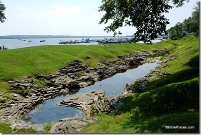
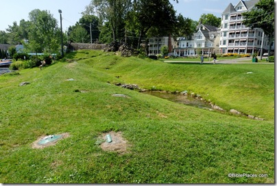
A friend tipped me off that my summer travels this year would have me near Chautauqua Institution in western New York, the location of Palestine Park.  Originally built in 1874, the model of the land of Palestine (as it was then known) has been reconstructed and enlarged over the years to its present size of 350 feet long (110 m) at a scale of 1.75 feet to the mile (0.34 meters to the km).

The model blends into its surroundings and you don’t realize you’ve arrived until you’re standing in it.  This is a view of the area from the “north” with the edge of “Mount Hermon” visible on the right.
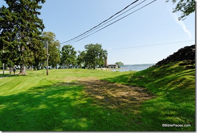
100802340tb Approaching Palestine Park

The best view of the model is from the top of Mount Hermon.  Lake Chautauqua stands in for the Mediterranean Sea, but since the park is on the lake’s western shore, the sun rises on the wrong side of this “world.”
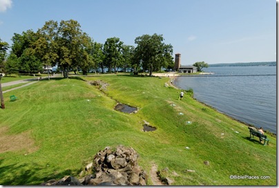
100802338tb Palestine Park overview from north

The model includes major landmarks such as Mount Tabor, the Hill of Moreh, and the Jezreel Valley, but I found it difficult to easily identify the physical features because of the uniform shade of the green grass.
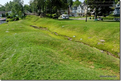
100802308tb Palestine Park view north

In the photo below, you can see the Sea of Galilee distinctly, and in the foreground the labeled sites are Nain (left) and Mt. Moreh (center).
100802302tb Palestine Park northern hills

The two major lakes are the most easily identifiable features and both are shaped appropriately.  The Sea of Galilee (below) is surrounded by biblical cities (not exactly in the right places), including Tiberias, Magdala, Capernaum, Bethsaida, and Gergesa.  Perceptive visitors may wonder why the “Mount of Beatitudes” is placed on a high mountain on the lake’s west side.  This reflects a 19th-century view that Jesus gave the Sermon on the Mount at the place today known as Mt. Arbel.
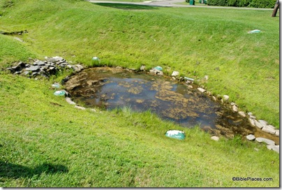
100802303tb Palestine Park Sea of Galilee

Every Sunday and Monday evenings a local pastor, allegedly in costume, gives presentations of the model using biblical stories.  Mounts Gerizim and Ebal, located under the boys, would provide an ideal place for many wonderful and important history lessons.

100802307tb Palestine Park Mt Gerizim and Mt Ebal

Jerusalem is uniquely marked on the model with a depiction of the (modern) Old City walls.  The model labels a mixture of sites from the Old Testament, New Testament, and later periods. 

Approximately sixty sites are identified, including the Mount of Olives and Bethany (behind Jerusalem in the photo below).
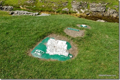
100802310tb Palestine Park, Jerusalem, Mount of Olives

The model also includes the rugged hill country of Transjordan and labels sites including Macherus, Mt. Nebo, Ramoth-gilead, and Gerasa.  The large lake shown below is the Dead Sea.  For a better photo that includes the lisan peninsula, see yesterday’s post.
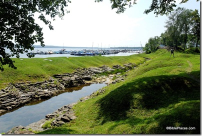
100802323tb Palestine Park, Dead Sea, Transjordan

For more information about the premises where the model is located, you can visit the website of the Chautauqua Institution (but Palestine Park is ignored on the site).  The entrance fee for the morning was $16, which I felt was a bit unfair, especially since I only spent about 15 minutes at the model (but more than that walking in from the parking lot).  Wikipedia has a brief article about the place, and you can quickly locate the site on Google Maps here.  If you visit in the summer on a Sunday or Monday evening, you can join the free tour (weather permitting).  At other times , you can enjoy a self-guided tour with the assistance of either a cassette tape or a booklet.

A connection I only learned when writing this post is that the man who directed the creation of the park, John H. Vincent, co-wrote Earthly Footsteps of the Man of Galilee, one of the first works that I selected for the Historic Views of the Holy Land series.  He is listed on the title page as the “Chancellor of Chautauqua.”  There is a whole history of American interest in the Holy Land in the 1800s of which I have been ignorant. 

If you have visited Palestine Park and have any observations or suggestions for potential visitors, feel free to comment below.

Share: