fbpx
(Post by A.D. Riddle)


I recently discovered a mapping resource hosted by the University of Arkansas, the CORONA Atlas of the Middle East. The CORONA Atlas is not a brand new website (it was reviewed in 2012), but it says it is still in BETA stage. Simply put, the CORONA Atlas of the Middle East overlays CORONA satellite imagery over Google Earth imagery.

What is CORONA imagery?

During the Cold War, CORONA was a codename for one of the United States’ top-secret satellite missions created to capture high-resolution imagery. The first mission was launched into space in 1960, and the program continued until 1972. The imagery was declassified in 1995, making it available to the public.

What is the value of CORONA imagery?

From the CORONA Atlas of the Middle East:

In regions like the Middle East, CORONA imagery is particularly important for archaeology because urban development, agricultural intensification, and reservoir construction over the past several decades have obscured or destroyed countless archaeological sites and other ancient features such as roads and canals. These sites are often clearly visible on CORONA imagery, enabling researchers to map sites that have been lost and to discover many that have never before been documented. 

For example, in 1998, James Hoffmeier and his team were able to locate additional sections of Egypt’s east frontier canal in northern Sinai thanks to CORONA imagery.


What has the University of Arkansas done with the imagery?

First, even though CORONA imagery is in the public domain, there are costs associated with digitization of the original film and acquisition of the files. The University of Arkansas has purchased much of this imagery and made it available for researchers. Second, the University of Arkansas corrected the spatial geometry of the photos for distortion (orthorectification) and has positioned the imagery in real geographic space (georectification). This allows the CORONA Atlas to overlay the CORONA imagery on top of other imagery that is positioned in the same geographic space.

How can the CORONA Atlas of the Middle East be used?

Recently, I was trying to locate the site of Samsat in Turkey. Samsat is believed to be ancient Kummuḫ, capital of a Neo-Hittite kingdom by the same name. (In the Hellenistic period, it was replaced by the kingdom of Commagene.) The problem with finding Samsat today, however, is that it now lies at that bottom of Lake Atatürk Dam. It is very hard to find a tell in a lake. The Atatürk Dam was built on the Euphrates River and was completed in 1990. The reservoir flooded the valley of the Euphrates River and its tributaries, and the lake today covers approximately 320 square miles. The CORONA Atlas of the Middle East allows me to see Samsat (and the Euphrates River) before it was submerged, and to locate it with precision in Google Earth, because you can adjust the transparency of the CORONA imagery. The CORONA atlas also has tools for measuring, obtaining coordinates, and capturing imagery for other uses.

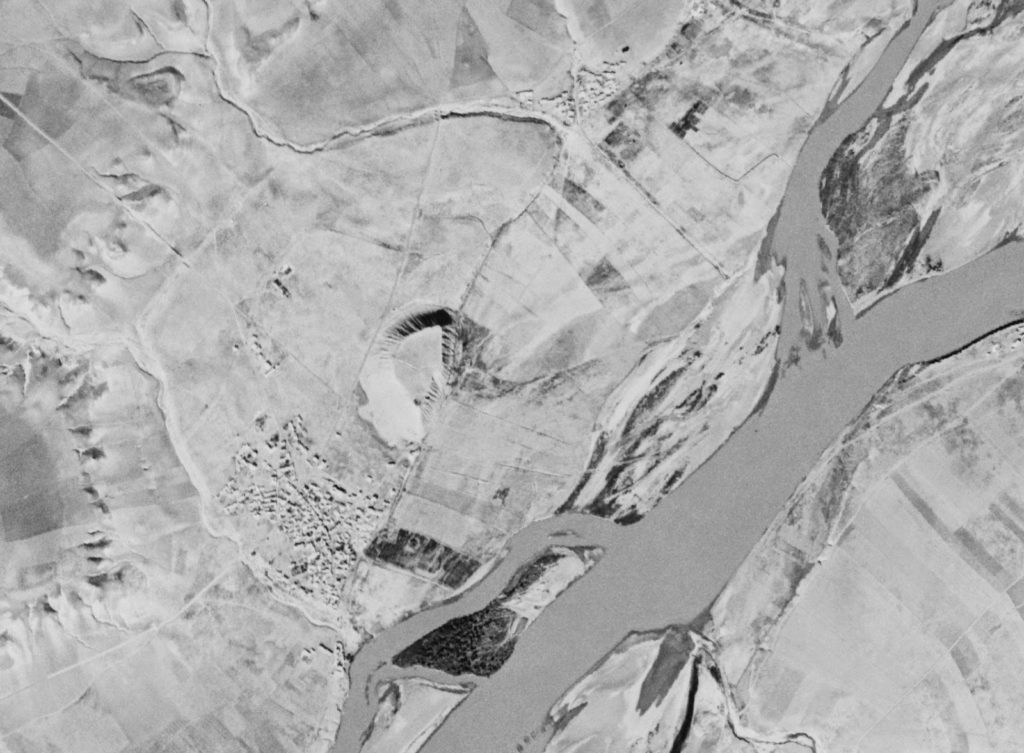
Here is a comparison of images taken from the CORONA Atlas of the Middle East. On the left is the Google Earth imagery, in the center is the CORONA imagery with some transparency over Google Earth, and on the right is the CORONA imagery.

The tell of Samsat is located in the center of the right photograph. Here is a close-up.

Head on over and poke around. It took my internet service several moments to load imagery, so it may require you to have a little patience.

Share:
(Posted by Michael J. Caba)
 

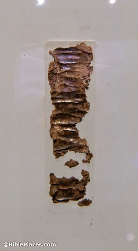
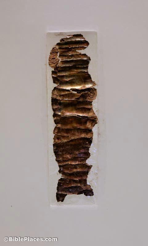
These two small scrolls are known as the Silver Scrolls. They contain the oldest known copies of biblical passages. Written about 600 BC, they were discovered in 1979 in Jerusalem at a place outside the Old City known as Ketef Hinnom. The Hebrew language text on the scrolls is taken from Numbers 6:24-26 which reads, “May Yahweh bless you and keep you; May Yahweh cause his face to shine upon you and grant you peace.” The scroll to the left is roughly 4″ long and the one to the right is about 1.5″ long. Both scrolls are now located in the Israel Museum.

For those interested in Biblical studies, the scrolls speak to the antiquity of the Torah, the first five books of the Hebrew Bible (i.e., the Christian Old Testament). Some critical theories postulate a late date of composition for these texts, say, the 6th-5th BC, but the earlier existence of these scrolls—and their Biblical passages—weighs to some extent against this theory.

For information on similar artifacts related to the Bible, see Bible and Archaeology – Online Museum.

(Photos: BiblePlaces.com. Significant resource for further study: Gabriel Barkay, et al., “The Challenges of Ketef Hinnom: Using Advanced Technologies to Recover the Earliest Biblical Texts and their Context,” Near Eastern Archaeology, 66/4 [Dec. 2003]: 162-71.)

Share:

Leen Ritmeyer has begun a new series showing the development of the Temple Mount from the time of Abraham until the Early Muslim period.

Ritmeyer also explains how his forthcoming guidebook on the Temple Mount is different from The Quest.

CoinWeek has an article on the tiniest ancient coins.

Yisrael Hasson is expecting to be appointed the new head of the Israel Antiquities Authority.

Scott Stripling describes the four causes of the destruction of antiquities.

Mark Wilson describes his collection of Starbucks mugs from the eastern Mediterranean.

HT: Paleojudaica, Joseph Lauer

Share:

Luke Chandler notes that plans are underway to establish a new national park at Khirbet Qeiyafa.

Steven Notley is on The Book and the Spade this week discussing Mary Magdalene and Magdala.

The latest edition of DigSight includes a summary of this year’s expedition to Lachish.

The New York Times explains why smaller archaeological museums struggle to build their collections today.

With the recent discovery of the Hadrianic inscription in Jerusalem, Ferrell Jenkins shares more about discoveries related to this emperor.

The city of Jerusalem has a goal of building more than 1,200 new hotel rooms in the next two years in order to alleviate the shortage and bring down prices.

Shmuel Browns shares some photographs from Israel of a variety of textures.

Share:

Wayne Stiles is leading an extraordinary tour of Israel that you should consider joining. Three features immediately mark this as a unique opportunity.

1. This tour has an exclusive focus on the life of Jesus. One of the struggles many have on their first tour is the lack of focus, as you jump from one period to another and back again all day, every day.

When you’re zeroed in on the four Gospels, you’ll be making all kinds of connections as you see, listen, and read about the life of the Messiah.

2. The particular itinerary of this trip is outstanding. Not only is it focused on the life of Jesus, you will see all kinds of places you won’t see on any other trip. Wayne gave me a chance to review the itinerary earlier this year and I was highly impressed. After some suggested tweaks, I don’t think you’ll find a better tour schedule.

3. Wayne Stiles has a unique gift for bringing the biblical world into our own. Some teachers are history gurus, but they can’t translate their research into how it affects us today. Wayne is superb at doing this in his books, on his blog, and at the sites. He is passionate, accurate, and faithful.

So that’s my three cents. I am often asked about a trip to Israel that I would recommend. Unless you’re an enrolled college student, I don’t have too many good suggestions. Today I do. I’d encourage you to take the opportunity while you can.

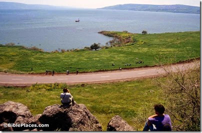
Cove of the Sower from top, tbs76029303
Try out the acoustics at the amazing Cove of the Sower!
Share:

From the Israel Antiquities Authority:

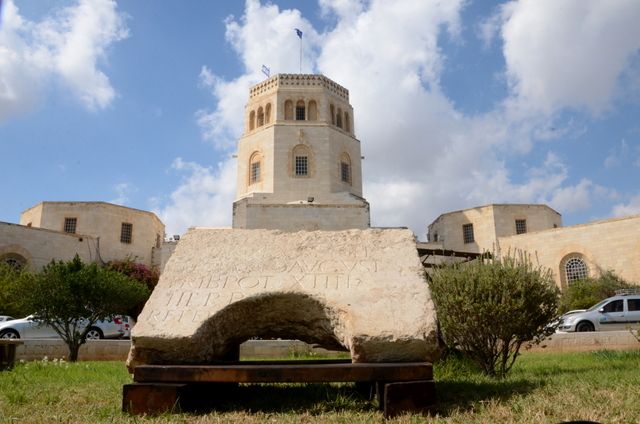
A rare find of tremendous historical significance was discovered in Jerusalem: a fragment of a stone engraved with an official Latin inscription dedicated to the Roman emperor Hadrian. Researchers believe this is among the most important Latin inscriptions ever discovered in Jerusalem.

During the past year the Israel Antiquities Authority conducted salvage excavations in several areas north of Damascus Gate. In one of those areas a stone fragment bearing an official Latin inscription from the Roman period was discovered. According to Dr. Rina Avner and Roie Greenwald, excavation directors on behalf of the Israel Antiquities Authority, “We found the inscription incorporated in secondary use around the opening of a deep cistern. In antiquity, as today, it was customary to recycle building materials and the official inscription was evidently removed from its original location and integrated in a floor for the practical purpose of building the cistern.

Furthermore, in order to fit it with the capstone, the bottom part of the inscription was sawed round.”

Upon finding the inscription it was immediately clear to the excavators that they had uncovered an especially significant discovery, as indicated by the size and clarity of the letters.

The inscriptions, consisting of six lines of Latin text engraved on hard limestone, was read and translated by Avner Ecker and Hannah Cotton of the Hebrew University of Jerusalem. The English translation of the inscription is as follows: (1st hand) To the Imperator Caesar Traianus Hadrianus Augustus, son of the deified Traianus Parthicus, grandson of the deified Nerva, high priest, invested with tribunician power for the 14th time, consul for the third time, father of the country (dedicated by) the 10th legion Fretensis (2nd hand) Antoniniana.

According to Ecker and Cotton, “This inscription was dedicated by Legio X Fretensis to the emperor
Hadrian in the year 129/130 CE.” Their analysis shows that the fragment of the inscription revealed by the IAA archaeologists is none other than the right half of a complete inscription, the other part of which was discovered nearby in the late nineteenth century and was published by the pre-eminent French archaeologist Charles Clermont-Ganneau. That stone is currently on display in the courtyard of Studium Biblicum Franciscanum Museum.

The full press release is here. The Times of Israel carries the story with more photos (only the last one gives you a sense of the inscription’s size). The Jerusalem Post has a 1-minute video without sound.

UPDATE: Joseph Lauer has sent some new information, including a link to four high-resolution photos and a link to an illustrated and informative post by Leen Ritmeyer.

Photograph of the inscription against the background of the Rockefeller Museum, seat of the Israel Antiquities Authority. Photographic credit: Yoli Shwartz, courtesy of the Israel Antiquities Authority
Hadrianic inscription on display in front of the Rockefeller Museum Photograph by Yoli Shwartz, courtesy of the Israel Antiquities Authority
Share: