fbpx

A mosaic discovered near Nicosia, Cyprus, depicts scenes from a chariot race.

Archaeologists working in Rome discovered a 3rd-century building that apparently burned down with a dog inside.

One artist has envisioned the ancient Roman road system as a modern metro map. But see Mark Hoffman’s quibbles.

The Spatial History Project at Stanford University is documenting how Rome has changed over the centuries.

Carl Rasmussen recently visited Miniatürk, a park that displays 131 models of structures in Turkey.

The “gateway to hell” at Hierapolis has “moved” in recent years. Carl Rasmussen explains.

Mark Hoffman notes that Athens has now received photo-realistic 3D treatment in Google Earth.

A first-century AD statue of Zeus Enthroned will be returned by the Getty Museum to Italy.

The Vatican Apostolic Library has released the first issue of a new newsletter, “Online Window into the Library.”

“Noah’s Beasts: Sculpted Animals from Ancient Mesopotamia” is a new exhibit at the Morgan
Library and Museum in NYC.

Liberty Museum’s Biblical Museum has added to its collection the armor of a Roman soldier used in Ben Hur and Julius Caesar.

The tables of contents are online for the May issue of BASOR and the June issue of Near Eastern Archaeology. The former includes an article on the Philistine cemetery of Ashkelon, while the latter
issue is focused on early sites in Jordan.

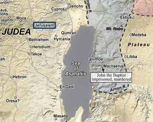
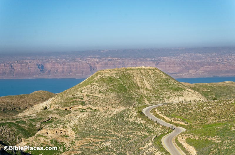
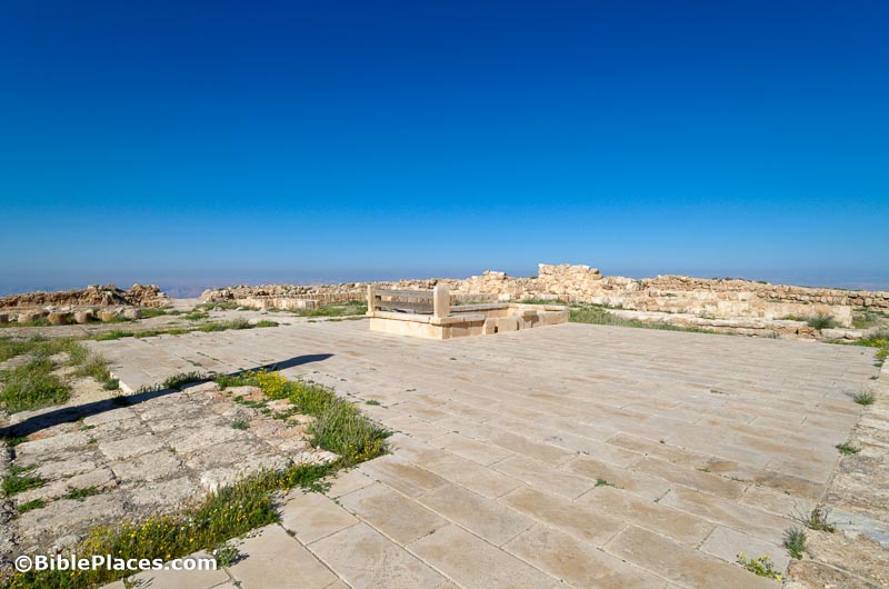
The latest issue of Biblical Archaeology Review includes articles on Macherus, Pilate, and the four-
room house.

HT: Joseph Lauer, Charles Savelle, Agade, Ted Weis, Alexander Schick

Share:

Archaeologists have recently identified the presence of child slaves in Amarna, Egypt, from shortly after the traditional date of the Israelite exodus.

A team from Yale and Royal Museums of Art and History has discovered the oldest known monumental hieroglyphics in Egypt.

An Egyptian Slab Lost in Berlin During World War II Has Been Found—in Michigan.”

It’s not easy excavating and conserving a second solar boat of Khufu next to the Great Pyramids of Giza.

Researchers have published a study concluding that the DNA of ancient Egyptians was closer to the inhabitants Turkey and the Levant than to Africans.

Dahshur is now free of encroachments made in the aftermath of Egypt’s 2011 revolution.

Archaeologists have reported the discovery of a large ritual bath (mikveh) at Macherus. (See the photo we posted here last November, and see another posted by Ferrell Jenkins.)

A recent ACOR lecture by Glenn J. Corbett entitled “Archaeology in the Attic: Preserving Archival Treasures of Jordan” is now online. He discusses the recent donations of the photo collections of Jane Taylor and Rami Khouri.

A Roman villa on the coast of Libya has been unearthed with numerous treasures, statues, and mosaics.

Smithsonian has produced a breathless video revealing a tablet depicting the ziggurat of Babylon.

(The suggestion that Nebuchadnezzar built the tower of Babel is silly.)

HT: Joseph Lauer, Agade, Steven Anderson

Share:

In the final season of the Tel Gezer Project, archaeologists have found evidence of Merneptah’s fiery destruction of the city, including the skeletons of an adult and child. The capture of Gezer is mentioned in the famous Merneptah Stele, along with the slaughter of Israel.
Norma Franklin explains why the winery they discovered at Jezreel fits the time and place of Naboth’s vineyard.

The IAA has posted a 3-minute video on the “Siloam street” and drainage channel that is being excavated between the Pool of Siloam and the Temple Mount.

Gabriel Barkay is interviewed on the World Affairs Report (28 min, mp3).

Did Jeremiah bury his loin cloth at the Euphrates or at Ein Perat? Ferrell Jenkins provides photos of both and some evidence for the latter.

Carl Rasmussen shares photos and reflects on his time in Jerusalem during the Six Day War.

Photorientalist exhibits photographs from the 19th and 20th centuries, including a number of exhibitions that tell a story, such as “Palestine’s Nativity Trail.” They are accepting submissions.

One of your considerations in choosing a summer excavation to join is the field school. Year after year, the Tell es-Safi team has one of the best schedules of lectures and field trips.

The PEF’s refusal to accept papers which discuss Jewish excavations in Jerusalem ultimately led to its cancellation of the conference on “Anglo-German Exploration of the Holy Land 1865-1915.”

The Book and the Spade reposts a Dead Sea Scrolls Documentary, produced for the 50th anniversary of the discovery and including audio from Albright, Yadin, Trever, DeVaux, and others.

J. C. McKeown writes about famous doctors in the ancient world on the Oxford University Press blog.

Gary Rendsburg has recently posted his 1998 interview of Cyrus Gordon on YouTube.

A new program at Leiden University seeks “to show the great potential video games have for archaeology in terms of public outreach, heritage preservation, and education, but also for actual research.”

Eisenbrauns has a big sale going in July, with 60 titles at 60-80% off. Here are a few recommendations:

HT: Joseph Lauer, Agade, AWOL, John DeLancey

Share:

A lot happened while we were traveling in June, and I think it is going to take us four roundups to catch up. Today we begin with stories related to Israel.

Archaeologists have discovered a Crusader-era tunnel in Tiberias that apparently led from the fortress to the harbor.

Students excavating in Modiin discovered a collection of women’s jewelry from the Crusader period.

Excavations at the site of Huqoq in Galilee have discovered agricultural installations in use in either the Middle Bronze Age or the Roman-Byzantine period.

Weekly reports are available for ABR’s first season at Shiloh: Week 2 by Mark Hassler, Week 3 by

Andrew Kvasnica, and Week 4 by Gary Byers.

Scholars at Tel Aviv University have used multispectral imaging to reveal text on ancient “blank” potsherds from the First Temple period.

Emek Shaveh has petitioned Israel’s high court to halt excavations in the Western Wall tunnels.

An alert hiker reported suspicious activity which led to the capture of two antiquities thieves near the site of Sepphoris.

The new National Campus for the Archaeology of Israel remains unopened due to a lack of donations. This article in Apollo magazine reviews the controversy over moving archaeological material from east to west Jerusalem.

Haaretz reports on a new exhibit at the Israel Museum, “Faces of Power: Coins from the Victor Adda Collection.” These 75 gold coins depict Roman emperors and their wives and have never been publicly displayed before.

A nighttime audiovisual show at the City of David begins later this month.

The Israeli government has temporarily restricted civilians from visiting the Golan viewpoints overlooking Qunetra.

Appian Media has released a free (and downloadable), 10-minute video on Magdala.

Wayne Stiles notes the irony that “the Church of the Holy Sepulchre demonstrates the need for the place it hallows.”

There are several coming Israel tours of note. Wayne Stiles is taking a group October 26–November 6 and another March 16-27, 2018. Joel Kramer (SourceFlix) is leading a trip March 11-24.

This weekend, fans are reenacting the Battle of the Horns of Hattin in which the Muslims defeated the Crusaders in 1187.

HT: Joseph Lauer, Charles Savelle, Agade

Share:

Archaeologists excavating in the Timna Valley near Eilat have discovered fabric that was dyed red and blue. This is the first time that such a colored clothing has been discovered from this ancient period. The Times of Israel provides a summary of a journal article and includes some photographs and a video.

Since 2013, Dr. Erez Ben-Yosef of Tel Aviv University has directed excavations in the Timna Valley where his team has found textiles dating back to the Iron Age (11-10 centuries BCE). On some of the fragments, there is a decorative pattern of red and blue bands.
In an article published Wednesday in the scientific journal PLOS ONE, the researchers hypothesize that the metalworkers, considered fine craftsmen, “were probably entitled to wear colorful clothing as a mark of their high status.”
According to Ben-Yosef and the IAA’s Dr. Naama Sukenik, the findings indicate that the society at Timna, identified with the Kingdom of Edom, was hierarchical and included an upper class that had access to colorful, prestigious textiles.
The concept of highly prized, skilled laborers flies in the face of conventional wisdom, which had supposed that slaves had largely manned the isolated copper mines.

Personally I think the speculation about the identification of the workers is unwarranted, given that we have essentially nothing to compare this with given the lack of preservation of perishable materials in the rest of Israel. And if the dating to the 10th century is correct, then this area was likely under the control of Israel, not Edom (2 Sam 8:14; 1 Kgs 9:26; 2 Chr 8:17). But one can certainly conclude that the workers here had access to a good shopping mall.

The official press release is posted here. The AFTAU has issued a press release here. Some high-res photos are available here.

HT: Joseph Lauer

Timna Valley Slaves Hill aerial from north, ws032317820
“Slaves’ Hill” in Timna Valley;
“Solomon’s Pillars” is located on the left
Share:
(Post by A.D. Riddle)


A few years ago, we wrote a recommendation when Bible Mapper version 5 was first released. At the time Mark Hoffman, a Bible Mapper user, recorded seven tutorial videos to help out new users.

Mark just moved the tutorials over to YouTube two weeks ago. The videos are a fantastic introduction to some of Bible Mapper’s customization options, and they will give the jump start you need to start creating custom maps right away.

BibleMapper can be downloaded here. Many features can be used with the free version, but a one-time license key ($37) is required to save your work and to access advanced features.
Be sure to watch Mark Hoffman’s tutorial videos on YouTube to help you quickly get started making maps.
You can read our original review here.

To review, the strengths of Bible Mapper are:

  • Accuracy of the data.
  • Ability to customize the look of the terrain, to select features and cities to be displayed, to modify the look and position of labels, and even to import your own sites directly using a kmz/kml file.
  • Permission to use the maps you create copyright-free in papers, lectures, websites, and publications.
Share: