The holiday of Hanukkah is an appropriate time to announce the discovery of a Hasmonean-period building in Jerusalem. The structure is located in the Central Valley just south of the Dung Gate in the former Givati parking lot. The Israel Antiquities Authority describes the find in a press release.
In recent months remains of an impressive building from the Hasmonean period (second century BCE) are being unearthed in excavations the Israel Antiquities Authority is directing in the Giv‘ati parking lot, located in the City of David in the Walls Around Jerusalem National Park. The excavations are sponsored by the “Friends of City of David”.
The building stands c. 4 meters high and covers an area of c. 64 sq. m. The building’s broad walls (more than one meter thick) are made of roughly hewn limestone blocks that were arranged as headers and stretchers, a construction method characteristic of the Hasmonean period.
Although numerous pottery vessels were discovered inside the building, it was mainly the coins that surprised the researchers. These indicated the structure was erected in the early second century BCE and continued into the Hasmonean period, during which time significant changes were made inside it.
According to Dr. Doron Ben Ami and Yana Tchekhanovets, the excavation directors on behalf to the Israel Antiquities Authority, “The importance of this discovery is primarily because of the conspicuous paucity of buildings from the Hasmonean city of Jerusalem in archaeological research, despite the many excavations that have been conducted to date. Apart from several remains of the city’s fortifications that were discovered in different parts of Jerusalem, as well as pottery and other small finds, none of the Hasmonean city’s buildings have been uncovered so far, and this discovery bridges a certain gap in Jerusalem’s settlement sequence. The Hasmonean city, which is well-known to us from the historical descriptions that appear in the works of Josephus, has suddenly acquired tangible expression”.
The story is also reported by Arutz-7 and Israel HaYom.
We’ve reported on excavations at this same area many times in the past:
- Feb 2012: New Visitor Center Approved for City of David (with 2 photos)
- Aug 2010: Cameo Stone Discovered in Jerusalem’s Central Valley
- Sept 2009: Petition Against City of David Excavations Rejected
- Aug 2009: Roman Building Excavated in City of David
- Jan 2009: Roman Figurine Discovered in Jerusalem
- Dec 2008: 264 Gold Coins Found in City of David
- Nov 2008: Beautiful Earring Found in Jerusalem
- Aug 2008: City of David Excavation Report (with photo)
- Dec 2007: Palace of Queen Helena Found? (with aerial photo)

Photo by Assaf Peretz, courtesy Israel Antiquities Authority.
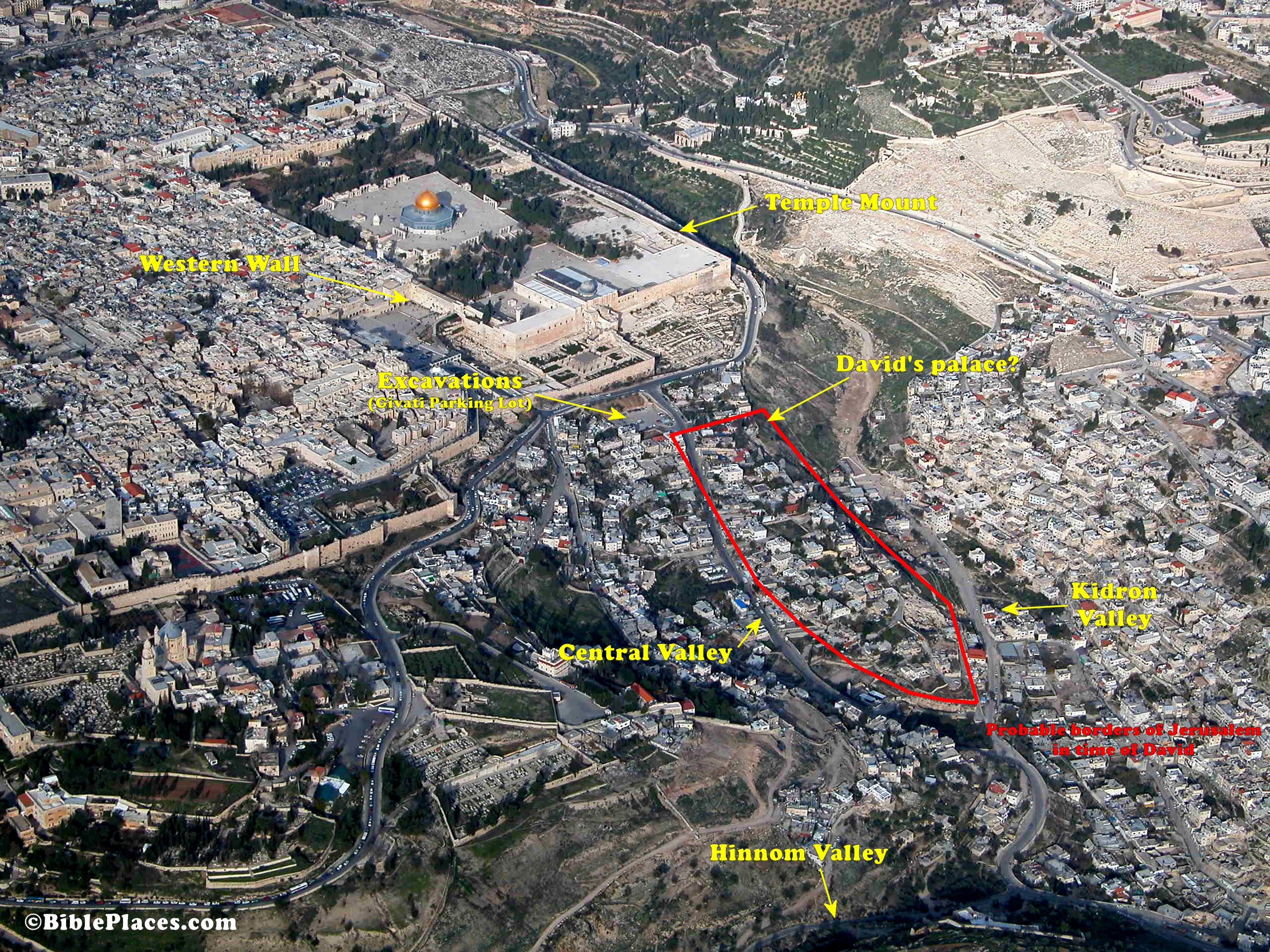
Jerusalem from the southwest Click photograph for higher-resolution version.
UPDATE (12/4): Eric Welch has sent this photo taken at the excavations during the summer.


