(Post by Seth M. Rodriquez)

Where can you see the American seal in Jerusalem? In honor of Independence Day in the United States, this week’s “Picture of the Week” will show you.

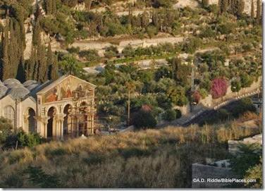
The photo above was taken in the Church of All Nations (also known as the Basilica of the Agony) on the Mount of Olives. The church is built over the traditional location of the place where Jesus prayed the night he was arrested. The modern church was completed in 1924, but it sits on the location of two earlier churches: one from the fourth century and another from the twelfth century.

The photograph shows the interior of one of the church’s twelve cupolas. The American seal can be seen at the bottom of the photo (click the picture to enlarge it). The ceiling of this church actually contains the seals or coats-of-arms of several countries, all of whom donated money to help construct the building. Argentina, Belgium, Brazil, Canada, Chile, England, France, Germany, Italy, Mexico, Spain, and the U.S. are all represented.

In his book, The Holy Land, Jerome Murphy-O’Connor provides the following information about the church:

This church … built in 1924, is located on the traditional site of the garden in which Jesus collapsed. No one can be sure of the exact spot at which he prayed, but this limited area was certainly close to the natural route leading from the Temple to the summit of the Mount of Olives and the ridge leading to Bethany.

The present edifice … is the latest in a series of three churches. It covers ‘the elegant church’ (Egeria) built between AD 379 and 384 … on the site where the pre-Constantinian Jerusalem community commemorated the prayer of Christ. Willibald, in 724-5, is the last pilgrim to mention this church; it was destroyed by an earthquake some twenty years later. The Crusaders first built an oratory in the ruins which they later (c.1170) replaced by a church …. The fate of this building is unknown; still functioning in 1323, it was abandoned in 1345.

Additional information about the modern church (as well as additional pictures) can be found on the Franciscan Cyberspot here. A 360-degree image of the inside of the church is available here.

This photo and over 1,500 others are available in Volume 3 of the Pictorial Library of Bible Lands, which can be purchased here for $39 (with free shipping). Additional photos and information about the Mount of Olives is available here on the BiblePlaces website. This page on LifeintheHolyLand.com includes a photograph of the area taken in the 1890s before the Church of All Nations was built.

Excerpt was taken from Jerome Murphy-O’Connor, The Holy Land: An Oxford Archaeological Guide from Earliest Times to 1700, 4th ed. (Oxford University Press, 1998), pp. 128-129. The fifth edition of this book is available here.

Share:

Archaeologists who have been excavating for several years at the biblical site of Shiloh are now claiming to have discovered evidence for the location of the tabernacle. From Israel HaYom:

Archaeologists discover holes carved into the ground in Shiloh which could have held the beams of The Tabernacle or Tent of Meeting, which, according to the Bible, housed the Ark of the Covenant.
The Tabernacle or Tent of Meeting — which, according to the Bible, housed the Ark of the Covenant — was a temporary structure made of wooden beams and fabric, not materials cut out for thousands of years of survival.
Nevertheless, undaunted, archaeologists have searched for evidence of the Tent of Meeting for years, which they posited would be found in ancient Shiloh (next to the settlement of Shiloh in the Binyamin region). Now it appears their efforts have borne fruit, yielding assumptions that the Tent of Meeting indeed stood there.
The findings, which will be presented at a conference of the Shiloh Association scheduled to take place this week in ancient Shiloh, include the discovery of holes carved into the ground which could have held the beams of a temporary structure.
Because the Tent of Meeting and Ark of the Covenant were portable, archaeologists are considering the possibility that the Tent of Meeting stood there. The Tent of Meeting served as a place of prayer and sacrifice until the First Temple in Jerusalem was built by King Solomon.
Near the holes, in the northern part of Tel Shiloh, structures were unearthed that correspond to the dates when Joshua first settled the land of Israel until the period of King David’s reign.
One of these structures was found to contain ceramic vessels as well as three large taboon clay ovens.

The article explains why archaeologists believe these vessels were used in the tabernacle. Thee excavators also found a section of the city wall of Shiloh. Arutz-7 also reports on the discovery.

Background and photos of the site of Shiloh are here, and images of a tabernacle replica in southern Israel are here.

Shiloh area of tabernacle, tb051808076
Area of tabernacle discovery before excavations.
Photo from Pictorial Library of Bible Lands,
volume 2.
Share:

Evidence of the Roman siege of Jerusalem in AD 70 has been found in excavations near the Western Wall of the Temple Mount of Jerusalem. From the Jerusalem Post:

The Antiquities Authority on Thursday unearthed for the first time a small 2,000-year-old cistern near the Western Wall that connects an archeological find with the famine that occurred during the Roman siege of Jerusalem during that era.
The cistern – found near Robinson’s Arch in a drainage channel from the Shiloah Pool in the City of David – contained three intact cooking pots and a small ceramic oil lamp.
According to Eli Shukron, the excavations director for the Antiquities Authority, the discovery is unprecedented.
“The complete cooking pots and ceramic oil lamp indicate that the people went down into the cistern where they secretly ate the food that was contained in the pots, without anyone seeing them,” he said. “This is consistent with the account provided by Josephus.”

The Jerusalem Post story continues with Josephus’ description of the last desperate days of the Roman siege.

The story is also reported by Arutz-7, and the Israel Antiquities Authority press release includes high-res photos (direct link). A 3-minute video shows the discovery with audio in Hebrew.

HT: Joseph Lauer

IMG_4445
IMG_4404
IMG_4414
Photographs by Vladimir Naykhin/Israel Antiquities Authority.
Share:

(Post by Seth M. Rodriquez)

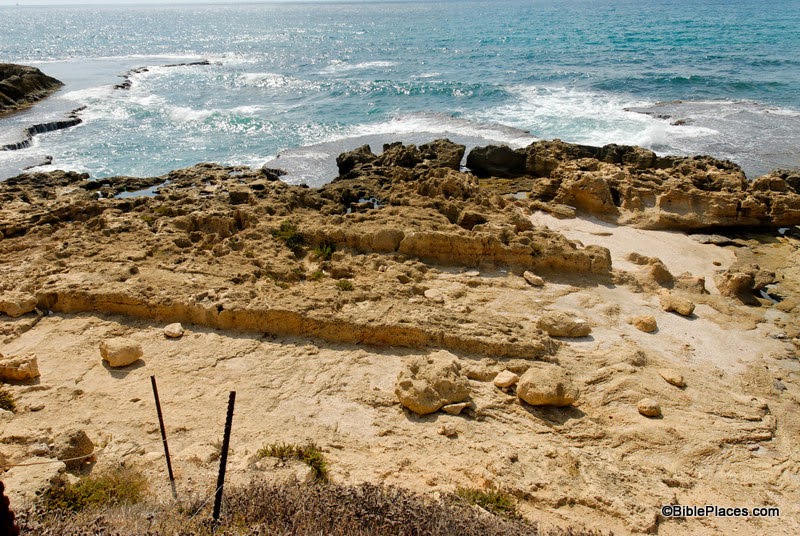
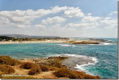
At first glance, our picture of the week looks like a peaceful, pleasant Mediterranean beach. However, there is more here than meets the eye. This is the site of a famous battle waged by Alexander the Great, and the place still bears the marks of Alexander’s army. In fact before 332 B.C., this beach didn’t even exist.

In antiquity, the city of Tyre was comprised of a fortified settlement on the mainland and another settlement on an island about half a mile off the coast. What you are looking at is the southern side of the isthmus that was created when Alexander’s army built a causeway between the mainland and the island. The image below from the maps of the Survey of Western Palestine provides a bird’s eye view of the former island with the narrow isthmus. (These maps are available here in digital form for only $35.)

The Wycliffe Historical Geography of Bible Lands describes the confrontation between the inhabitants of Tyre and Alexander the Great in this way:

Tyre alone opposed Alexander. The Tyrians initially offered submission and tribute to him, thinking they would thereby gain substantial freedom, as they had before. But when they saw that Alexander intended personally to occupy the city, they determined to resist.

Hope of Tyrian success in withstanding the siege was not unfounded. Their city was located on an island a half mile from shore; the current in the channel which separated it from land was swift. Their fleet controlled the sea. The city wall on the landside rose to 150 feet. There were assurances of help from Carthage and elsewhere. But Alexander devised unexpected tactics. He resolved to construct a causeway 200 feet wide out to the island, on which he could plant his siege engines. Ruins of mainland Tyre furnished material for the causeway. The Tyrians fought heroically. They destroyed the engines of war by fire-ships and damaged the mole, or causeway. They hurled pots of burning naphtha, sulfur, and red-hot sand from catapults.  Seeing that the battle could not be won without the use of a fleet, Alexander obtained contingents from Sidon, Greek allies, and Cyprus. After a siege of seven months, the wall was breached and the city taken after savage fighting.

Many people see this as the part of the fulfillment of Ezekiel’s prophesies about Tyre found in Ezekiel 26-28, especially these verses:

Behold, I am against you, O Tyre, and will bring up many nations against you, as the sea brings up its waves. They shall destroy the walls of Tyre and break down her towers, and I will scrape her soil from her and make her a bare rock. (Ezek. 26:3-4, ESV)

Our picture of the week was taken by A.D. Riddle, and is available in Volume 8 of the Pictorial Library of Bible Lands. This photo and over 700 others are available here for $34 (with free shipping). Additional photos and information about Tyre can be found here on the BiblePlaces website, and here on LifeintheHolyLand.com.  The quote above was taken from The Wycliffe Historical Geography of Bible Lands by Charles F. Pfeiffer and Howard F. Vos (Chicago: Moody Press, 1967), 210-211.

Share:

(Post by Seth M. Rodriquez)

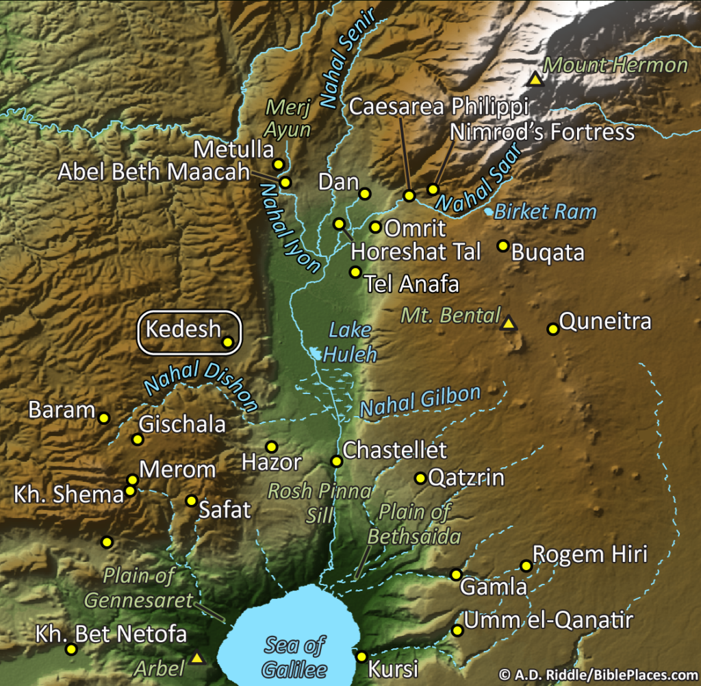
Our photo of the week is a profile of the small, but significant site of Abel-beth-maacah. If the name doesn’t ring a bell, then allow me to refresh your memory with a story …

During the reign of David, shortly after the time when Absalom tried to usurp the throne, a man named Sheba rebelled against David and led away the entire northern kingdom (2 Sam. 20:1-2). So David sent Joab and some of his soldiers to pursue him. Joab and his troops were coming up from the south, so naturally Sheba headed north.  In fact, he kept running north until he reached one of last cities before reaching Israel’s northern border: the city of Abel-beth-maacah (2 Sam. 20:14).

Unfortunately for him that proved to be a poor choice. While Joab was attacking the city, things took a turn to everyone’s advantage (except Sheba’s):

Then a wise woman called from the city, “Listen! Listen! Tell Joab, ‘Come here, that I may speak to you.’” And he came near her …. Then she said, “They used to say in former times, ‘Let them but ask counsel at Abel,’ and so they settled a matter. I am one of those who are peaceable and faithful in Israel. You seek to destroy a city that is a mother in Israel. Why will you swallow up the heritage of the Lord?” Joab answered, “Far be it from me, far be it, that I should swallow up or destroy! That is not true. But a man of the hill country of Ephraim, called Sheba the son of Bichri, has lifted up his hand against King David. Give up him alone, and I will withdraw from the city.” And the woman said to Joab, “Behold, his head shall be thrown to you over the wall.” Then the woman went to all the people in her wisdom. And they cut off the head of Sheba the son of Bichri and threw it out to Joab. So he blew the trumpet, and they dispersed from the city, every man to his home. And Joab returned to Jerusalem to the king. (2 Sam. 20:16-22, ESV)

Thus ends the story of Sheba … but not of Abel-beth-maacah. The city is mentioned two other times in the Bible. One occurrence is in the story of the war between King Asa of Judah and King Baasha of Israel (1 Kgs. 15:16-22). During the struggle, Asa is able to convince Israel’s northern neighbor, King Ben-Hadad I of Damascus, to attack Israel’s northern territories to draw Baasha away from his southern borders (1 Kgs. 15:20). Abel-beth-maacah and the neighboring city of Ijon are specifically mentioned.

The other occurrence is similar, although it records events that happened about 150 years later. In 2 Kings 15:29, Tiglath-pileser III of Assyria begins to conquer Israel by taking over its northern regions. Again, Abel-beth-maacah and Ijon are specifically mentioned.  Being situated on Israel’s northern border meant that you were first in line when an invading army showed up.

As I have mentioned before, one of the most valuable aspects of the Pictorial Library of the Bible Lands is that it includes places and things that are not normally included in a collection of biblical places. Abel-beth-maacah is a case in point. So the next time this site comes up in your OT Survey class or your Sunday School lesson or sermon preparation, you need not be content showing where Abel-beth-maacah is on a map but can also include a couple of pictures to give your listeners a feel for the place.

One final note: As I was writing this post, I was pleased to learn that a major excavation project at Abel-beth-maacah is starting this summer. Information about the dig and several additional photos of the site are available at www.abel-beth-maacah.org. They also have a Facebook page available here, and a blog here.

The photo above and over 1,100 others are available in Volume 1 of the Pictorial Library of the Bible Lands, and is available here for $39 with free shipping. Photos and information of neighboring locations are available herehere, and here on the BiblePlaces website, and here and here on LifeintheHolyLand.com.

Share:

Architip is a new app that uses augmented reality (AR) technology to help users see what ancient sites in Israel used to look like. From The Times of Israel:

Augmented reality is a technology that uses mathematics, models, location services, camera technology, and advanced algorithms to impose a virtual image that melds into a real-life one. “For example, you might look at an ancient mosaic on the floor of a synagogue or church, and barely see the decorations on it because of the fading,” said Yaron Benvenisti, CEO of Architip, which is located in Jerusalem and has been operating for about six months. “With Architip, you would see the mosaic in full color, with all its drawings intact.”
Because each site needs to be mapped and augmented separately, Architip is being marketed as a “white label” engine, which will be used at specific sites. As a pilot, the Architip R&D team, led by Israeli AR and computer vision pioneer Sagiv Philipp, has mapped and “virtualized” the Tel Lachish archaeological site in central Israel. Tel Lachish was a fortified city surrounded by towers, and had many stately buildings, but looking at the site today, it’s hard to visualize the city as it was. With Architip, users can see the site in all its ancient glory just by holding up their smartphone’s camera at the location and looking at the screen.
“With Architip, you can see Tel Lachish as it was,” Benvenisti said, “walking through its streets and seeing the reconstruction through your device.” All a user has to do is point their device at a specific point, and Archtip’s technology does the rest.

The full article, including an illustration, is here. The company website includes a video demo that shows other features. I think that Lachish may be an ideal first choice if you’re just testing things out, but they’re going to have to choose more popular sites if they want more than a handful of users.

HT: Stephen Smuts

Share: