fbpx

It’s difficult to tell what, if anything, is new in this article about excavations near the Temple Mount, but if you need a refresher on the goings-on there for the past several years, you may find this helpful.
From the Algemeiner:

Old City expert Rabbi Barnea Selevan, a veteran licensed tour guide and co-director of Foundation Stone, is excited about a series of archeological digs taking place in the vicinity of the Western Wall. For the past several years, the Western Wall Heritage Foundation has sponsored excavations at the back of the plaza, and workers have uncovered part of a Roman colonnaded street dating back to the 2nd century C.E.
But what was ignored until recently, according to Selevan, are several small stone buildings, overgrown and blocked by material from the dig.
“When I look down from the street in front of the Chabad building several levels above the site, those old walls are the most exciting thing I see,” Selevan tells JNS.org. “There’s no question they’re from First Temple times.” Seals from the Temple were found nearby. The walls, according to some archeologists, are from homes that were abandoned but not destroyed by the Roman onslaught on Jerusalem in 70 C.E.
Selevan notes that the streets exposed at the back of the plaza lead to the Temple Mount in the Robinson’s Arch area and provide evidence that the Romans stayed in Jerusalem and used the Temple Mount during the early Roman period.

The article continues to describe excavations at the Givati Parking Lot as well as conservation work on the walls of the Old City.

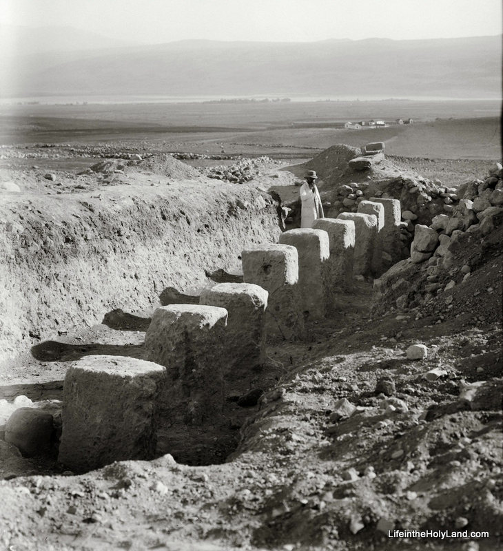
Valley Cardo excavations near Western Wall, tb010312457
Excavations of the Byzantine Cardo near the Western Wall.
Photo from the Jerusalem volume.

HT: Joseph Lauer

Share:

(Post by Seth M. Rodriquez)

Jesus began one his parables by saying, “A man was going down from Jerusalem to Jericho and he fell among robbers, who stripped him and beat him and departed, leaving him half dead.” (Luke 10:30, ESV.)  Thus began the well-known “Parable of the Good Samaritan.”  Although that particular route would have been well-known to Jesus’ hearers, most readers of the Bible today are not familiar with it.

Enter the Pictorial Library of the Bible Lands … One of the most admirable features of the PLBL is that it takes you to out-of-the-way places that you have never visited but always wished that you had.

Our picture of the week is from Volume 4 of the PLBL and shows us the remains of the Roman road that led from Jerusalem to Jericho in Jesus’ day.  Elsewhere in the Bible, this route is referred to as the Ascent of Adummim (Josh. 15:7; 18:17).

In the picture, the viewer is looking east toward the rugged hills of the Judean Wilderness that lie between Jerusalem and Jericho.  In the foreground the remains of the road can be seen stretching out before the feet of the photographer.  The small cliff to the right seems to be man-made and was probably cut to give more space for the road. Only the foundation of the road remains today.

The PowerPoint notes from the PLBL provide the following insights into this significant road (the links have been added to the notes for the benefit of our readers):

The “Ascent of Adummim” was the main route from Jericho to Jerusalem in antiquity. It followed a ridge located south of the Wadi Qilt and north of Nahal Og, and near Jerusalem was forced to cross the Nahal Og at a more passable location. Among the biblical events which likely occurred on this route were David’s flight from Absalom (2 Sam 15-16), Zedekiah’s flight from the Babylonians (2 Kgs 25:4), the story of the Good Samaritan (Luke 10:25-37), and Jesus’ travels from Jericho to Jerusalem (e.g., Luke 19:28).

How long does it take to walk from Jericho to Jerusalem? On one recent occasion, it took a group of hikers 8 hours to cover the distance of 15 miles (24 km), with an elevation gain of about 3,400 feet (1,060 m). Not counting breaks, we walked for six and a half hours. Had it been hotter or had we run into any difficulties, the journey would have taken longer.

Jesus traveled this route many times. He likely came this way most of the times that he journeyed to Jerusalem from Galilee, though we know of at least two occasions when he attempted to travel through Samaria (John 4; Luke 9:52-53). Scripture records at least two trips by way of Jericho, but he probably went this way dozens of times in his life. It’s a reasonable conclusion that Jesus’ parents had to climb back up this route to Jerusalem after realizing that their twelve-year-old son was not in their caravan (Luke 2:41-50). Parts of the Roman road are still visible in places, and the way today is safe and pleasant.

This picture and over 1,500 others are available in Volume 4 of the Pictorial Library of Bible Lands and is available here for $39 (with free shipping).  More photos and information about this region are available on the BiblePlaces website here.  For further discussion and images that illustrate the story of the Good Samaritan, see this page on LifeintheHolyLand.com.

Share:

Israeli archaeologists have discovered a quarry from the Herodian period north of the Old City of Jerusalem. The quarry was revealed in the course of construction of Highway 21. The IAA press release describes the results of the excavation.

An enormous quarry from the time of the Second Temple (first century CE) was exposed in recent weeks in excavations the Israel Antiquities Authority is carrying out prior to the paving of Highway 21 by the Moriah Company. A 2,000 year old key, pick axes, severance wedges etc are also among the artifacts uncovered during the course of the excavation.
According to Irina Zilberbod, excavation director on behalf of the Israel Antiquities Authority, “The quarrying phenomenon created a spectacular sight of bedrock columns and steps and craters of sorts that were the result of the rock-cuttings. What remained are rock masses in various stages of quarrying, and there were those that were found in a preliminary stage of rock-cutting prior to detachment. Some of the stones that were quarried are more than 2 meters long. The giant stones were probably hewn for the sake of the construction of the city’s magnificent public buildings”.
Zilberbod explains, “The pick axes were used to cut the severance channels around the stone block in the bedrock surface and the arrowhead-shaped detachment wedge, which is solid iron, was designed to detach the base of the stone from the bedrock by means of striking it with a hammer. The key that was found, and which was probably used to open a door some 2,000 years ago, is curved and has teeth. What was it doing there? We can only surmise that it might have fallen from the pocket of one of the quarrymen”.
The enormous quarries that were exposed – totaling a 1,000 square meters in area – join other quarries that were previously documented and studied by the Israel Antiquities Authority. Research has shown that the northern neighborhoods of modern Jerusalem are situated on Jerusalem’s “city of quarries” from the Second Temple period.

The rest of the press release considers the questions of why this area was attractive to ancient quarriers and how they moved the stones to the building sites.

In September 2007 another Herodian quarry (location, photos) was discovered in the same neighborhood. In July 2009 a quarry was found on Shmuel Hanavi Street. Today’s story is also carried by the Times of Israel.

1
Aerial view of the quarries. Photo by Skyview Company.
2
Artifacts discovered in quarry. Photo by Clara Amit.
3
Key from the time of Jesus discovered in quarry. Photo by Clara Amit.

All photos courtesy of the Israel Antiquities Authority.

Share:

The Crusader fortress of Tzuba overlooks the route coming up to Jerusalem from the coast. Jacob Solomon gives an introduction to the site in Haaretz (free access with registration).

Fortress Tzuba is a nice little bonus that transforms the otherwise ordinary Tel Aviv-Jerusalem drive into an excursion. Find it by accident, and you’ll gasp – “Am I suddenly on the wrong side of Europe?” You won’t be completely wrong, either. Fortress Tzuba looks like a medieval Scottish Border castle that somehow missed the attention of restorers.
[…]
This fortress – which they named Belmont – controlled the key route between Jaffa and Jerusalem. As you explore, you can identify features common to citadels built during this period in Israel – and all across Europe, for that matter – such as the double walls that protect the inner keep, and the outer vaulted chambers with their herringbone ceilings. This structure is likely to have been erected toward the end of the reign of Baldwin III (1131-1174), the king of the Crusader Latin Kingdom of Jerusalem, which in its heyday extended from Eilat to Beirut.
The word “explore” is the operative word here. Unlike the Crusader citadels of Monfort and Belvoir farther north, Belmont has not been restored. Entrance is free, but you’ll have to be your own guide, especially in working out which parts of the recently excavated site are from the age of the Crusaders, and which belong to the later Muslim Period. (This is part of what makes the site such a curiosity – to be sure, there are no detailed, multi-lingual signs to lead you.) As a general rule, the structures made of larger, rougher-cut stones that fit together like a 3-D puzzle are from the Crusaders. Those made of smaller, pebble-like stones held together by mortar come from the later Turkish Period, when the fortress accommodated generations of village leaders.

The article does not mention that Tzuba may preserve the name of the biblical site of Zobah, mentioned in the city lists of Judah in the Septuagint text of Joshua 15:59.

Zobah castle and village ruins, tb020305207
Ancient ruins of Tzuba, possibly biblical Zobah
Photo from the Pictorial Library of Bible Lands, volume 4
Share:

Tom Powers has created a map identifying visible remnants of the ancient aqueducts in Bethlehem.

“Thessaloniki’s Pompeii” will be preserved.

Israel Knohl speculates that a second Gabriel Stone may exist. The display of the first Gabriel Stone at the Israel Museum has produced a number of articles.

The Lowell Thomas Travelogues are now featured in an exhibit at Marist College in Poughkeepsie, New York.

A new exhibit open until July: Mapping the Holy Land: Cartographic Treasures from the Trevor and Susan Chinn Collection in the Israel Museum.

A video of Aren Maeir’s recent lecture on Gath at William Jessup University is now available along with his PowerPoint presentation.

“Issa is the Name, Basketball is the Game” – If you’ve seen the signs in the Old City and wondered what the story was, this article explains it all.

HT: Charles Savelle, Joseph Lauer, Jack Sasson

Issa is the Name, Basketball is the Game, sign in Old City, tb010310723
“Issa is the Name” sign in the Old City
Photo from “Signs of the Holy Land
Share:

A new excavation is beginning this summer at Ashdod-Yam that you may want to consider joining. If its location on a beautiful Mediterranean beach appeals to you, you can skip the rest of this post and sign up here.

While the site was settled for several millennia and includes an impressive Early Islamic and Crusader fortress (see photo below), the excavation will focus on the Iron Age enclosure with particular interest in the late 8th and early 7th centuries (the time when Hezekiah and Manasseh were ruling in Judah). The project’s website lists five goals for the planned five seasons of excavation:

  • To understand the history of the site during the period of Assyrian domination and hopefully to discover an Assyrian emporium.
  • To learn about the sea trade that occurred at the site.
  • To study pottery from the first half of the 7th century.
  • To discover evidence of Greek mercenaries stationed at the site on behalf of Egypt.
  • To shed light on the Philistines after their conquest by Babylon in the 6th century.

The excavation website provides more information about the history of the site, excavations during the 1960s, and a diagram of the ruins. You can also see a list of the extensive staff and support the project through a donation. The home page includes some impressive images of the site. The excavation is co-directed by Prof. Angelika Berlejung of the University of Leipzig and Dr. Alexander Fantalkin of Tel Aviv University. Registration is now open!

Ashdod-Yam aerial from west, tb121704854
Crusader fortress of Ashdod-Yam
Photo from the Pictorial Library of Bible Lands, volume 4
Share: