fbpx

Old City: A small excavation inside a dwelling south of Damascus Gate and west of the Austrian Hospice revealed pavement and pottery from the Mamluk period.

Rasm al-‘Amud: This site on the lower southeastern slopes of the Mount of Olives is located nearly 1 mile east of the City of David. Excavation of fifty squares revealed six strata dating from the Intermediate Bronze (VI-V), Middle Bronze IIA (IV), Middle Bronze IIC-Late Bronze (III), Iron II (II), and Late Roman-Early Byzantine (I). The best preserved remains are the earliest and come from a semi-nomadic group that settled down near the water source. In the 9th-7th centuries, the site was a cultivated garden and a jar handle was found with an inscription that reads “ …ל (?)מ/נחם ” (“Le[?]m/nhm”). The report includes a photo of the inscription.

Beit Hanina: Remains were excavated of seven phases of the Roman road that branched off from the Jerusalem-Shechem road heading towards the Beth Horon ridge. The report doesn’t mention it, but this is the route Paul would have taken on his way to Antipatris and Caesarea (Acts 23:31). Other road segments were excavated, but no map has been published.

Nahal Rephaim: A survey of this valley southwest of the Old City (see 2 Sam 5:18-25) identified 42 sites including watchman’s huts, a limekiln, a burial cave, a cistern, five roads, and farming terraces.

“Based on the rural nature of the surveyed area, it seems that it constituted part of Jerusalem’s agricultural hinterland, at least during some of the ancient periods.” Compare Isaiah 17:5: “It will be…as when a man gleans heads of grain in the Valley of Rephaim.”
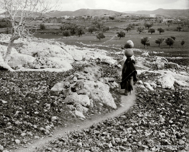
ancient-road-jerusalem-iaa-5419-2
Ancient road between Jerusalem and Beth Horon.
Photo by IAA.
Share:

(Post by Seth M. Rodriquez)

It is impossible to send a photographer back to biblical times to capture the sights that were familiar to Abraham, David, and Peter…but a photographer taking pictures in the early 20th century could come pretty close.

Our picture of the week comes from Volume 1 of The American Colony and Eric Matson Collection.  This is a remarkable collection of photographs from the first half of the 20th century.  I had a hand in the early stages of this project, working through and cataloging thousands of photos.  It was a remarkable experience and in the process I learned much about the cultures of that period, the daily life of the inhabitants, the notable events of the day, and the various archaeological sites.  The collection published by LifeInTheHolyLand.com is a selection of the best of the photographs taken by the American Colony and Eric Matson.  Over 4,000 photos from Palestine, Lebanon, Syria, Jordan, and Egypt are presented in eight volumes. We will spend the next few weeks highlighting a photo from each volume. LifeInTheHolyLand.com describes the collection in this way:

Founded in 1881 by Horatio Spafford (author of the famous hymn, It is Well With My Soul), the American Colony in Jerusalem operated a thriving photographic enterprise for almost four decades. Their images document the land and its people, with a special emphasis on biblical and archaeological sites, inspirational scenes, and historic events. One of the photographers, G. Eric Matson, inherited the archive, adding to it his own later work through the “Matson Photo Service.”

As you spend time in the collection, you really do feel like you have stepped back in time.  The landscapes are picturesque because buildings are sparse or non-existent and the air is free from smog. The local villages are full of primitive dwellings while the new churches, hospitals, and municipal buildings are pristine.  You see dirt roads, horse-drawn carriages, boats powered by wind, and people walking from one town to the next.  Archaeological sites are untouched by the excavator’s spade or are being subjected to excavation for first time.  What an amazing time to be a photographer in the land of the Bible!

For example, as I was looking through Volume 1 the picture above stood out to me.  Two women are walking barefoot along a narrow, dirt path in the hills of Ephraim, balancing water jugs on their heads.  Behind them is the small town of Lower Beth Horon surrounded by farmland and a handful of trees.  You can almost feel the silence that must have hung in the air in this sleepy countryside.  Such a scene must have been familiar during the biblical period, and a photo such as this has the ability to transport us back to biblical times and to help us read Scripture in its historical context.

This photograph and 600 others are available in Volume 1 of The American Colony and Eric Matson Collection and can be purchased here for $20 (with free shipping).  Volume 1 focuses on “Northern Palestine,” and other photos from the volume can be seen here, here, and elsewhere on LifeInTheHolyLand.com.  Images and information about other work carried out by women during this period can be found here.

Share:

The level of the Dead Sea has risen for the first time in the last ten years.

Egyptian police seized a carload of 863 ancient artifacts, including 10 scarabs, 180 amulets, 120 Ptolemaic coins, 407 Roman coins of bronze, 3 Osirion wooden statues, and a limestone statue.

Victor Avigdor Hurowitz, Professor in the Department of Bible, Archaeology and Ancient Near East at Ben-Gurion University, has died after a long illness.

Shmuel Browns’ Photo of the Week is an impressive shot of the Keshet Cave in western Galilee.

The Samaritans on Mount Gerizim can vote twice this week.

Accordance Bible Software has an outstanding sale going on right now for both sets (9 volumes) of the Zondervan Illustrated Bible Background Commentary, Old and New Testaments. It’s marked down now 63% to $150. These volumes have lots of images you can easily search and use. Sale ends on Monday.

HT: Charles Savelle

Dead Sea, Ras el Feshkha, mat01742

Western shore of the Dead Sea in early 1900s
Photo from Southern Palestine photo collection
Share:

This may be the most interesting archaeological excavation in the Old City of Jerusalem in the last few years. The Lutheran Church of the Redeemer is located next door to the Church of the Holy Sepulcher. From DW:

Two-thousand years of biblical history lay buried 14 meters beneath the Lutheran Church of the Redeemer in Jerusalem. German archeologist Dieter Vieweger led the excavation of the site.
A Herodian quarry, the remains of Golgotha, buildings from the period of the Roman Emperor Hadrian, mosaics from the Church of Saint Maria Latina: At the end of 2012, the Archaeological Park was opened under the Lutheran Church of the Redeemer in Jerusalem, giving visitors the chance to take a tour of these locations and understand the city’s colorful past. German archeologist Dieter Vieweger spent three years building the park together with a team of students and experts.
[…]
The archaeological park makes 2,000 years of history in Jerusalem visible – from Herod to the Crusaders to today. As a biblical archeologist, which chapter in history do you find most interesting?
For me, of course, the oldest layers are the most interesting – those buried 14 meters (46 feet) under the Church of the Redeemer. That’s where we found a stone quarry built by Herod the Great. You can actually walk around it and see how thick the stones were carved out, sawn and broken. The quarry was used to expand the city to the east of the site at Herod’s instruction. But not all of the stone was taken from the ground where the Church of the Redeemer now stands. This area was later called Golgotha, the location where Jesus was crucified. In this section of the archeological park, visitors come very close to Christian and Jewish history.

The full article is here. The site is now open to the public, but it closes early in the afternoon. In a post last year, Tom Powers wrote about his tour of the site before it opened.

German Church of the Redeemer, mat00862
Lutheran Church of the Redeemer, early 1900s
Photo from The American Colony and Eric Matson Collection
Share:

The Israel Museum’s largest and most expensive archaeological project will open on February 12 and run for nine months. From Phys.org:

Israel’s national museum said Tuesday it will open what it calls the world’s first exhibition devoted to the architectural legacy of biblical King Herod, the Jewish proxy monarch who ruled Jerusalem and the Holy Land under Roman occupation two millennia ago. The display includes the reconstructed tomb and sarcophagus of one of antiquity’s most notable and despised figures, curators say. […] Herod’s final grandiose project was to prepare for death. Curators believe Herod constructed an extravagant, 25-meter-high (80-foot-high) tomb. Israeli archaeologist Ehud Netzer spent 35 years of his career searching for it. In 2007, Netzer drew international attention when he announced he had found what he believed was the tomb at the Herodion, the ruler’s winter palace, located on a cone-like hill that still today juts out prominently in the barren landscape of the Judean Desert, near the West Bank city of Bethlehem. In 2008, the archaeologist approached the Israel Museum about creating an exhibit that would display artifacts from one of the greatest finds of his career. While surveying the Herodion site with museum staff, Netzer fell to his death. Museum staff pushed forward with planning the exhibit. In 2011, the museum used a crane to remove dozens of half-ton columns and the roof of what Netzer identified as the top floor of Herod’s tomb, which he thought held his sarcophagus. Each stone was affixed with an electronic chip so it could be more easily be put back together at the Israel Museum. Three sarcophagi were found at the site, and curators believe one was Herod’s. Though it bears no inscription, it is made of a special reddish stone, found smashed into hundreds of pieces. The Jewish zealots who took over the Herodion after Herod’s death likely smashed the sarcophagus to pieces, destroying the symbol of a man who worked with the empire they were rebelling against, curators said.

The full story is here. Barry Britnell also notes a 60-second promo video made by the Israel Museum. In related news, The Times of Israel reports:

As part of a new plan, a replica of his tomb at Herodium, situated outside the West Bank city of Bethlehem, will tower to 83 feet and will be visible from Jerusalem.

Herodium Herod's tomb, tb051708036 Remains of Herod’s tomb at the Herodium.
Photo from Judah and the Dead Sea.

Share:

The New York Times has a profile of the Carchemish excavations, including results from the first two
years. I particularly enjoyed Mr. Marchetti’s story of discovering an almost intact monolith lying on the surface on his first day on the site.

This Jerusalem Post article on Jesus and the Jordan River discusses both tourist sites on the northern and southern ends.

This Haaretz article on “Masada for runners” isn’t what I expected. (I wanted fastest times to the top; they tell you to run around the bottom.)

Google Street View now covers much of Israel, including “most of Israel’s large and medium sized towns, many villages in central Israel and the Galilee, and historical and tourist sites such as the Dead Sea, the coral reefs of Eilat, the Dead Sea, Megiddo, and many more.” It does not include Judea and Samaria.

“Museum staff in Manchester have devised a computer console which allows visitors to ‘handle’ ancient artefacts. The technology at Manchester Museum – the first of its kind in the UK – allows the public to virtually touch delicate objects which would normally be kept behind glass.”

Tyndale Tech has a great run-down of computer resources for Old Testament Studies.

HT: BibleX, Jack Sasson

Carchemish citadel and Euphrates River from north, adr1005191620
Carchemish citadel and Euphrates River from the north.
Photo from the fantastic Pictorial Library of Bible Lands.
Share: