fbpx

The Macherus article in the newest issue of Biblical Archaeology Review is quite good, especially with its reconstruction diagrams. A particularly impressive photo is the panoramic shot from Macherus showing Masada, Herodium, and Jerusalem. I was surprised to see the entire article available online this morning. If you don’t subscribe to the print edition, you have a brief chance to read it before it goes behind the subscription wall. An annual digital subscription to BAR is now available for $20. A 21-m-long sediment sample near the Dead Sea is providing scientists with information about the area’s climate in history. According to Thomas Litt, the results “clearly show how surprisingly fast lush Mediterranean sclerophyll vegetation can morph into steppe or even desert vegetation within a few decades if it becomes drier.” The level of the Sea of Galilee dropped more than two feet this summer. Carl Rasmussen has just added photos to his site of a place in Galilee I have not seen: Domus Galilaeae is a Roman Catholic retreat center overlooking the northern side of the Sea of Galilee. And his latest travel tip suggests an alternative viewpoint now that Arbel is controlled by Park Rangers and closes way too early. Wednesday marked the 200th anniversary of John Lewis Burckhardt’s visit to Petra. He was 27 when he re-discovered the Nabatean city for the western world on August 22, 1812. Gus W. Van Beek died this week. He was Curator of Old World Archaeology in the National Museum of Natural History, Smithsonian Institution and recent author of Glorious Mud! How in the world did the ancients ever move massive stones such as the trilithons in the Jupiter Temple of Baalbek that weigh more than 1,000 tons? Paleobabble answers that question with diagrams and translation from an older French article. Baalbek, Jupiter Temple western wall trilithon, adr090511208 Trilithon in Jupiter Temple, Baalbek (photo from the Lebanon volume of the Pictorial Library of Bible Lands)

Share:

(Post by Seth M. Rodriquez)

As I’ve pointed out before in this series, pictures can be powerful tools in the hands of the Bible teacher.  The right picture can illuminate a passage and bring deeper understanding.  This week’s photo is another example.  It comes from Volume 7 of the revised and expanded edition of the Pictorial Library of Bible Lands, which focuses on Egypt.  The photo is entitled “Nile River Valley Near Beni Hasan Tombs from East” (photo ID #: tb010805121).

When the Israelites were about to enter the Promised Land, Moses contrasted the land of Egypt with the land of Canaan:

For the land, into which you are entering to possess it, is not like the land of Egypt from which you came, where you used to sow your seed and water it with your foot like a vegetable garden. But the land into which you are about to cross to possess it, a land of hills and valleys, drinks water from the rain of heaven, a land for which the Lord your God cares; the eyes of the Lord your God are always on it, from the beginning even to the end of the year. (Deut. 11:10-12, NASB)

In the context of the chapter, Moses is warning the people to obey God’s commandments so that they will prosper in the land.  He explains that life in the Promised Land will be very different than it was in Egypt, and this week’s photo helps explain why.

The agriculture of Egypt is based on the water from the Nile.  Farmers plant their crops in the flat land around the Nile, in part, because they have easy access to water from there.  The phrase in verse 10 “sow your seed and water it with your foot” has produced a number of interpretations, such as carrying the water by foot in buckets, digging channels with one’s feet, and using a mechanical device that is powered by foot.  Whatever the correct interpretation, the point is that in Egypt it was possible to provide water for your crops by mere manpower.  In this week’s photo, you can see the relationship between the farmland and the Nile, and it is clear from this picture that it would be a relatively easy task to get water from the Nile to the crops growing nearby.

By contrast, the agriculture of Canaan is vastly different.  There is no convenient and reliable natural source of water for the farmer’s crops.  In contrast to the flat farmlands that surround the Nile, Canaan is “a land of hills and valleys,” which makes moving water from one place to another difficult.  And the only major river that flows through the land, the Jordan, is below sea level for most of its course and is basically useless for irrigation.  Before the advent of modern machinery, the only way the fields could be watered was by rain.

 
So in Deuteronomy 11, Moses warns the people that they must obey God to thrive in the Promised Land.  If they obey, then God will send the rain and they will have food (Deut. 11:13-15).  If they don’t, then:
 

He will shut up the heavens so that there will be no rain and the ground will not yield its fruit; and you will perish quickly from the good land which the Lord is giving you. (Deut. 11:17, NASB)


The land to which God was leading His people was a land that required them to walk by faith and depend on Him.
 
This and other photos of the Nile Valley are included in Volume 7 of the Pictorial Library of Bible Lands and can be purchased here. More information and photos about the Nile River can be found on the BiblePlaces website here.  For more thoughts on how the Land of Israel was a land that fostered faith, see my post here.
Share:

Free on Kindle today: The Apostle: The Life of Paul, by John Pollock. The ASOR Blog has posted the latest Archaeology Roundup. Three new volumes of the City of David final excavation reports have been published. If you have not had the chance to visit Hebron, you should take the illustrated tour today with Wayne Stiles. (Another version with smaller images is published at the Jerusalem Post.) Is skinny-dipping in the Sea of Galilee sacrilegious? The Washington Post gives my answer to the question. WiFi access is important enough to visitors in Israel that one biblical village has equipped their donkeys with WiFi routers. HT: Charles Savelle Sea of Galilee windsurfer, tb060105650 Windsurfer on Sea of Galilee (photo source)

Share:

This article, from Jewish Ideas Daily, claims that an ancient agricultural village in Modiin Illit will be opened exclusively for the ultra-Orthodox (Haredim).

In the middle of Modiin Ilit, specifically in Kiryat Sefer, there has been an ancient archaeological site dating back to the Second Temple period. The site is an ancient agricultural village, with a wine press and a synagogue that are intact. While the site from an archaeological perspective is in usually good condition, the site has sat for many years, since it was discovered, and left in disrepair. It has recently been decided, by the Iryah in coordination with the government, to clean it up and turn it into an archaeological park. The mayor of Modiin Ilit announced that as per the agreement with the government, especially because of its location being in the middle of a haredi city, which is in writing and is final, the site will be managed by the haredi community and will tell the historical narrative as per the Torah rather than science and archaeology. R’ Yaakov Guterman said "the site will operate according to the narrative of our rabbonim, according to Jewish historical sources as brought in Tanakh and form the gemara and words of Chazal. The site will be open only to the haredi community, who will now have a worthy place to visit and to connect to our roots and history, without the distortions found elsewhere, where one risks hearing false opinions even to the point of apikorsus, God forbid. Also in the governmental decision it was written that the haredi community will establish the atmosphere of the site and all the details and historical mentions will be only according to sources from Chazal."

The article provides some commentary on the alleged agreement. One additional point: if restricting a rather ordinary archaeological site like this one to the ultra-Orthodox community were to improve relations between the religious and archaeological groups, it might be a worthwhile “sacrifice” for the public. Update: Paleojudaica links to the story in Haaretz, along with a response by the mayor of Modiin to close the city’s central park to ultra-Orthodox. HT: Daniel Wright

Share:

Objects from a 13th-century BC cultic pit discovered in 2010 near Jokneam go on display this week at Haifa’s National Maritime Museum. More than 200 items were found in a favissa near Tel Qashish during construction of a pipeline. From the Jerusalem Post:

The treasure trove contains pottery vessels from the Late Canaanite Age IIB (1300-1200 BCE), which were stored in an elliptical pit of limestone rock – 3 meters high by 1.5 meters wide by 3 meters deep – containing more than 200 items, mostly previously unknown and quite rare, according to a statement from the exhibition. Inside the pit were items made locally, in Mycenae and in Cyprus. The locally-made products presumably for cult use included goblets – one with a man’s face sculpted on it – tall cylindrical stands, small stands, incense burners and chalices for libation, burning oil and incense. According to the exhibition, they indicate that the trove belonged to a local temple that has not yet been discovered and were items brought by worshipers. However, researchers have neither been able to identify the specific deity nor the worshipers themselves. “The pottery was either buried in haste for fear of damage by enemy forces, or stored in the pit when there was no more room elsewhere, or discarded,” the statement from the exhibition said. Among other more common local items were bowls, jugs, juglets, cooking pots, oil lamps, Canaanite jars and cup-andsaucer sets. From Cyprus, the favissa contained bowls of white-slip and base-ring wares, as well as white-shaved juglets.

The full story is here. We noted the original discovery in June 2010. The IAA press release includes a few photos and six high-resolution images are available here. The original audio slideshow is still available at Discovery News. HT: Joseph Lauer 1 Cultic objects at time of discovery.
Photo by Assaf Peretz, courtesy of the Israel Antiquities Authority.

Share:

The results of the first season of the Jezreel Expedition are summarized at The Bible and Interpretation. The regional survey this summer was successful in preparing the team for beginning excavations next year. The article begins:

Members of the Jezreel Expedition headed by co-directors Norma Franklin (Zinman Institute of Archaeology, University of Haifa) and Jennie Ebeling (Department of Archaeology and Art History, University of Evansville) conducted an intensive landscape survey of “greater Jezreel” in June 2012. The main goal of the inaugural season was to record surface features in a three square kilometer area to the west, north, and east of Tel Jezreel in order to identify areas for excavation in summer 2013 (Figure 1). The Jezreel team documented more than 360 features, including cisterns, cave tombs, rock-cut tombs, agricultural and industrial installations, terrace and village walls, quarries and more; most of these features had never been systematically recorded before. The results of this survey shed light on the extent of different settlements at Jezreel from late prehistory through to the 20th century CE Palestinian village of Zer’in.

The article also includes an image from the recent LiDAR scan. The city of Jezreel is best known as the location of Naboth’s vineyard and Jehu’s coup. Here Jehu ordered the deaths of the kings of Israel and Judah as well as Queen Jezebel (2 Kings 9-10). In a 2008 article, co-director Franklin argued that the fortified enclosure of Jezreel was constructed not by Ahab but nearly a century later by Jeroboam II. 
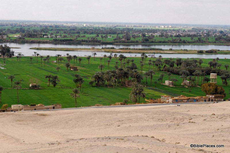
Tel Jezreel and Mount Gilboa from the west (photo from the Pictorial Library of Bible Lands, volume 2)

Share: