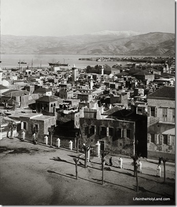
One of these days I’m going to get to Beirut, Lebanon.  Until then, I’m going to imagine that it looks just like this.

Beirut and St George's Bay, mat10591

Beirut and St. George’s Bay, probably in 1920s

J. L. Porter visited the city in the 1870s and wrote about it in The Giant Cities of Bashan and Syria’s Holy Places:  “The site of Beyrout is among the finest in the world. From the base of Lebanon a triangular plain juts into the sea, and round a little bay on its northern shore nestles the nucleus of the city, engirt by old walls and towers. Behind the city the ground rises with a gentle slope, and is thickly studded with villas of every graceful form which Eastern fancy, grafted on Western taste, can devise; and all embosomed in the foliage of the orange, mulberry, and palm. In spring time and summer Beyrout is beautiful. The glory of Lebanon behind, a mantle of verdure wrapped closely round it, fringed by a pearly strand; in front the boundless sea, bright and blue as the heavens that over-arch it. Such is Beyrout” (282).

The photo and quotation are both taken from the Lebanon, Syria, and Jordan volume of The American Colony and Eric Matson Collection (Library of Congress, LC-matpc-10591).
Share:

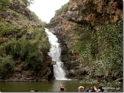
One of my favorite hikes in Israel is along the Nahal Yehudiyeh in the Golan Heights.  You have to swim, and in non-summer months the water is a bit chilly.  But it’s an exciting hike in many ways. 

Arutz-7 has a story which includes the details you need to know before you go.  One sample:

Hiking the upper section of Nahal Yehudia is considered to be appropriate for good hikers who can swim, as there are a couple of places where you have to climb down the rock face with the help of handholds or a ladder into a deep pool that you have to swim across. Note that you must start out on the well-marked trail by noon.
The hike starts above the wadi on the red trail, walking through a deserted Syrian village of basalt field stones built on the remains of an earlier Jewish town from the Roman-Byzantine period.
Remains of a wall have led archaeologists to suggest that Yehudia is Soganey, one of the three fortresses (the other two are Gamla and Sele’ukya) in the Golan built by Josephus at the time of the Roman Revolt.

I don’t know how easy it is to find any more, but a great resource for adventures like these is the book by Joel Roskin, Waterwalks in Israel (Jerusalem Post, 1996).

Nahal Yehudiyeh waterfall and pool, tb040703201 Nahal Yehudiyeh waterfall

UPDATE: The author of the article, Shmuel Browns, has commented below. Take a look at his website for a more comprehensive article and photos.

Share:

A recent comment on a previous post has alerted me to the existence of the Magdala Project Blog.  It appears to be current (the most recent post was 4 days ago), and it is loaded with lots of information and photos.  Recent posts include:

Another one that may be of interest to readers are statistics of the Sea of Galilee, with data from the Israel Ministry of Environmental Protection.

You can also see a slide show from the Magdala excavations here.

Share:

On the one-year anniversary of the ESV Study Bible, Justin Taylor reveals that a new Bible atlas is in production.

For those who have appreciated the maps and illustrations in the ESVSB, in June we’ll release the Crossway ESV Bible Atlas, which we’re very excited about. It was a huge project, but OT scholar and archaeologist John Currid (RTS-Charlotte) and cartographer David Barrett have done an outstanding job with it. There’s about 65,000 words explaining the geography and cultures of the biblical world, along with 175 full-color maps, including some in 3D, 70 photos, numerous recreations, a fully searchable CD, and a detailed 16.5 x 22-inch map of Palestine.

He does not mention that David Barrett is also the creator of the recently released Bible Mapper 4

Readers here may be interested to know that the majority of the photos in the new atlas come from the image collection of BiblePlaces.com.

HT: Ted Weis

Share:

What is your favorite view in the Middle East?  I have a number of places that I aspire to be on the rare day when the air is crystal clear.  Perhaps my top three viewpoints in Israel are Nebi Samwil, Mount Carmel, and Arbel.  On the other side of the Jordan River, Mount Nebo ranks first. 

Unfortunately, I have never been there on a really clear day.

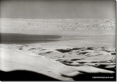
The photo below was taken in the 1930s, when factories and automobiles were less troublesome to photographers.  The view is from Mount Nebo, and you can see beyond the northern end of the Dead Sea to the Judean wilderness and even Jerusalem.

Dead Sea and Judean wilderness, view from Mt Nebo, mat03779
View from Mount Nebo with Dead Sea

I’m linking this photo to the highest resolution available (5200 x 3700 pixels), which will make it a slow download, but those of you with interest will be able to pick out a lot of detail.

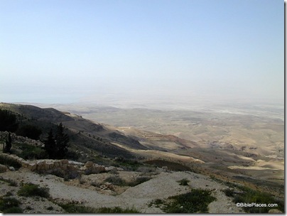
For comparison, the photo below was taken from Mount Nebo on a more typical day.

Mt Nebo view to Dead Sea, tb031801859

The top photo is taken from the Lebanon, Syria, and Jordan volume of The American Colony and Eric Matson Collection (Library of Congress, LC-matpc-03779).  The bottom photo is rotten and will never appear in one of my photo collections.

Share:

Apparently the story has been circulating that Cambyses’ lost army has been found.  But it’s not true.

This week UNESCO is holding in Acco the second annual World Heritage Workshop on “Disaster Risk Reduction to Cultural Heritage Sites.”

Ferrell Jenkins posts a beautiful aerial photo of the coastal side of Tel Dor.

We’re glad to see that The Bible and Interpretation now has an RSS feed.

I am off in a few hours to New Orleans for a couple of conferences related to the Bible and
archaeology.  I don’t know if I’ll have an internet connection or much time, but if I do, I may post some observations.  Readers of this blog going to the ETS meeting may be interested in this paper:

Seth Rodriquez, Site Identification: In Search of a Methodology
Wednesday, Nov. 18, 10:10-10-50am
Marriott, Ile de France I, 3rd Floor

Share: