fbpx

The Jerusalem Post reports on the finds that we speculated on before (with photos).  While they certainly uncovered some new things in the dig, the article does not mention any surprising finds.  In short, any archaeologist could have predicted that digging in this place would reveal:

The Valley Cardo (aka Eastern Cardo): the full 35 foot (11 m) width of the street was uncovered. 

This same street was uncovered about 150 feet (50 m) to the south.

A ritual bath (mikveh) from the Second Temple period.  They have found 150 of these all over the city.

A portion of the Lower Aqueduct which brought water from Solomon’s Pools to the Temple Mount. 

Numerous remains of this aqueduct have been found elsewhere, including slightly to the south outside the Old City wall.

An escarpment.  The article suggests that this a significant discovery, but scholars have long believed that the natural defenses of the Western Hill made it more difficult for the Romans to capture in 70 A.D.  Any casual observer can see the steep drop-off as one approaches the Western Wall from the west.  For a while, some believed that the Western Hill must have been fortified on its eastern side in order to explain why it took the Romans a month to conquer the area.  But no evidence of a wall has ever been discovered, and Josephus, who describes the city’s fortifications at length, never mentions a wall in this area. 

These remains will be preserved under a new building for the Western Wall Heritage Foundation. 

This is the same organization that controls access to the tunnel excavations north of the prayer plaza.


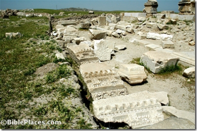
Valley Cardo near Dung Gate (south of excavation area)
Share:

The first is a brand new work, released a few months ago.  The second is the 4th edition and is due out in April.  I have not seen either and so can only judge them by their covers (and both fail on that count).  There must be a good market for Bible atlases with so many out there; in addition to these, I am aware of two revisions underway and two new ones being written.


The IVP Atlas of Bible History, by Paul Lawrence

* Includes nearly 100 superb relief maps.
* Features over 140 colour photographs.
* Includes over 20 site plans and panoramic reconstructions.
* Draws on the latest finds of historians and archaeologists.
* Includes special features on topics such as the peoples and languages of the Bible throughout the text.
* Also includes a Scripture index.
This atlas is currently available for $28 from either Eisenbrauns or Amazon.


Oxford Bible Atlas, 4th ed., by Adrian Curtis

This new edition of the Oxford Bible Atlas, now with full-colour maps and illustrations, has been thoroughly revised to bring it up to date with regard both to biblical scholarship and to archaeology and topography. The Atlas will help readers of the Bible understand the contexts in which its stories are set and to appreciate the world from which it emerged and which formed its background. Maps show the geographical setting of the Bible’s stories and reflect the successive stages of the Bible’s accounts, while specially chosen full-colour illustrations bring the countries and their peoples to life. The accompanying text describes the land of Palestine, and its wider ancient Near Eastern and east Mediterranean settin  gs. It outlines clearly the successive historical periods, and describes the major civilizations with which Israelites, Jews, and early Christians came into contact. There is also an illustrated survey of the relevance of archaeology for the study of the Bible. The Atlas provides a superb guide to the geography of the Holy Land throughout biblical history, from the Exodus period through to New Testament times.

This edition will be available in April and is currently priced at $28 at Eisenbrauns and $23 at Amazon.

Share:

Haaretz has an article that reports a new proposal by Boaz Zissu of Bar Ilan University (the Hebrew version has a small photo and map).  He suggests that Nob is near a quarry that he excavated on the northern end of the Kidron Valley.  The strange thing is that he comes to this conclusion based on what he did not find.  He found a quarry, but no ancient settlement.  He found pottery, and concludes that it must have come from somewhere nearby, and perhaps that somewhere was Nob.  Perhaps.

In favor of his identification is this: his site is between Anathoth and Jerusalem, which matches the general location given in this important geographical passage:

Isaiah 10:28-32 (NIV) “They enter Aiath; they pass through Migron; they store supplies at Micmash. They go over the pass, and say, “We will camp overnight at Geba.” Ramah trembles; Gibeah of  Saul flees. Cry out, O Daughter of Gallim! Listen, O Laishah! Poor Anathoth! Madmenah is in flight; the people of Gebim take cover. This day they will halt at Nob; they will shake their fist at the mount of the Daughter of Zion, at the hill of Jerusalem.”  (Cf. Neh. 11:32.)


Source: Pictorial Library of Bible Lands, vol. 3, Jerusalem

Against his identification is the fact that he found pottery from the end of the Iron Age, but an important biblical passage indicates that Nob was inhabited in the early Iron Age (1 Sam 21-22).  Though not mentioned explicitly, most believe that the tabernacle was located at Nob when Saul ordered the slaughter of the priests.  The absence of pottery from Iron IIa doesn’t prove that the quarry is not (near) Nob, but before an identification can be made with any certainty, such pottery must be found.

Of greater concern is the apparent methodology.  I stress “apparent” because I am basing this on the newspaper article and not on the archaeologist’s proposal itself (and there may be a great gulf between the two).  The problem seems to be that a site is found (or apparently found) and it is assumed to be a certain prominent place mentioned in the Bible.  In fact, there are several places that this site could be, as you can see from the Isaiah passage quoted above.  Scholars are reasonably certain where Anathoth is (modern Anata), and no one doubts the location of Jerusalem.  But there are two other sites that are yet unidentified and this quarry could be related to either of them.

There are hundreds of unidentified tells and hundreds of sites mentioned in the Bible and other ancient texts that we cannot locate.  Matching the two is not always easy, especially in a land where inscriptions are rarely preserved. 


Source: Survey of Western Palestine, Sheet 17

Most geographers follow Albright in locating Nob near what is known today as Mt. Scopus (Ras el-Mesharif).  This is where Edward Robinson was looking as well, though his attempts to find ruins were “without the slightest success” (Biblical Researches 2:150).  Aharoni suggested that Nob was just over the hill at Isawiyeh (Land of the Bible, p. 393), but Rainey thinks either Madmenah or Gebim could be Isawiyeh and Nob is el-Mesharif or further south, et-Tur (Sacred Bridge, p. 235).  An important factor in these identifications is Isaiah’s mention of shaking the fist at Jerusalem, implying that the two can see each other.

Everyone agrees that the solution cannot be determined without archaeological remains from the time periods in which the site is mentioned in the historical texts.

Share:

I bet most of my readers can’t guess what it is.  #1, of course, is the Western Wall.

#2 is not:

  • The Machpelah in Hebron
  • Masada
  • Qumran
  • Bethlehem (think Ruth and David)
  • Joseph’s Tomb, or anything in Shechem
  • The Temple Mount, the City of David, or anything in Jerusalem

In fact, it’s not anything related to the Bible at all.

Nor is it the tomb of Rambam (Maimonaides), Rabbi Akiva, Rabbi Nahman, or Rabbi Judah the Prince.  Nor is it connected to any of the famous rabbinic cities, including Tiberias, Sepphoris, or Yavneh.

The honor of the most visited Jewish religious site belongs to the tomb of Rabbi Shimon Bar Yochai on Mt. Merom.  Each year hundreds of thousands visit the site for the Lag B’omer celebration; more than a million visit annually.

Share:

If you were planning to visit the archaeology wing at the Israel Museum in, oh, the next 2-3 years, you’re going to be disappointed.  According to the museum’s website, the wing “is currently closed for comprehensive renewal and will reopen to the public in 2009-2010.”  It really is a shame that they cannot renovate a section at a time, so that a portion of the exhibits are open to the public.  Or create a temporary exhibit of the most important finds.  Until then, the public can visit the lousy Rockefeller Museum (some great finds, but poorly displayed and described), the Eretz Israel Museum in Tel Aviv, or the Hecht Museum in Haifa.

Safe prediction: the museum wing will not finished when they say.


Israel Museum from east
Share:

Dismantling of the western ramp to the Temple Mount is discussed in these articles by Haaretz and YNetNews (discussed previously on this blog here and here; cf. also here).  The new information is that the ramp will be a bridge, crossing from the Jewish Quarter on the Western Hill.  There’s also the possibility that the earthen mound would be removed but the ramp not replaced at all.  The old news is that work will begin on this any day.

Share:
About the BiblePlaces Blog

The BiblePlaces Blog provides updates and analysis of the latest in biblical archaeology, history, and geography. Unless otherwise noted, the posts are written by Todd Bolen, PhD, Professor of Biblical Studies at The Master’s University.

Notice

As an Amazon Associate we earn from qualifying purchases. In any case, we will provide honest advice.