fbpx

In the Old City of Jerusalem, opportunities are rare to excavate large areas. The best such opportunity followed the recapture of Jerusalem in 1967 when archaeologist Nahman Avigad opened areas that led to the discoveries of the Broad Wall, Israelite Tower, Nea Church, and the Byzantine Cardo. Most tourists to the Old City today see the remains of that Cardo, perhaps while grabbing a bite to eat or doing some shopping.
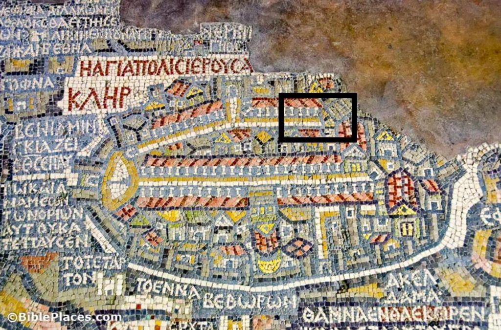
Jerusalem, as depicted on the Medeba Map (circa AD 580); the excavation area is marked with a black box

The Cardo is depicted on the Medeba Map, a Byzantine-era mosaic that once displayed all of the Holy Land, with Jerusalem at the center. The map shows two colonnaded north-south streets through Jerusalem. The western street is more prominent, and it connected the Church of the Holy Sepulcher with the northern gate (today the Damascus Gate) and the Nea Church.

Plans to construct a heritage center at the back side of the Western Wall prayer plaza provided Shlomit Weksler-Bdolah and Alexander Onn with the opportunity to see what lay beneath before the building went up. Their large-scale excavations from 2005 to 2010 revealed a Old Testament-era four room house (described here last week) and the Eastern Cardo. They uncovered a few other things as well, including a portion of the Low-Level Aqueduct, but these are the two main discoveries described in their report in Ancient Jerusalem Revealed.

If you can picture the Western Cardo (aka “the Cardo”) in the Jewish Quarter, you can picture the Eastern Cardo. Both consist of a large paved street with sidewalks on either side and with porticoes probably on both sides as well. The street continued in use for nearly 2,000 years, so a lot of the superstructure was missing, including nearly all of the columns. The Eastern Cardo is slightly wider than the Western Cardo, which is not what you would expect from the Medeba Map. The excavators suggest that the Western Cardo was more prominent on the map because this street connected the churches that the pilgrims visited.
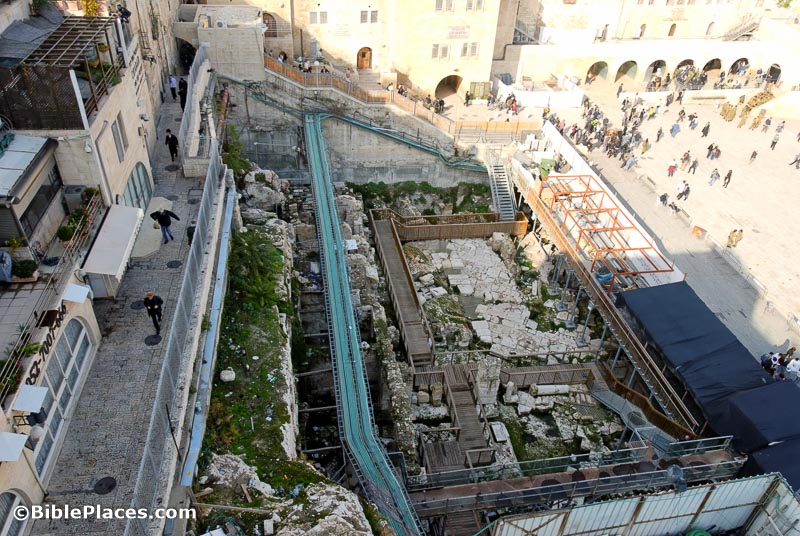
Eastern Cardo excavations, with paving stones visible

The Eastern Cardo ran from the present-day Damascus Gate south to the area of the present-day Dung Gate, but unlike the Western Cardo, it was constructed in its full length in the Roman period. The archaeologists know that because they found the latest material they found in sealed contexts beneath the paving stones is early 2nd century AD. But while most have expected that the street was built during the Aelia Capitolina renovation circa AD 130, the excavators think it predates that by a few years. It cannot date before Hadrian’s reign (117-138), because of a coin found beneath the pavement, but it may date to Hadrian’s earliest years. The street continued in use through the Byzantine period.

The conclusion of the article describes the history of the street over the following 1,500 years. The short version is this: as years went by, the street’s elevation increased (ultimately 13 feet higher in the 20th century) and its width decreased (down from 77 feet to 9 feet). Presumably at least a portion of this street will be displayed to visitors in the lowest level of the heritage center now under construction.
Share:

For many years there was a big pit at the back of the Western Wall prayer plaza. If you climbed up the hill, you could see over the barrier walls and watch the hole get deeper. But it was difficult to know what they were finding. One natural guess, given the position of the pit, was that they would find the eastern branch of the Cardo. And they did. They continued digging and discovered a house from the Old Testament period. Their findings are given in a chapter of Ancient Jerusalem Revealed entitled “A First Temple Period Building and the Roman Eastern Cardo in the Western Wall Plaza.” The authors are the archaeologists Shlomit Weksler-Bdolah and Alexander Onn.

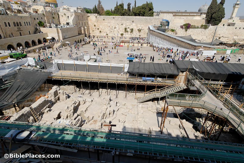
Western Wall plaza excavations, 2008

Below all of the human remains, the archaeologists found bedrock that had been quarried in the 7th century BC. On top of that, they found a portion of a “four-room house,” also dating to the 7th century. In the Bible, the two most significant kings ruling over Jerusalem in the 7th century were Manasseh and Josiah. So this house was likely built during the reign of one of them.

They uncovered a portion of the house that measures 27 x 27 feet (8.5 x 8.5m). The walls were preserved to a height of—get this—16 feet (5 m)! That is very unusual for something this old, with all of the later bulldozers to come through (I’m thinking here of Nebuchadnezzar, the Romans, the Persians, even Herod). The structure was well-built, with “uniform, homogeneous courses of slightly trimmed stones.” The layout of the house had three parallel rooms, characteristic of the “four-room house.” The fourth room, running along the back, was beyond the area of the excavation.

The destruction of the building is interesting. The archaeologists determined that the building was destroyed quickly, either by an earthquake or more likely by the Babylonians. Yet the building lacked complete vessels, indicating that the house was abandoned before the destruction. One theory the excavators suggest is that the inhabitants may have been deported to Babylon in the days of King Jehoiachin (2 Kgs 24:12-16).

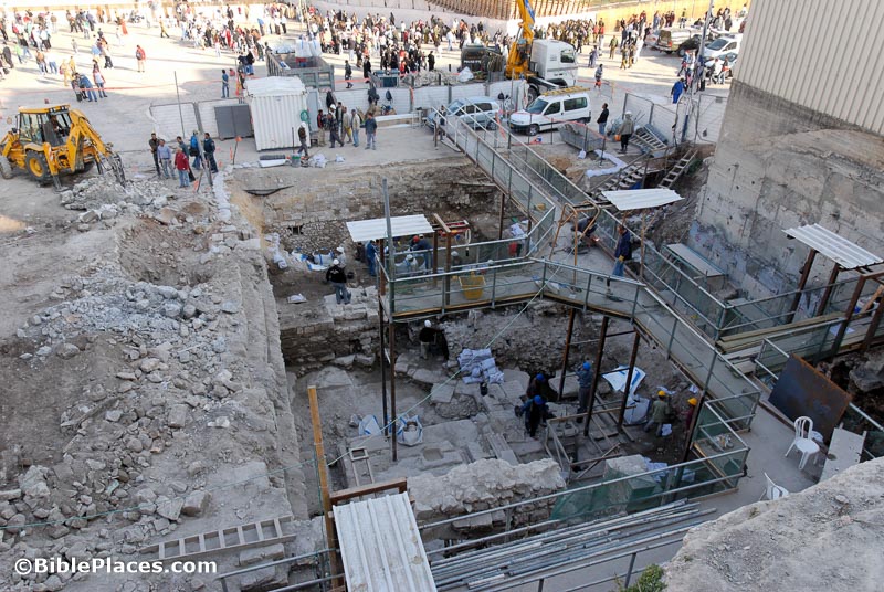
Western Wall excavations, 2006

What do you think they found in the house? If you’re an archaeology fan, you might just pause here and think about what you would expect to find in a 7th-century house in Jerusalem. You should get some of your guesses right, because the findings are not surprising.

1) Pottery characteristic of the 7th and early 6th centuries.

2) Lots of figurines. About 450 fragments of females, male riders, and animals. This almost sounds like a toy store. A particularly interesting one is of a lion with a small animal in its mouth. This may be a lion having lunch or a lioness carrying its cub.

3) Personal seals with Hebrew names. One of these seals has a cool depiction of an archer. (I’d like a seal like that, please.) Inscribed names include: Hagav, Netanyahu, Yadayahu, and Nawa or Nera.
The archaeologists consider the seals of most value in determining who lived in this house. They believe that these seals “suggest that its inhabitants belonged to the upper class and perhaps served as part of the administrative apparatus in Jerusalem.”

I suppose that we can imagine that the people who lived here were well-connected in Jerusalem, and it’s quite reasonable to think that they may well have been acquainted with Jerusalem inhabitants we know from the Bible, such as Jeremiah, Ezekiel, Zephaniah, and Josiah.

The article continues with what they found from later periods—primarily the Eastern Cardo. I hope to to read and summarize that here next week.

Share:

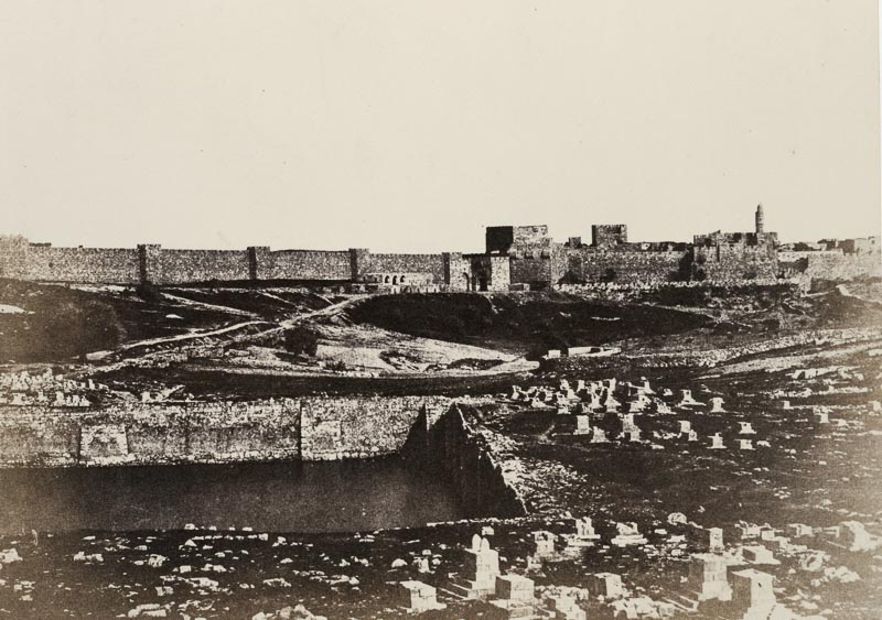
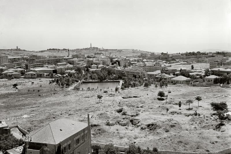
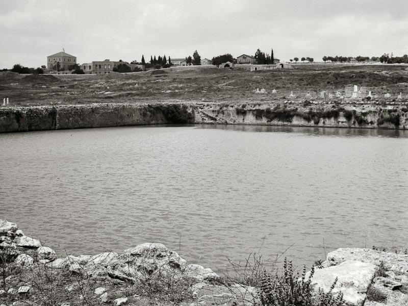
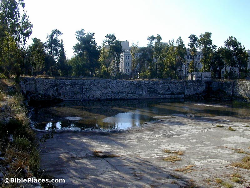
Excavations by David Amit in the area where the Museum of Tolerance is being built in West Jerusalem have revealed that the Mamilla Pool dates to the time of King Herod. While there are a number of pools in the Jerusalem area that date to the time of Herod, no one has ever been sure about the large one that’s rather tucked away down the street from the King David Hotel. Amit reports the results of his excavation in Ancient Jerusalem Revealed.

Amit comes to this conclusion from his excavations of an area slightly uphill from the pool where he uncovered a portion of the Upper Aqueduct system from the Second Temple period. By determining that that the pool is part of this aqueduct system, it is clear that the Mamilla Pool dates to the Second Temple period.

In addition, the excavations revealed an earlier water system from approximately the time of Hezekiah. A massive dam was constructed to divert run-off into Jerusalem, possibly into the Mishneh Quarter. This forerunner to the Upper Aqueduct system may have been constructed to provide water to the new inhabitants on Jerusalem’s Western Hill. Next to the dam, a contemporary Iron Age building may have served as an administrative building, possibly for supervising and maintaining the system. Amit notes the large number of royal seal impressions found in the area may support this theory.

It does seem that wherever one digs in Jerusalem, or in its vicinity, one finds something of interest. This rather modest dig adds significant contributions to our understanding of the water systems of Jerusalem in both the Old and New Testament eras.

Mamilla Pool, circa 1860. You don’t realize how close it is to the Old City until you move the buildings out of the way.

Mamilla Pool, circa 1910, with some buildings in the way.

Mamilla Pool, filled with water, early 1900s.

Mamilla Pool, in more recent days.
Share:

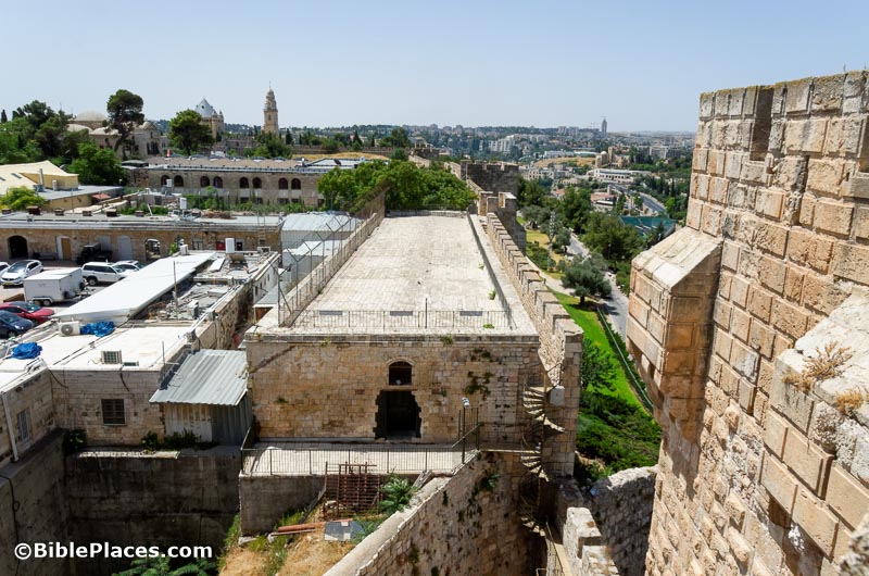
There is an Israeli police station today just inside Jaffa Gate to the right. The Israelis took it over from the Jordanians who used it for the same purpose. The Jordanians inherited it from the British Mandate authorities. One of the buildings of this complex is known as the Kishle. The Kishle served as the prison during British Mandate times. Before the British, the building served the Ottoman police force. And before them, this was the location of the Roman legion charged with keeping the peace in the centuries following the Jewish Revolt. And below that archaeologists have discovered foundations of King Herod’s palace.

There’s clearly a pattern here, and it’s likely related to the geography. This area is the high ground on the Western Hill, and it provides a commanding position of the surrounding area. Unfortunately all of this construction has made uncovering earlier remains difficult. In fact, in the conclusion of the article being summarized here, the archaeologist soberly notes that all that left of Herod’s great palace are scattered remnants of its podium.

Kishle building from the north

Amit Re’em excavated the Kishle in 2000 and 2001, and his report in Ancient Jerusalem Revealed provides a summary of his discoveries. The article is succinct and well-illustrated, moving from the earlier periods to the later ones. My focus here will be the same as that named in the title of the article, “First and Second Temple Period Fortifications and Herod’s Palace in the Jerusalem Compound.”

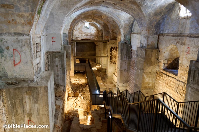
Kishle interior

What gets me most excited about this excavation is not the foundations of Herod’s palace but a large section of wall constructed by Hezekiah. If you have studied Jerusalem’s history, you know of the “Broad Wall,” a 25-foot-wide fortification located today in the middle of the Jewish Quarter. What Re’em revealed is more of this same wall, but on the western side of the Western Hill. This is valuable because this is now only the second portion of this wall discovered to date. (This point is a useful illustration of how relatively little is either preserved or accessible in Jerusalem today.)

A length of about 50 feet was exposed, preserved to a height of 8 to 9 feet. That’s not as big as the “Broad Wall” portion, but it’s quite substantial. The construction was also impressive, as the wall was made of “large, well-trimmed stones (90×35 cm.) laid in header/stretcher fashion in the best tradition of First Temple period fortification construction.”

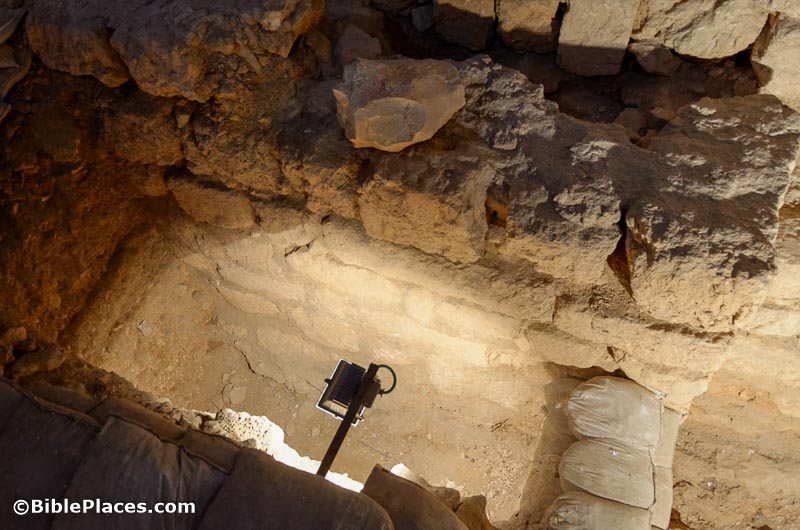
City wall from time of King Hezekiah

But then Re’em goes a step further, claiming that the common view that Jerusalem’s Western Hill was quickly populated with exiles from Samaria is wrong. I think it’s best to hear his claim in his own words:

The new finds from the Kishle contradict [previous] researchers’ conclusion that Jerusalem, limited to the area [of] the City of David and the Temple Mount, rapidly developed to occupy the Western Hill as a result of a mass influx of refugees to Judah and Jerusalem following the Assyrian destruction of the northern Kingdom of Israel at the end of the 8th century BCE. The settlement process on the Western Hill appears to have been gradual, beginning during the first half of the 8th century BCE.

Unfortunately he moves straight on to the next subject without giving a scrap of evidence for his conclusion. I would say that there is evidence in the Bible, usually ignored, that indicates that Jerusalem’s Western Hill was not only settled earlier in the 8th century, but it was also fortified! I think I’ll follow Re’em’s example by throwing that out there and then just moving on.

The Kishle excavations also revealed some of the “First Wall,” built by the Hasmoneans in the 2nd century. Re’em uncovered remains of this wall that were 16 feet wide and exposed for a length of 75 feet. It may be noted that all of these excavations are constrained by the walls of the elongated structure of the Kishle.

From Herod’s palace we have some walls, and the article gives the dimensions, the most interesting of which is one that was preserved to a height of 22 feet. The discussion here is not much more than a page long, and the bottom line is that when you combine results from this dig with others in the area, it is clear that Herod’s palace was massive in size, covering the area of the Citadel, the Kishle, the Armenian Garden, and most of today’s Armenian Quarter.

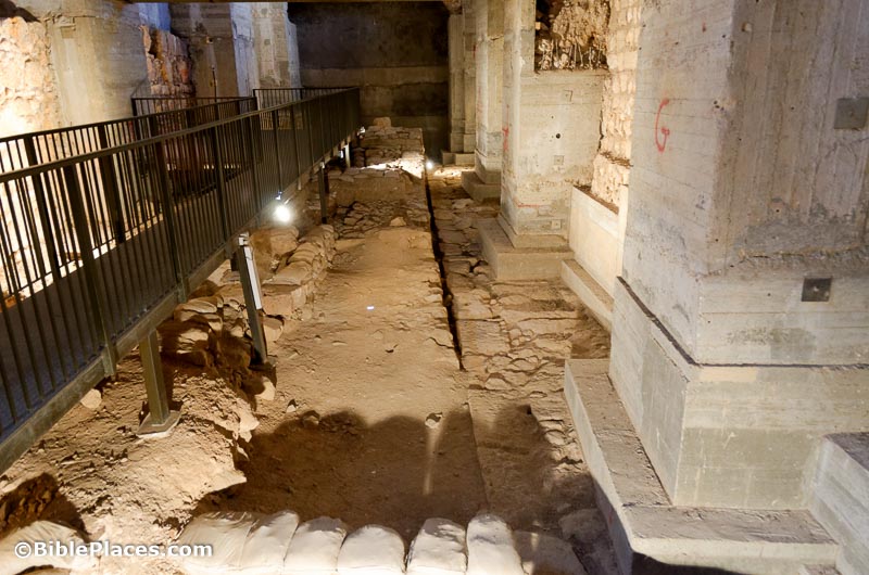
Foundation wall of Herod’s palace

The final section of this article surveys discoveries from later periods, including a Late Roman channel, medieval dyeing vats, a wall that is probably Ayyubid, and graffiti inscribed by prisoners held by the British Mandate authorities.

Share:

I mentioned in my introduction to this book that Ancient Jerusalem Revealed really provides a “who’s who” in modern Jerusalem archaeology. Dan Bahat is another well-known name, having served as district archaeologist of Jerusalem for some years and having written the Illustrated Atlas of Jerusalem. Bahat is also known for his excavations of the Western Wall Tunnel, and this article provides information from more recent work.

The main point that Bahat wants to make in this article is that Amos Kloner is wrong about the dating of the arched bridge that begins with Wilson’s Arch and runs west. All agree it originally dates to the Herodian period and was destroyed by the Romans. Kloner challenged Bahat’s dating to the Umayyad period, proposing instead that was rebuilt in the Late Roman period (AD 70-330). Bahat is back to prove that he was right all along. This debate does not interest me much, so I’m going to move along.

Unlike the Triple Gate article from last week, this chapter has more illustrations. I especially like the one showing the two-story vault structure supporting the bridge, built over a couple of ritual baths with a four-sided mikveh used for the purification of vessels in the foreground. The reconstruction of the Temple Mount in the Crusader era is strange, however: I don’t think that the Dome of the Rock used to be on the northern end of the Temple Mount.

A few other discoveries round out the article:

  • A three-story Crusader building
  • A Roman-era latrine beneath the three-story Crusader building
  • A Hasmonean ritual bath beneath the latrine beneath the three-story Crusader building

Every article concludes with a selected bibliography. This one has six entries, including one by Bahat, two by R. W. Hamilton, and one by Charles Warren.

Share:

From 1997 to 1999, Yuval Baruch and Ronny Reich excavated along the southern wall of the Temple Mount. More specifically, they unearthed material in front of the Triple Gate and along the wall to the southeastern corner of the Temple Mount. Their work is summarized in a chapter they wrote in Ancient Jerusalem Revealed.

The first interesting discovery they made was of a ritual bath (mikveh) underneath the wall of the Temple Mount. Since this predates the Herodian construction, it dates to the Hasmonean period. The mikveh has a double entrance divided by a quarried pilaster. Those are my favorite kind.

A second find is more briefly described: they discovered the fragment of a Herodian doorpost that matches the western doorpost of the Triple Gate. I am sad that there was not a photo.

They also found fragments they believe belonged to the Royal Stoa on the Temple Mount above.

These were thrown down when the Romans destroyed the city. The authors don’t mention, but I will add, that it is absolutely amazing just how little is preserved of this structure that Josephus described as “more noteworthy than any other under the sun” (Ant. 15.412). BTW, if you’re looking for a handy description of the “magnificent stones and wonderful buildings” of the Temple Mount, I wrote an essay on this for the Lexham Geographic Commentary on the Gospels.

Here’s another remarkable fact: the excavators revealed some 80 meters of the Temple Mount wall east of the Triple Gate, and they determined that a sloped street ran along the top of a series of 18 vaulted shops, yet they found no actual evidence for the street itself. It is amazing to me how much of antiquity has just vanished.

I love the photo of the arches burned into the Temple Mount wall. While it was a sad day for Jerusalem shopkeepers, it provides a poignant scene of the city’s destruction in AD 70. (I have a less dramatic photo here.)

Ronny Reich is the mikveh expert, so I was interested to read his suggestion that ritual baths near the Temple Mount can be dated based upon which direction they pointed. Those quarried along a southeast-northwest axis are pre-Herodian, while those oriented north-south are Herodian. The change in orientation is owing to the dominant feature in the area: the earlier ritual baths follow the natural topography of Mount Moriah, while the later ones are aligned according to Herod’s Temple Mount.

Baruch and Reich save the best for last. They propose that the sloped street that ran from the Triple Gate eastward was used for bringing sheep into the Temple Mount for slaughter. It also was periodically used for the removal of the red heifer. In support of this is the fact that the street is sloped, not stepped, and they contend that the third gate of the Triple Gate was used for animals, not people. This, they believe, makes better sense than a 200-foot high bridge spanning the Kidron Valley.

I enjoyed reading this article, but it would have been better with more illustrations.

Share: