fbpx

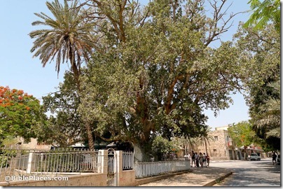
Question: Many years ago I read that Herod the Great had planted sycamore trees lining the street at Jericho. If true, the irony would be when Zacchaeus climbed one such tree to see Jesus. I cannot locate that reference. Have you come across this? –L.M.


Answer:

1. I have not heard of this.

2. It sounds suspicious (“too good to be true”; “preaches too well”).

3. The only primary source I can think of that would mention this is Josephus. A search of the works of Josephus showed only one reference to sycamore and it is related to King Solomon.

4. I checked two good commentaries on Luke and neither of them say anything about it.

I would guess it’s one of those urban legends. If anyone knows anything else, please comment below
or send me an email.

Sycamore-fig tree, Jericho, tb052205965
Sycamore tree in Jericho
(photo source)
Share:

(Post by Seth M. Rodriquez)

Joshua 3:15 makes the following comment in passing: “now the Jordan overflows all its banks throughout the time of harvest” (ESV). In the context of this chapter, Israel is about to cross into the Promised Land over a miraculously dry riverbed and this comment is included to give greater significance to the miracle. But before you rush to the Jordan with your camera during the next harvest season to snap a photo of this natural phenomena, let me save you some shekels by telling you that the flooding of the Jordan River is not something that happens today.

According to a 2010 report about the Jordan River (noted previously on this blog here), the Jordan River contains only 3% of the water that it did 100 years ago.  According to that report, the river discharged 1.3 billion cubic meters of water in the 19th and early 20th centuries (but see a more conservative estimate in the quotation below from the Encyclopaedia Judaica).  The report contrasts this with the current discharge of the river which is 20 to 30 million cubic meters.  Or to put it in numerical form:

  • 1,300,000,000 cubic meters per year in the past.
  •     30,000,000 cubic meters per year today.

 So “overflowing all its banks” is not a phrase that is typically used when describing the Jordan River today.

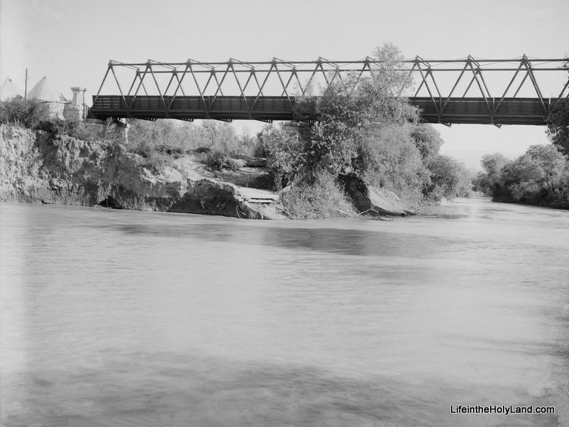
Fortunately, we have photographs from the first half of the 20th century that can help us illustrate this biblical phrase.  Our picture of the week (and a bonus picture) come from Volume 3 of The American Colony and Eric Matson Collection which focuses on Southern Palestine.  To show the contrast in the river’s levels, I have included two photos from that collection.  The first photo is a picture of the newly constructed Allenby Bridge with the Jordan River flowing peacefully about 30 feet below it. 

(As a side note, this is not the Allenby Bridge/King Hussein Bridge used today, but merely a forerunner of the modern bridge.)

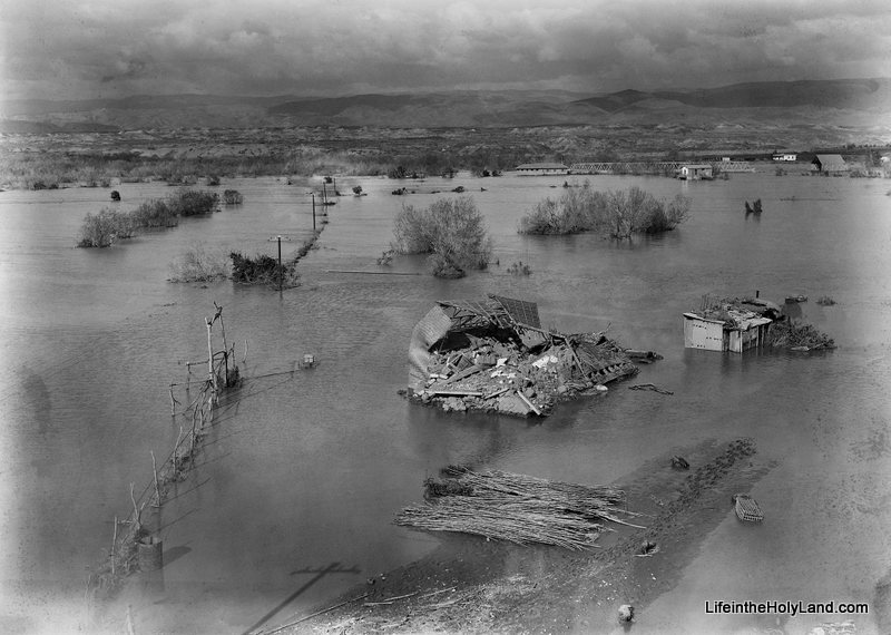
The date of the photograph above is around 1920.  The photograph below was taken in February, 1935.  This was an unusually high year for the Jordan River and it “overflowed all its banks,” damaging and destroying surrounding buildings and roads.

If you look closely in the upper right section of the photo you can see the Allenby Bridge with its bottom edge touching the water.  A closer view of the bridge can be seen in another photo from the collection which is posted here.

This flood year is mentioned in passing in the Encyclopaedia Judaica:

The Jordan discharges c. 875 million cu. m. into the Dead Sea a year; its yearly fluctuations are great and are caused mainly by the Yarmuk: in 1933, 287 million cu. m. and in 1935, 1,313 million cu. m.

According to this statistic, the Jordan River discharged 50% more water that year than the yearly average.  There is no way of knowing how much water was discharged during the year that Joshua and the Israelites crossed, but we can be certain that the photograph above is a much better illustration of how it looked than any picture that could be taken today.

Fortunately the future of the Jordan River is looking brighter.  This last summer, this blog noted a report about a plan by Israel to divert some additional water to Jordan River (see post here).  Perhaps future generations will again be able to see the Jordan overflow its banks.

These photographs and over 550 others are available in Volume 3 of The American Colony and Eric Matson Collection and can be purchased here for $20 (with free shipping).  Other historic images of the Jordan River can be seen here and here on LifeintheHolyLand.com, as well as a page devoted to illustrating Joshua and the Israelites “Entering the Promised Land” here

Share:

The New York Times has a profile of the Carchemish excavations, including results from the first two
years. I particularly enjoyed Mr. Marchetti’s story of discovering an almost intact monolith lying on the surface on his first day on the site.

This Jerusalem Post article on Jesus and the Jordan River discusses both tourist sites on the northern and southern ends.

This Haaretz article on “Masada for runners” isn’t what I expected. (I wanted fastest times to the top; they tell you to run around the bottom.)

Google Street View now covers much of Israel, including “most of Israel’s large and medium sized towns, many villages in central Israel and the Galilee, and historical and tourist sites such as the Dead Sea, the coral reefs of Eilat, the Dead Sea, Megiddo, and many more.” It does not include Judea and Samaria.

“Museum staff in Manchester have devised a computer console which allows visitors to ‘handle’ ancient artefacts. The technology at Manchester Museum – the first of its kind in the UK – allows the public to virtually touch delicate objects which would normally be kept behind glass.”

Tyndale Tech has a great run-down of computer resources for Old Testament Studies.

HT: BibleX, Jack Sasson

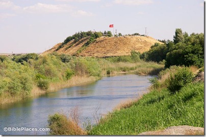
Carchemish citadel and Euphrates River from north, adr1005191620
Carchemish citadel and Euphrates River from the north.
Photo from the fantastic Pictorial Library of Bible Lands.
Share:

From the Caspari Center Media Review:

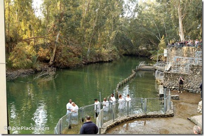
The Yardenit Baptism Site, situated on the Jordan River, is to undergo extensive development in the coming year. In order to improve the site, a fourth baptism station will be opened up, and “10 new ceramic wall hangings with the text from the Book of Mark 1:9-11, which speaks of John baptizing Jesus, [will be] added to the 70 plaques” that constitute the “Wall of New Life.” A representative from the site says that “the guiding principle underlining Yardenit … is the fact that it is totally non-denominational, and pilgrims are welcome to perform their baptism rituals in accordance with their particular beliefs and traditions.”

This must mean that business is good. In the meantime, it may be more difficult to get photos of the river without bulldozers and rebar.

The above article is not yet online. Copyright of the article remains with the Caspari Center.

Jordan River baptism at Yardenit baptismal site, tb011406482

Jordan River baptismal site at Yardenit
Photo from Galilee and the North
Share:

Vandals spray-painted anti-Christian graffiti on the Dormition Abbey church. UPDATE: The graffiti was near the Dormition Abbey, just outside Zion Gate on the door of the Franciscan Convent.

Haaretz has a photo. (Thanks, Dina.)

Israel and Jordan are planning to work together to rehabilitate the Jordan River.

The case for the authenticity of the Gospel of Jesus’ Wife is getting weaker.

Aren Maeir posts an archaeological note relating to Sukkot.

If you’re interested in historical fiction set in the life of the early church, The Scribes is currently free for Kindle.

The problem with blackmail is that it never stops, even between governments and world-class museums.

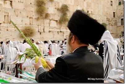
How is the Messiah related to the feast of Sukkot? Wayne Stiles explains and illustrates.

HT: Jack Sasson

Man with four species during Sukkot at Western Wall, cd091006002

Sukkot prayers (photo source)
Share:

A Reuters report describes how the Jordan River has shrunk over the years but a new plan will bring the stream back to life.

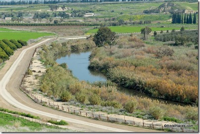
Today, as a result of years of overtaxing for irrigation and drinking water, [the Jordan River] snakes irresolutely along the valley from the Sea of Galilee to the Dead Sea. As far as the eye can see, it is just a few meters wide.
“It’s five percent of what once flowed,” said Ben Ari, who is one of the rehabilitation project leaders. “You can easily walk across without getting your head wet.”
Almost all the water that feeds the river is diverted by Syria, Jordan and Israel before it reaches the south, he explained.
But for the first time, Israel — which is two-thirds arid and has battled drought since its establishment 64 years ago — has a water surplus.
This follows decades of massive investment in the country’s water infrastructure. It re-uses 75 percent of its wastewater, mostly for agriculture, and by next year, 85 percent of drinking water will come from desalination plants.
The Israeli government has chosen to use this bounty to rehabilitate the country’s rivers. The Jordan tops the list.

The rest of the story describes other ways that Israel plans to promote tourism in the area. The article does not mention the impact this may have on the Dead Sea.

HT: Charles Savelle

Jordan River, tb020506945
The Jordan River south of the Sea of Galilee
Share:
About the BiblePlaces Blog

The BiblePlaces Blog provides updates and analysis of the latest in biblical archaeology, history, and geography. Unless otherwise noted, the posts are written by Todd Bolen, PhD, Professor of Biblical Studies at The Master’s University.

Notice

As an Amazon Associate we earn from qualifying purchases. In any case, we will provide honest advice.