fbpx

A recent study suggests that most of the terraces in the hill country of Judah were built in the last 400 years and none of them as early as the Iron Age. But that may not be the last word.

The plan to turn the archaeological site underneath Robinson’s Arch into a prayer site is facing opposition from many archaeologists, including Gabriel Barkay, Amihai Mazar, Dan Bahat, and Ronny Reich.

Hundreds of coins in museums in Jordan were replaced with fake ones. Apparently they were stolen years ago but only discovered recently.

Victor Sasson provides a contrary view on the Jehoash Inscription.

Eric M. Meyers shares the story of Yigael Yadin’s last night in America.

The Lod Mosaic, a 3rd century AD Roman work, is touring the United States and is currently in Florida.

Andrew George provides an interesting, behind-the-scenes take on how looting contributed to scholastic knowledge about the Epic of Gilgamesh.

The Caspari Center is offering a ten-day course in Israel in April on “Jesus the Jew.”

Wayne Stiles shows how Jesus’s conversation with his disciples at Tabgha can free you from the comparison trap.

Shmuel Browns shares some recent photographs he took while hiking in Nahal Og.

Time Scanners is a PBS series that uses technology to study ancient structures, including the Temple
Mount and the Colosseum.

HT: Ted Weis, Steven Anderson, Paleojudaica

Share:

A study of the temperature of the walls of Tut’s tomb is promising for those looking for a hidden chamber.

Ben Carson believes the pyramids of Egypt were built by Joseph to store grain.

Joseph’s tomb has been restored.

The Hebron archaeological site will not be leased to Jewish settlers.

The PEF has posted a brief video compilation of their recent conference on Jericho.

G. M. Grena reports on a new book dedicated to Robert Deutsch (that includes a chapter by Gabriel
Barkay), his visit to Passages exhibit and lecture, a forthcoming game, and a secret link.

If you don’t know about the Lanier Theological Library, you should read this.

This is your last chance to get in on Logos’s Classic Studies and Atlases on Biblical Geography (7 vols.) at the best pricing ($24-30).

Now free in pdf format: The Petrie Museum of Egyptian Archaeology: Characters and Collections, by Alice Stevenson.

Our most popular photo this week on Facebook and Twitter was this Psalm 23 image from the American Colony Collection.

Shepherd resting with flock at Ein Farah, mat05629
Shepherd tending his flock at a spring in the Judean wilderness
Share:
by Chris McKinny

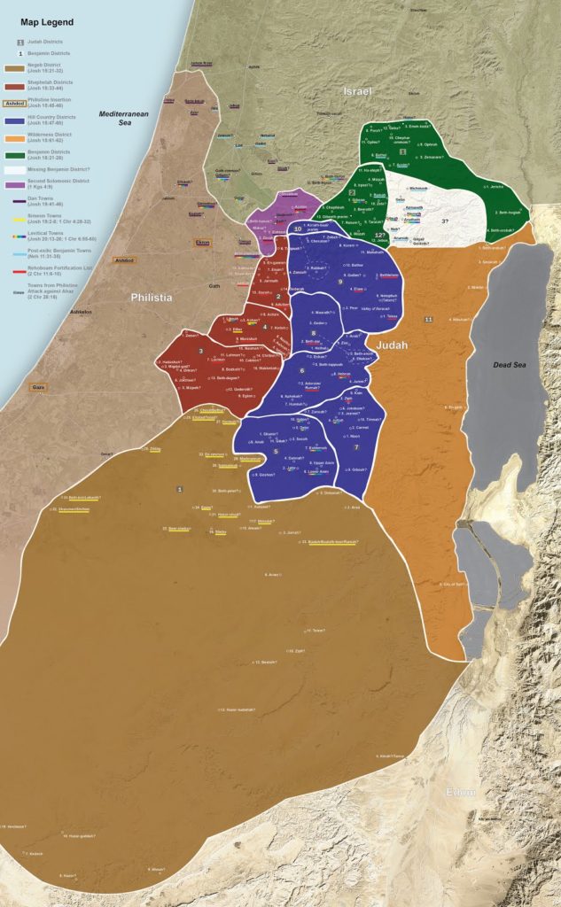
Many visitors to Israel have visited the Nahal Zin and hiked into Ein Avdat. While witnessing the canyon’s spectacular views and wildlife, visitors will probably be informed that Nahal Zin was the southern border of the promised land (and thereby Canaan and the tribe of Judah) based on a connection between the large, continuous canyon (Arabic – Wadi el-Marra) and the southern boundary descriptions in the Bible (Num. 34:4; Josh. 15:3).

Ein Avdat – BiblePlaces.com

The identification of Wadi el-Marra with part of the Wilderness of Zin seems to be very plausible, even if the name “Nahal Zin” is a modern construction. Essentially, the identification of Wadi el-Marra with the southern boundary is based on the following two pieces of evidence: 1.) Wadi el-Marra is the only natural topographic boundary in the region and 2.) it is located between the Ascent of Akkrabim and Kadesh-barnea (Ein el-Qudeirat), which fits the biblical description. However, there is an additional piece of evidence that seems to make this identification even more secure – the location of Mount Halak at Jebel Halaq. Update – see here for Musil’s description of Jebel Halaq (German).

Southern Boundary Markers of Canaan/Judah on Karte Von Arabia Petraea (A. Musil 1906)

This identification was made over a century ago by Alois Musil in his Karte Von Arabia Petraea who was told that the northern cliff face of Wadi el-Marra (i.e. Nahal Zin) was called Jebel Halaq by the local population. Since “jebel” means “mountain” in Arabic and the second part of the name is identical to the biblical place name, this identification was generally accepted. However, since the early cartographic projects did not cover the Negev Highlands (e.g., the Survey of Western Palestine, Van De Velde’s Map) most are unaware of this connection and its implications for biblical geography. Mount Halak is mentioned twice in the book of Joshua, in both cases it is within a north-south boundary description describing the territory that Joshua conquered.

“So Joshua took all that land, the hill country and all the Negeb and all the land of Goshen and the lowland and the Arabah and the hill country of Israel and its lowland from Mount Halak, which rises toward Seir, as far as Baal-gad in the Valley of Lebanon below Mount Hermon. And he captured all their kings and struck them and put them to death. Joshua made war a long time with all those kings.” (Josh. 11:16–18 ESV) 

“And these are the kings of the land whom Joshua and the people of Israel defeated on the west side of the Jordan, from Baal-gad in the Valley of Lebanon to Mount Halak, that rises toward Seir” (Joshua 12:7 ESV)

Aerial view of Nahal Zin with view of Mount Halak (Jebel Halaq), photo by Bill Schlegel

Jebel Halaq faces towards southern Jordan and the mountains of Edom (i.e. Mt. Seir), which matches the passages from Joshua. When we add Mount Halak (Jebel Halaq) to the accepted identifications of Tamar (En-Hazeva), the Ascent of Akkrabim (Roman road west of Tamar rising to Mamshit), and Kadesh-barnea (Ein el-Qudeirat), it is clear that the various boundary descriptions were describing the same border, which they demarcated using various topographical features (oases, mountains, and natural roads). 

For those who visit the Nahal Zin/Ein Avdat, Mount Halak (Jebel Halaq) can be seen either on the bus ride down to the hike or at the Ben-Gurion tomb, which overlooks the Nahal Zin. Be sure to look that way next time you make it down there!

Ben-Gurion tombs with Nahal Zin and Mount Halak in background
Share:

A new study claims that an Egyptian text is the oldest known abecedary.

Haaretz‘s report on Gabriel Barkay’s Temple Mount sifting project include several pictures of findings.

A UNESCO resolution that claimed the Western Wall prayer plaza as an Islamic shrine has made some people unhappy.

German experts are restoring the golden mask of King Tut after its beard was broken off and clumsily repaired.

The Journal of Near Eastern Archaeology reports that there are groups other than the Islamic State who are destroying and plundering antiquities in Syria.

The Getty Villa in Los Angeles is exhibiting 1800’s era watercolor paintings of Greece, many offering insight into how ancient sites looked in the early 19th century.

Emily Corrigan shares her experience of a summer on the Jezreel Expedition.

Egyptian authorities are investigating the embezzlement of $20 million from construction funds for the Grand Egyptian Museum.

Zahi Hawass throws cold water on the proposal that Nefertiti’s tomb has finally been located.

Ferrell Jenkins shares a photo he took of a fishing boat on the Sea of Galilee as the sun was rising.

The newly renovated Waldorf-Astoria in Jerusalem has been ranked the top hotel in the Middle East in a survey by Condé Nast Traveler.

Test your knowledge about Petra with 10 questions at the ASOR Blog.

The newly released NIV Zondervan Study Bible, edited by D. A. Carson, is on sale now for Kindle for $7.99. (I wrote the notes for 2 Kings.)

Chris McKinny has made available on Academia his presentation on “Kiriath-Jearim (Deir el-‘Azhar): Archaeological Investigations of a Biblical Town in the Judean Hill Country.”

Conference at Hebrew U on Oct 29: “I Know What You Did Last Summer: A Glimpse at the Excavations and Surveys of the Institute of Archaeology, 2015 Season.”

Adam Zertal died on Sunday at the age of 79. He was best known for his survey of the hill country of Samaria and his identification of a structure on Mount Ebal as the altar of Joshua.

Thomas Schaub died on Monday at the age of 82. Schaub excavated Bab edh-Dhra.

HT: Ted Weis, Charles Savelle, Joseph Lauer, Agade, Paleojudaica

Share:

This week’s sandstorm in Israel is the worst it has experienced since the nation was founded in 1948.

Air pollution in Jerusalem was 173 times higher than average. Carl Rasmussen shares a video showing how bad it was on the Mount of Olives.

What exactly is a 100-foot-deep shaft doing next to the Rockefeller Archaeological Museum in Jerusalem?

Andrew Bernhard posts on the End of the Gospel of Jesus’ Wife Forgery Debate.

Thieves in Galilee were caught removing a sixth century mosaic church floor in Gush Tefen.

The cisterns at Arad are now open to visitors.

Muslim “sentinels” protecting the Temple Mount from “sacrilege” have now been outlawed by Israeli police.

If your interest is in exotic shofars and what Jewish halakah has to say about it, Zoo Torah has a free pdf on the subject.

The BBC reports on six “lesser-known wonders of the ancient world,” including the site of Baalbek in Lebanon.

The Jerusalem Post Magazine reports on sinkholes around the Dead Sea. (At the moment of posting this, the link is not working. Perhaps it will return.)

ISIS is destroying ancient buildings in order to conceal evidence that they are looting for profit.

The Institute for Digital Archaeology plans to distribute 10,000 3-D cameras in the coming year in
order to document archaeological sites and objects in West Asia before they are destroyed.

A luncheon will honor James F. Strange at this ASOR meeting in Atlanta.

Ferrell Jenkins illustrates what David meant when he wrote about “a dry and weary land where there is no water.”

Did you know that the Upper Room is located directly above David’s Tomb?

The Dead Sea Scrolls scam at the California Science Center closed this week.

“The Manar al-Athar open-access photo-archive (based at the University of Oxford) aims to provide high resolution, searchable images, freely-downloadable for teaching, research, heritage projects, and publication. It covers buildings and art in the areas of the former Roman empire which later came under Islamic rule (e.g. Syro-Palestine/the Levant, Arabia, Egypt, and North Africa), from ca. 300 BC to the present, but especially Roman, late antique, and early Islamic art, architecture, and sacred sites.”

HT: Charles Savelle, Ted Weis, Agade, Joseph Lauer, Jared Clark

Our Facebook photo with the most clicks in the past week was the final one in our “holy rocks” series.

Gezer standing stones, bowing down, tb091405098
Standing stones at Gezer
Share:

The first permanent Roman legionary camp has been discovered near Megiddo. Scholars long knew of its existence because of the site’s preserved name of Legio, but only recently have they found remains. This year-old article at Bible History Daily has more of the background than the recent news reports.

Excavators working at the Jewish village of Shikhin near Sepphoris have discovered a pottery workshop.

A family in Ein Kerem near Jerusalem found an ancient mikveh (ritual bath) underneath their living room. High-res photos are available here.

Jodi Magness has discovered more mosaics in her excavation of the Jewish synagogue of Huqoq. For photos, see the links at the end of the article.

Here’s the latest on the gate discovered this week at Gath.

UNESCO has added the tombs of Beth Shearim, Jordan’s Baptism Site, and Susa to its World Heritage List.

CNN has put the Dome of the Rock in the number one spot of places to visit before they are destroyed. ISIS-controlled Palmyra is not on the list.

This looks interesting: Urban Legends of the New Testament: 40 Common Misconceptions. It quotes this blog and comes out on Monday.

Wayne Stiles is leading a tour focused on the life and land of Jesus in 2016, with a $550 reduction from this year’s tour price with the early bird rate.

A detailed report of the destruction to the archaeological site of Palmyra is available from the ASOR Syrian Heritage Initiative.

Ross Burns is keeping a tally of destruction to historic Syrian sites.

The Palestine Exploration Fund has been celebrating its 150th anniversary.

Here’s a unique aerial photo of Gibeah of Saul (Tell el-Ful), taken in 1931 before King Hussein’s construction destroyed Saul’s palace.

Shlomo Moussaieff died recently.

HT: Agade, Paul Mitchell, Joseph Lauer, Charles Savelle, Steven Anderson

Roman-camp-Megiddo
Location of Roman legionary camp at Megiddo
Share: