fbpx

After 31 years of hosting The Book & The Spade, Gordon Govier shares some personal reflections.

An aging Lebanese potter laments the passing of his craft.

Archaeologists have found evidence of the “plague of Cyprian.”

Satellite images from the US State Department’s Cultural Heritage Center “document the scale of destruction that looters continue to inflict on archaeological heritage sites during the ongoing conflict in Syria.”

Identifying a complete set of Edward Robinson’s Biblical Researches in Palestine at archive.org is a bit confusing, but David Stark has posted links to volumes 1 and 2 (3 volumes from 1841 in a 2-volume set, 2nd/11th eds.) and volume 3 (the 1856 volume, Later Biblical Researches, 11th ed.).

Now on pre-pub for Logos Bible Software: Near East Archaeological Society Bulletin (1958–2013) (78 issues) – $99.95.

ASOR’s Archaeology Weekly Roundup has more.

I’ll be traveling the better part of the next two weeks and will not be posting much. If they discover an archive at Hazor, Gezer, or Gath, I’m sure that one of my fellow contributors will let you know.

HT: Charles Savelle, Jack Sasson, Joseph Lauer, Ted Weis

Share:

Aren Maeir reports on the highlights of the 2013 excavation season at Gath (Tell es-Safi).

A statue of a Phoenician priest dating to the 6th century BC has been discovered in Sidon.

The Pope has arrived in Jordan and heads to Israel soon.

Some religious Jews are afraid that if Catholic mass is permitted in the Upper Room that they will be unable to pray at the Tomb of David downstairs.

A new study suggests that some of Petra’s structures were intended to align with the solstices and equinoxes.

Archaeological work in Jerusalem indicates that it was the Roman construction of Aelia Capitolina that triggered the Bar Kochba Revolt (and not the other way around).

Have you ever wondered how Jonathan defeated the Philistines by climbing the cliff of Michmash?

Wayne Stiles explains it all with maps and photos.

Ferrell Jenkins and Leon Mauldin are traveling in eastern Turkey. They have recently visited Haran
and the Zeugma Mosaic Museum.

Muslims in eastern Syria have apparently destroyed a statue from the Neo-Assyrian period looted from Tell Ajaja.

The 2014 excavation season has begun at Tel Jezreel.

The PACE (Project on Ancient Cultural Engagement) online database has moved.

Judith McKenzie’s black and white photographs taken in 1982-1986 for The Architecture of Petra
(1990) are now all available online at the Petra Digital Archive. Other collections are also online, in high-resolution and free for use in educational and academic publications and research.

HT: Joseph Lauer, Jack Sasson

Share:

Gordon Franz reports on his time at the “International Noah and Judi Mountain Symposium” in Sirnak, Turkey. He also provides a summary of a number of the presentations.

On The Book and the Spade this week: “Discovering Dalmanutha” with Ken Dark (direct link).

Norma Franklin believes the Megiddo water system was built during the Middle Bronze Age.

George Athas asks, “What’s New in Biblical Inscriptions?” and he suggests a cautious approach in announcing new discoveries.

An enormous Corinthian capital has been excavated at a temple of Hadrian in western Turkey.

A report in the Belfast Telegraph provides details about the ongoing excavations at Sidon.

Aviva and Shmuel Bar-Am provide a tour of Gezer.

Before there was writing, there were clay balls. Scholars are trying to decipher the code from objects found in Iran.

Dove Booksellers reports that the retail price is jumping up to $395 for The Oxford Encyclopedia of the Bible and Archaeology. It’s on sale for $257 until Tuesday (cheaper than Amazon).

HT: Jack Sasson, Joseph Lauer, Explorator

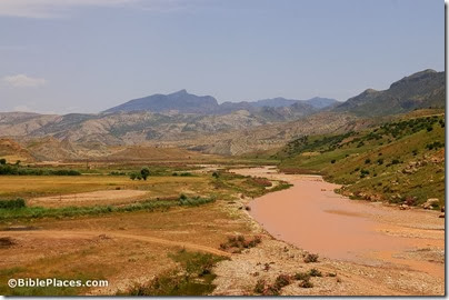
Mount Cudi from west, adr1005222380
Cudi (Judi) Dagh, possible location of Mount Ararat, from west
Photo from Eastern and Central Turkey
Share:
(Post by A.D. Riddle)

The answer to yesterday’s challenge is Nabi Yoûnis (or Nebi, Neby, Yunus, Younes, Yunas—there are a variety of English spellings. I will use the spelling “approved” by the U.S. Board on Geographic Names). It was answered correctly and quickly in the comments, so maybe next time, we should leave out the Google Earth view. The name Nabi Yoûnis is Arabic for Prophet Jonah, and the site commemorates the location where the great fish spit Jonah out onto dry land. It is located in Google Earth at 33.660894°, 35.418515°.

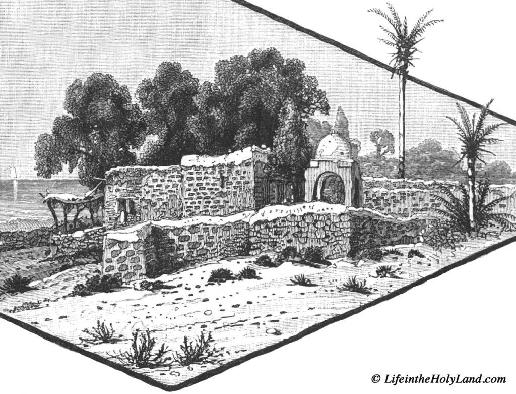
At 8:10 am on Tuesday, June 26, 1838, Edward Robinson passed by Khan Nabi Yoûnis on his way from Sidon to Beirut. He mentions that nearby was “Wely Neby Yunas, with a white dome, marking the place where, according to the Muhammedan legend, the prophet Jonas was thrown up by the fish” (Biblical Researches 3: 430-431). A nearly identically-worded description is found in Picturesque Palestine 3: 40. 

Drawing of Nabi Yoûnis from Picturesque Palestine, vol. 3.

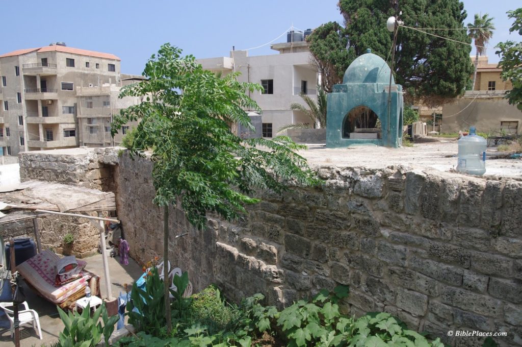
Today, the Muslim shrine described by Robinson is surrounded by the Shiite village named Nabi Yoûnis and bears little resemblance to the drawing above. Also, the dome is now green.

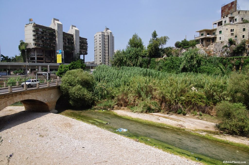
Modern Nabi Yoûnis. 

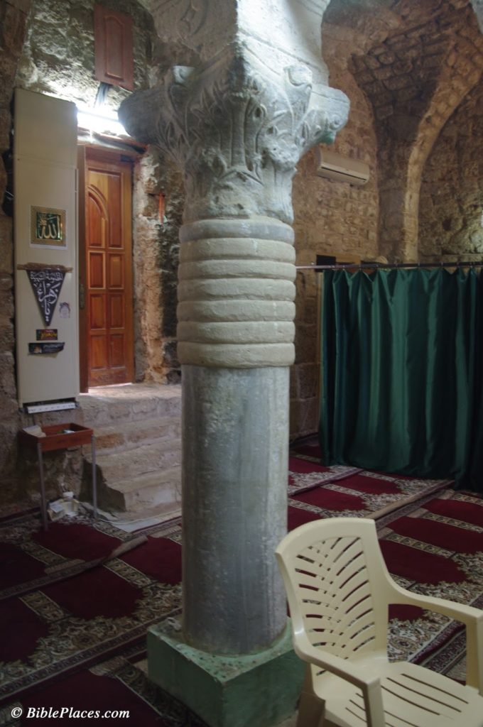
The Muslim shrine occupies the site of an earlier Byzantine church which was apparently destroyed by earthquake. Some remains from this church can be seen in reuse inside the shrine. During the Mamluk period, the structure was rebuilt and converted into a Muslim shrine.

Nabi Yoûnis, Corinthian capital from Byzantine church reused in modern Muslim shrine.

I have no way for evaluating whether or not this tradition is historically accurate, that Nabi Yoûnis is the place where Jonah was spit out. It is interesting to note that according to 2 Kings 14:25, a prophet named Jonah son of Amittai lived during Jeroboam II’s reign. This verse explains that Jonah announced large territorial gains for the kingdom of Israel in the time of Jeroboam II. For a brief moment in history, the boundary of the kingdom extended north to Lebo-Hamath, identified with modern Labwe in Lebanon. The Aramean kingdoms of Damascus and Hamath were also subjected to Israel. Nothing is said concerning the Phoenician coastal cities, so I do not know if Nabi Yoûnis would have been under some kind of Israelite control or not at this time as well.

Further note: a small side room in the Nabi Yoûnis shrine supposedly houses the tomb of Jonah. As with Noah, there are apparently multiple sites that are believed to be Jonah’s burial place. Another such tomb of Jonah is located in el-Meshhad, Israel, the site identified with Jonah’s hometown, Gath-hepher (see Picturesque Palestine 2: 61, illustration on 56).

References

Harb, Antoine Khoury.
2008     The Roots of Christianity in Lebanon. Beirut: Lebanese Heritage Foundation.
Share:
(Guest post by A.D. Riddle)

Unlike its neighbor to the south, Lebanon has only a handful of excavations currently in progress and there is no systematic archaeological survey of the entire country presently available. Sadly, archaeological work is only being carried out at a total of five (or so) sites: Sidon, Tell Arqa, Tell el-Burak (link 2, link 3), Baalbek, and Kamid el-Loz.

Tell Arqa in northern Lebanon.

Naturally, one would think that the paucity of archaeological work (and tourism, for that matter) is due to present security conditions. But that is only part of the story. Hélène Sader, a historian and archaeologist at the American University in Beirut, has written a piece for the ASOR blog entitled, “Archaeology in Lebanon Today: Its Politics and Its Problems,” in which she paints a fairly bleak portrait of the current situation.

The outdated antiquities law which established the Lebanese Directorate General of Antiquities (DGA) “as the sole authority” limits the DGA’s staff “to five archaeologists, five trainee archaeologists, and five architects in charge of regular and salvage excavations, restoration and conservation of historical and archaeological monuments, and the curatorship of the national and regional museums collections!” Following the Lebanese civil war (1975-1990), the Lebanese government set out to rebuild Beirut’s Central District. The DGA was then faced with the task of not only rebuilding the National Museum, but also “supervising the largest urban excavation site in the world with practically no qualified personnel, no funds, and no political support.” Since 2000, “the DGA has become extremely restrictive regarding long term excavation projects” and is “reluctant to issue permits to foreign institutions.” Numerous salvage excavations go unpublished and the excavated remains are “regularly bulldozed or disfigured by irresponsible urban planning without any objections.”
Sader concludes:

The DGA has been without leadership for the last four years. The last Director General resigned three years ago and the appointment of a new one is still blocked by political rivalries. The failure to build a new generation of professional and well-trained archaeologists is so dramatic that it is very hard today to find even a small pool of competent candidates for the position of Director General from within or outside the department of antiquities. Several DGA archaeologists and architects have lately resigned out of frustration and it seems that the institution is back to square one: no director general, insufficient numbers of qualified professionals, no reforms of the laws regulating archaeological work, no funds, and first and foremost, no vision and no direction for the future of archaeology in Lebanon.

We keep our fingers crossed that the future leadership of the DGA will have the political and financial support of the Lebanese government to build a modern institution and to promote archaeological research. Maybe then, like a phoenix, Lebanese Archaeology will rise from its ashes.

Share:

(Post by Seth M. Rodriquez)

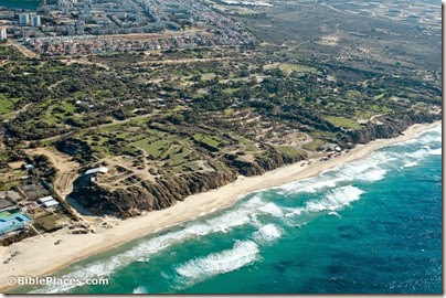
At first glance, our picture of the week looks like a peaceful, pleasant Mediterranean beach. However, there is more here than meets the eye. This is the site of a famous battle waged by Alexander the Great, and the place still bears the marks of Alexander’s army. In fact before 332 B.C., this beach didn’t even exist.

In antiquity, the city of Tyre was comprised of a fortified settlement on the mainland and another settlement on an island about half a mile off the coast. What you are looking at is the southern side of the isthmus that was created when Alexander’s army built a causeway between the mainland and the island. The image below from the maps of the Survey of Western Palestine provides a bird’s eye view of the former island with the narrow isthmus. (These maps are available here in digital form for only $35.)

The Wycliffe Historical Geography of Bible Lands describes the confrontation between the inhabitants of Tyre and Alexander the Great in this way:

Tyre alone opposed Alexander. The Tyrians initially offered submission and tribute to him, thinking they would thereby gain substantial freedom, as they had before. But when they saw that Alexander intended personally to occupy the city, they determined to resist.

Hope of Tyrian success in withstanding the siege was not unfounded. Their city was located on an island a half mile from shore; the current in the channel which separated it from land was swift. Their fleet controlled the sea. The city wall on the landside rose to 150 feet. There were assurances of help from Carthage and elsewhere. But Alexander devised unexpected tactics. He resolved to construct a causeway 200 feet wide out to the island, on which he could plant his siege engines. Ruins of mainland Tyre furnished material for the causeway. The Tyrians fought heroically. They destroyed the engines of war by fire-ships and damaged the mole, or causeway. They hurled pots of burning naphtha, sulfur, and red-hot sand from catapults.  Seeing that the battle could not be won without the use of a fleet, Alexander obtained contingents from Sidon, Greek allies, and Cyprus. After a siege of seven months, the wall was breached and the city taken after savage fighting.

Many people see this as the part of the fulfillment of Ezekiel’s prophesies about Tyre found in Ezekiel 26-28, especially these verses:

Behold, I am against you, O Tyre, and will bring up many nations against you, as the sea brings up its waves. They shall destroy the walls of Tyre and break down her towers, and I will scrape her soil from her and make her a bare rock. (Ezek. 26:3-4, ESV)

Our picture of the week was taken by A.D. Riddle, and is available in Volume 8 of the Pictorial Library of Bible Lands. This photo and over 700 others are available here for $34 (with free shipping). Additional photos and information about Tyre can be found here on the BiblePlaces website, and here on LifeintheHolyLand.com.  The quote above was taken from The Wycliffe Historical Geography of Bible Lands by Charles F. Pfeiffer and Howard F. Vos (Chicago: Moody Press, 1967), 210-211.

Share: