fbpx
(Post by A.D. Riddle)


I recently discovered a mapping resource hosted by the University of Arkansas, the CORONA Atlas of the Middle East. The CORONA Atlas is not a brand new website (it was reviewed in 2012), but it says it is still in BETA stage. Simply put, the CORONA Atlas of the Middle East overlays CORONA satellite imagery over Google Earth imagery.

What is CORONA imagery?

During the Cold War, CORONA was a codename for one of the United States’ top-secret satellite missions created to capture high-resolution imagery. The first mission was launched into space in 1960, and the program continued until 1972. The imagery was declassified in 1995, making it available to the public.

What is the value of CORONA imagery?

From the CORONA Atlas of the Middle East:

In regions like the Middle East, CORONA imagery is particularly important for archaeology because urban development, agricultural intensification, and reservoir construction over the past several decades have obscured or destroyed countless archaeological sites and other ancient features such as roads and canals. These sites are often clearly visible on CORONA imagery, enabling researchers to map sites that have been lost and to discover many that have never before been documented. 

For example, in 1998, James Hoffmeier and his team were able to locate additional sections of Egypt’s east frontier canal in northern Sinai thanks to CORONA imagery.


What has the University of Arkansas done with the imagery?

First, even though CORONA imagery is in the public domain, there are costs associated with digitization of the original film and acquisition of the files. The University of Arkansas has purchased much of this imagery and made it available for researchers. Second, the University of Arkansas corrected the spatial geometry of the photos for distortion (orthorectification) and has positioned the imagery in real geographic space (georectification). This allows the CORONA Atlas to overlay the CORONA imagery on top of other imagery that is positioned in the same geographic space.

How can the CORONA Atlas of the Middle East be used?

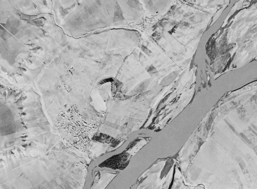
Recently, I was trying to locate the site of Samsat in Turkey. Samsat is believed to be ancient Kummuḫ, capital of a Neo-Hittite kingdom by the same name. (In the Hellenistic period, it was replaced by the kingdom of Commagene.) The problem with finding Samsat today, however, is that it now lies at that bottom of Lake Atatürk Dam. It is very hard to find a tell in a lake. The Atatürk Dam was built on the Euphrates River and was completed in 1990. The reservoir flooded the valley of the Euphrates River and its tributaries, and the lake today covers approximately 320 square miles. The CORONA Atlas of the Middle East allows me to see Samsat (and the Euphrates River) before it was submerged, and to locate it with precision in Google Earth, because you can adjust the transparency of the CORONA imagery. The CORONA atlas also has tools for measuring, obtaining coordinates, and capturing imagery for other uses.

Here is a comparison of images taken from the CORONA Atlas of the Middle East. On the left is the Google Earth imagery, in the center is the CORONA imagery with some transparency over Google Earth, and on the right is the CORONA imagery.

The tell of Samsat is located in the center of the right photograph. Here is a close-up.

Head on over and poke around. It took my internet service several moments to load imagery, so it may require you to have a little patience.

Share:

From the Jerusalem Post:

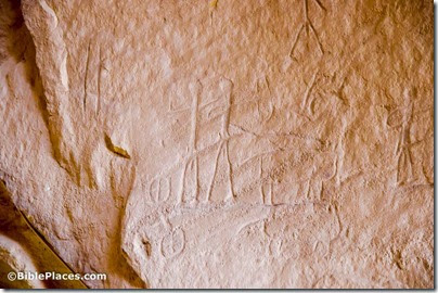
Using an innovative three dimensional technology, researchers have now made the Timna Valley Park the first setting in Israel where a large-scale rock engraving was scanned.
The project was headed by a team from the Computerized Archaeology Laboratory in the Institute of Archaeology at the Hebrew University of Jerusalem. The laboratory combines advanced mathematics and computing methods with modern, high-precision scanners to provide digital three dimensional models of archaeological finds. Dr. Leore Grosman directed the project by in collaboration with Assaf Holzer and the Timna Valley Park team, who provided important help and support.
The researchers’ first goal in scanning the engraving was to create a durable, long-lasting and accurate 3D model in case of future damage to the original. Their other goal was to create a precise model that will allow an objective study of the engraving, in order to gain a better understanding of the people who made it.

The full article includes an image of the 3-D model.

Timna Chariots engraving, adr1305175955
Chariots engraving at Timna Valley
Photo by A.D. Riddle
Share:

A Digital Reconstruction of the Northwest Palace at Nimrud, Assyria is a 3-minute video posted by the Metropolitan Museum of Art. It’s very good.

Steve Green’s museum in Washington, DC now has a name: museum of the Bible.

Some of Josephus’s works are available in audio format for free.

Shimon Gibson and James D. Tabor summarize their 2014 excavations on Mount Zion.

The Times of Israel: “Beneath the houses of Old Jerusalem’s Cotton Market neighborhood, a massive series of ancient buildings excavated by Israeli archaeologists is set to open to the public.”

ArtDaily: “The huge flat-topped rock on which the ancient Parthenon sits in the centre of Athens is starting to give way.”


Haaretz reports on large-scale animal sacrifice related to the Early Bronze temples at Megiddo.

Science 2.0: The enemy of archaeology is not people, it’s salt.

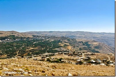
A Polish team has begun a new archaeological project near Tafilah in southern Jordan.

Filming has begun for a movie about four women whose lives intersect in the siege of Masada. “The Dovekeepers” is being produced by Roma Downey and Mark Burnett and is based on a historical novel by Alice Hoffman.

HT: Ted Weis, Agade, Joseph Lauer

Tafileh, possible Tophel, from north, tb061404220
The area of Tafileh, Jordan
Photo from the Pictorial Library of Bible Lands
Share:

From the New York Times:

Archaeologists around the world, who have long relied on the classic tools of their profession, like the trowel and the plumb bob, are now turning to the modern technology of drones to defend and explore endangered sites. And perhaps nowhere is the shift happening as swiftly as in Peru, where Dr. Castillo has created a drone air force to map, monitor and safeguard his country’s ancient treasures. Drones mark “a before and after in archaeology,” said Dr. Castillo, who is also a prominent archaeologist and one of a dozen experts who will outline the use of drones at a conference in San Francisco next year. […] In the Middle East, researchers have employed them to guard against looting. “Aerial survey at the site is allowing for the identification of new looting pits and determinations of whether any of the looters’ holes had been revisited,” said Morag Kersel, an archaeologist from DePaul University in Chicago who is part of a team using drones in Jordan and Israel. […] Though his work is focused on the deep past, Dr. Castillo is fascinated by gadgets and new technology. He began experimenting with drones about two years ago, buying a $100 one from the Sharper Image. Now he has a squadron of eight, all miniature helicopters that cost about $1,500 to $20,000. He hopes to soon add 20 more. The drones, he said, “solve the first riddle of archaeology.” “Finally you can fly whenever you want to, wherever you want to, in any angle, for anything you want and get the great picture you always thought you should take,” he said.

The full story focuses mostly on the use of drones in Peru. Aren Maeir recently posted a video showing a drone in use in his excavations of the Philistine city of Gath.

Share:

From the Jerusalem Post:

We’re all familiar with the kinds of archaeological research seen in movies and television — digging the earth, brushing the dust away, and examining artifacts up close. But these days, we can learn even more about ancient artifacts by combining traditional archaeology with cutting-edge technology.
At the Hebrew University’s Institute of Archaeology, researchers were curious to know more about a type of storage container that began appearing around the late 10th or early 9th century BCE. Due to their large swollen bodies, they are dubbed ‘Hippo’ jars.
To probe the deep secrets of these ancient jars, the researchers — Prof. Amihai Mazar, Prof. Uzy Smilansky, and Dr. Avshalom Karasik — went beyond traditional techniques by conducting a series of scans with 3D scanners and advanced computation.
[…]
The Hebrew University researchers measured 158 Hippo jars with a high resolution 3D scanner at the Computerized Archaeology Laboratory, which is directed by Dr. Leore Grosman. (The laboratory is a joint initiative of the Hebrew University, the Israel Antiquities Authority and the Weizmann Institute of Science, with the University of Haifa serving as a collaborating partner.)
Equipped with modern, high precision scanners, the lab created detailed three-dimensional models of the ‘Hippo’ jars.
These digital models provided precise measurements of the jars’ shape, which was later correlated with independent features, such as the source of the clay used to make them, the potters’ marks, and the jars’ distribution. They also provided information on the jars’ capacity, volume, height and maximal diameter.
What did the researchers learn from the 3D scans?

The article continues here. This is the first in a new column written by students at the Hebrew University’s Institute of Archaeology.

Jars
“Hippo” storage jars
Photo courtesy of Hebrew University Institute of Archaeology
Share:

What do you do when your summer excavation site turns out to be less than 5 miles from a war zone?
The Ashkelon team had to figure matters out on the fly.

Mark Hoffman is inviting everyone to join his free, online course, “Survey of the Lands of the Bible.”

This MOOC begins in September and you can participate as much and as little as desired.

Wayne Stiles has a well-written and well-illustrated article about Ein Parath, where Jeremiah buried his loincloth.

How did archaeologists come to reject the biblical description of Joshua’s conquest? Henry Smith explains. He is interviewed briefly about the article here.

Leon Mauldin takes his readers to the Mamertine Prison in Rome.

ISIS Is About to Destroy Biblical History in Iraq.

Cleopatra’s Needle in New York City is getting a laser cleaning. “In nanoseconds, the soot particles are turned into white-hot plasma.”

The latest issue of ‘Atiqot is online and it includes several articles about an excavation in the Kidron Valley.

Göbekli Tepe excavator Klaus Schmidt died last week.

Amnon Rosenfeld—In Memoriam, by Howard R. Feldman.

HT: Charles Savelle, G. M. Grena, Craig Dunning

110724879tb Egyptian obelisk, aka Cleopatra's Needle
Cleopatra’s Needle, New York City
Share: