Architip is a new app that uses augmented reality (AR) technology to help users see what ancient sites in Israel used to look like. From The Times of Israel:

Augmented reality is a technology that uses mathematics, models, location services, camera technology, and advanced algorithms to impose a virtual image that melds into a real-life one. “For example, you might look at an ancient mosaic on the floor of a synagogue or church, and barely see the decorations on it because of the fading,” said Yaron Benvenisti, CEO of Architip, which is located in Jerusalem and has been operating for about six months. “With Architip, you would see the mosaic in full color, with all its drawings intact.”
Because each site needs to be mapped and augmented separately, Architip is being marketed as a “white label” engine, which will be used at specific sites. As a pilot, the Architip R&D team, led by Israeli AR and computer vision pioneer Sagiv Philipp, has mapped and “virtualized” the Tel Lachish archaeological site in central Israel. Tel Lachish was a fortified city surrounded by towers, and had many stately buildings, but looking at the site today, it’s hard to visualize the city as it was. With Architip, users can see the site in all its ancient glory just by holding up their smartphone’s camera at the location and looking at the screen.
“With Architip, you can see Tel Lachish as it was,” Benvenisti said, “walking through its streets and seeing the reconstruction through your device.” All a user has to do is point their device at a specific point, and Archtip’s technology does the rest.

The full article, including an illustration, is here. The company website includes a video demo that shows other features. I think that Lachish may be an ideal first choice if you’re just testing things out, but they’re going to have to choose more popular sites if they want more than a handful of users.

HT: Stephen Smuts
Share:

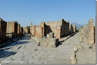
Gary Byers summarizes the result of the first week of excavations at Khirbet el-Maqatir. He thinks it may have been the best first week of finds at the site. Shimon Gibson will be resuming his excavations on Mount Zion from June 16 to July 11. Volunteers are welcome. A list of papers for the Noah’s Ark conference at Sirnak University in Turkey has been announced. Among the list is this one by Gordon Franz: “Did Sennacherib, King of Assyria, Worship Wood from Noah’s Ark?” Don Wimmer, director of excavations at Tall Safut in Jordan, died last week. Worsening conditions at the Cairo Museum are causing concern. The Green Scholars Initiative Series on Early Jewish Texts is a new book series to be published by Brill and led by Emanuel Tov. Scholars are using artificial intelligence programs to help reassemble more than 100,000 manuscript fragments from across the Mediterranean world. Stephen Gabriel Rosenberg has written the latest Archaeology in Israel Update—April 2013. Luke Chandler is leading a tour of Italy this fall. The New Interpreter’s Dictionary of the Bible (5 vols.) is now marked down 78% to $90. Until Friday. HT: Jack Sasson, Bill Soper Pompeii Consolare Street and Modesto Street intersection, tb111505131 Preserved ruins of Pompeii
Photo from Pictorial Library, Italy and Malta

Share:

From LiveScience.com:

For thousands of years, different groups of people have lived in the Negev desert, building stone walls and cities that survive to this day. But how did they make their living?
The current thinking is that these desert denizens didn’t practice agriculture before approximately the first century, surviving instead by raising animals, said Hendrik Bruins, a landscape archaeologist at Ben-Gurion University of the Negev.
But new research suggests people in this area, the Negev highlands, practiced agriculture as long ago as 5000 B.C., Bruins told LiveScience. If true, the finding could change historians’ views of the area’s inhabitants, who lived in the region in biblical times and even before, he added.

Bruins found that the area had been farmed in three periods.

He found three distinct layers in the earth indicating that the field had been cultivated, corresponding to three different periods of activity, with long gaps in between. The first one dated from 5000 B.C. to 4500 B.C., followed by another from 1600 B.C. to 950 B.C. and a final layer dating from A.D. 650 to A.D. 950.

The full story is here.

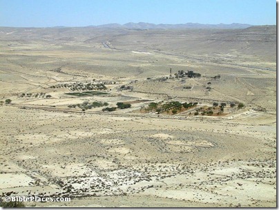
Avdat farm experiment, tb062400139
Experimental farm near Avdat
Photo from Pictorial Library of Bible Lands, volume 5.
Share:

The last week of ASOR’s March Fellowship Madness is here, and one donor be randomly selected to receive a copy of The Photographs of the American Palestine Exploration Society, which features over 150 pictures taken at sites around the Near East in 1875.

Here’s a very high-resolution panoramic shot of Jerusalem from the Mount of Olives.


Popular Mechanics has a story on the value of 3-D modeling for archaeology.

A 3-D model of the Temple of Amun-Ra at Karnak has been created with the help of the UCLA team who created one of Jerusalem’s Temple Mount.

Archaeologists working at Tel Habuwa east of the Suez Canal have found evidence for battles between the Egyptians and Hyksos.
A well-preserved sundial from the 13th century BC was discovered in the Valley of the Kings near Luxor.
Turkey is demanding Germany return more ancient artifacts.
The 1862 Middle East tour of the future King Edward VII is the subject of a new exhibition in 
Edinburgh.
HT: Joseph Lauer, Charles Savelle, Explorator
Share:

At Petra, LiDAR (Light Detection and Ranging laser) scanning and balloon-based 35mm photography are being used with other technologies to facilitate research and conservation.

Exploring Bible Lands is doing a series on the travels of the Ark of the Covenant, beginning at the Plains of Moab, crossing the Jordan River, and continuing on to Jericho, Mount Ebal and Mount Gerizim, and now Shiloh.

JPost: “Wild animals will soon be able to safely cross bustling Route 1 when the Israel National Roads Company completes work on an ecological corridor at the Sha’ar Hagai interchange.”

This 40-second video clip with Eilat Mazar describing her discovery of the seal impression of a biblical figure could be a good way to get attention at the start of a lesson. The Jehucal bullae was discovered in 2005.


Popular Archaeology has a lengthy feature this month on the Egyptian fortress in Joppa.

Some very well-preserved leather shoes worn 2,000 years ago were recently discovered in Egypt.

Egyptian officials have rejected a proposal to rent out five of the country’s archaeological sites to international tourism companies.

For the broader world of archaeology, see the Archaeology Weekly Roundup at the ASOR Blog.

HT: Jack Sasson

Share:

Shmuel Browns has a roundup of interesting items he has discovered as a guide this week, and he’s soliciting suggestions for a name for the series.

Seth Rodriquez illustrates each region of the land of Israel.

The presentations from “Managing Archaeological Data in the Digital Age: Best Practices and Realities” are now online.

Nearly $2 million has been spent to restore the archaeological remains of the Nabatean city of Avdat after vandals attacked it.

The Cyrus Cylinder will make its first appearance in the U.S. on March 9 at the Smithsonian.

GigaPan has some extremely high-resolution panoramic images of Jerusalem.

HT: Jack Sasson, Michael Oliver

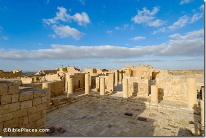
Avdat Byzantine Church of St Theodore, tb030607886
The Nabatean city of Avdat
Photo from the Pictorial Library of Bible Lands
Share: